File:PublicTransportHeadways BraunschweigHbf.png
Jump to navigation
Jump to search

Size of this preview: 800 × 337 pixels. Other resolutions: 320 × 135 pixels | 640 × 269 pixels | 1,585 × 667 pixels.
Original file (1,585 × 667 pixels, file size: 1.24 MB, MIME type: image/png)
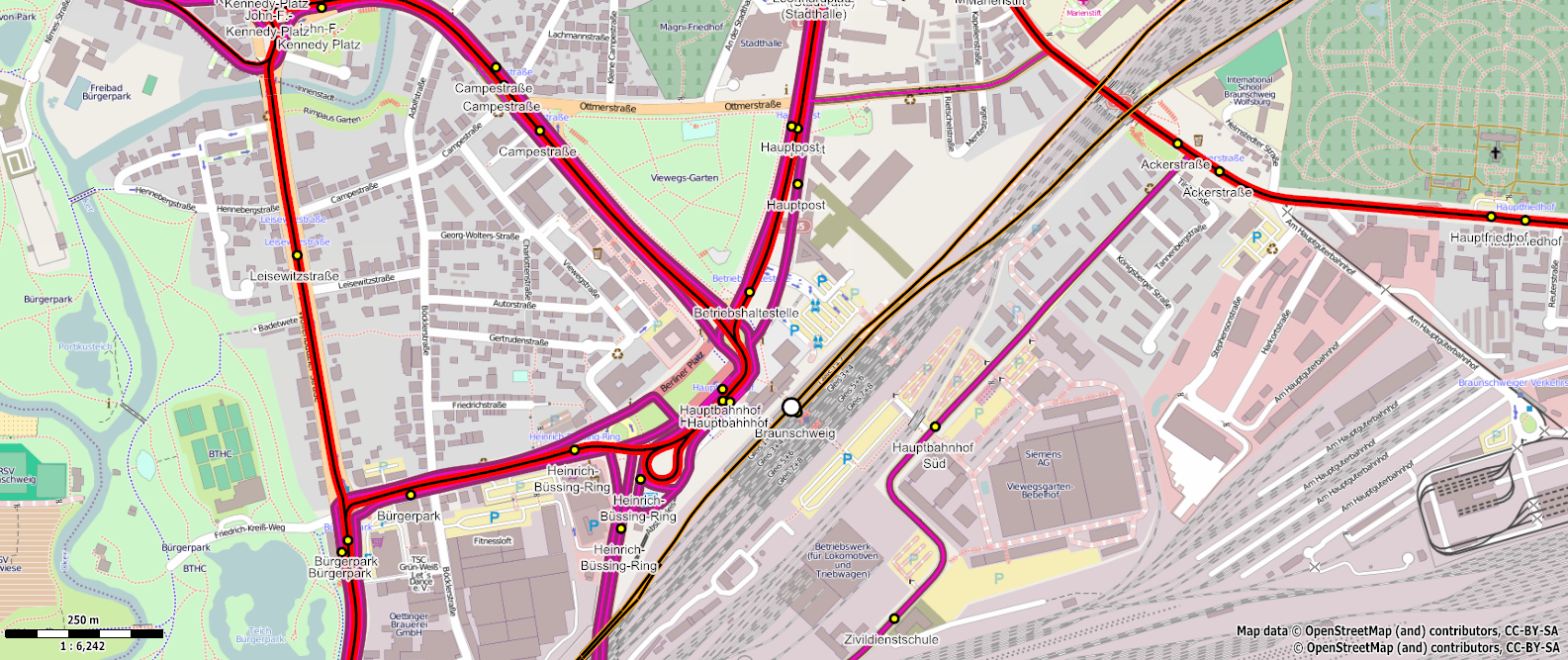
Visualization of the headways of public transport routes (Screenshot of Maperitive). A thicker line indicates a higher frequency and a shorter time headway. Red = tramway, magenta = bus, orange = trains.
- This media file was uploaded by author of the work and its copyright holder.
Licensing
| Contains map data © OpenStreetMap contributors, made available under the terms of the Open Database License (ODbL).
The ODbL does not require any particular license for maps produced from ODbL data, produced maps may be subject also to other licences. |
File history
Click on a date/time to view the file as it appeared at that time.
| Date/Time | Thumbnail | Dimensions | User | Comment | |
|---|---|---|---|---|---|
| current | 22:55, 7 March 2013 | | 1,585 × 667 (1.24 MB) | Vicuna (talk | contribs) | Visualization of the headways of public transport routes. A thicker line indicates a higher frequency and a shorter time headway. Red = tramway, magenta = bus, orange = trains. |
You cannot overwrite this file.
File usage
The following page uses this file: