File:Routing CycleStreets.png
Jump to navigation
Jump to search


Size of this preview: 800 × 455 pixels. Other resolutions: 320 × 182 pixels | 640 × 364 pixels | 934 × 531 pixels.
Original file (934 × 531 pixels, file size: 437 KB, MIME type: image/png)
Summary
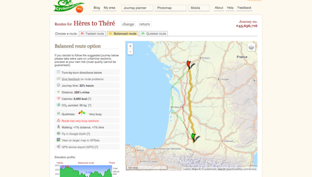
Routing from Hères, France to Thère, France using CycleStreets
Licensing
![]()
![]()
![]()
This work is licensed under the Creative Commons Attribution-ShareAlike 3.0 License.
Attribution not specified as a parameter! THIS LICENSE ALWAYS REQUIRES ATTRIBUTION! Use {{CC-BY-SA-3.0|Attribution, typically name of author}} See Template:CC-BY-SA-3.0 for full description how this template should be used.
Attribution not specified as a parameter! THIS LICENSE ALWAYS REQUIRES ATTRIBUTION! Use {{CC-BY-SA-3.0|Attribution, typically name of author}} See Template:CC-BY-SA-3.0 for full description how this template should be used.
File history
Click on a date/time to view the file as it appeared at that time.
| Date/Time | Thumbnail | Dimensions | User | Comment | |
|---|---|---|---|---|---|
| current | 15:19, 11 August 2015 | | 934 × 531 (437 KB) | Cyclestreets (talk | contribs) | Routing from Hères, France to Thère, France using CycleStreets |
You cannot overwrite this file.
File usage
The following 4 pages use this file: