File:San Pablo City 2010-01-30.png
Jump to navigation
Jump to search


Size of this preview: 600 × 600 pixels. Other resolutions: 240 × 240 pixels | 480 × 480 pixels | 780 × 780 pixels.
Original file (780 × 780 pixels, file size: 79 KB, MIME type: image/png)
Summary
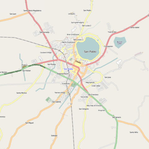
| Description | San Pablo City, Laguna as of January 30, 2010. Mapped almost single-handedly by Ian Lopez. |
|---|---|
| Author | seav |
| Source | OSM (Mapnik layer) (permalink to map) |
| Date | 2010-01-30 |
| Permission | CC-BY-SA |
Licensing
Licensing
![]()
![]()
![]()
This screenshot contains OpenStreetMap Carto rendering.
The OpenStreetMap Carto map style is made available under the Creative Commons CC-0 1.0 Universal Public Domain Dedication.
- Attribution to the map data:
![]()
Contains map data © OpenStreetMap contributors, made available under the terms of the Creative Commons Attribution-ShareAlike 2.0 (CC-BY-SA-2.0).
File history
Click on a date/time to view the file as it appeared at that time.
| Date/Time | Thumbnail | Dimensions | User | Comment | |
|---|---|---|---|---|---|
| current | 09:49, 30 January 2010 | | 780 × 780 (79 KB) | Seav (talk | contribs) | ==Information== {{Information |Description = San Pablo City, Laguna as of January 30, 2010. Mapped almost single-handedly by Ian Lopez. |Source = OSM (Mapnik layer) |Author = seav |Date = 20 |
You cannot overwrite this file.
File usage
The following page uses this file: