File:Secondary Expressway Rendering Mockup.png
Jump to navigation
Jump to search

Size of this preview: 800 × 312 pixels. Other resolutions: 320 × 125 pixels | 1,000 × 390 pixels.
Original file (1,000 × 390 pixels, file size: 246 KB, MIME type: image/png)
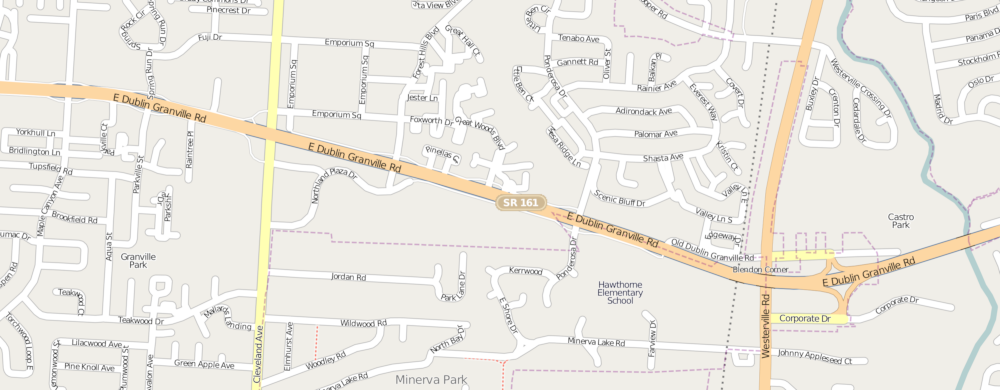
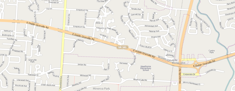
Proposed rendering for the combination of highway=secondary and expressway=yes per Proposed features/Expressway indication. Also shows optimistic, narrower version of highway=secondary_link.
Licensing
![]()
![]()
![]()
This screenshot contains OpenStreetMap Carto rendering.
The OpenStreetMap Carto map style is made available under the Creative Commons CC-0 1.0 Universal Public Domain Dedication.
- Attribution to the map data:
![]()
Contains map data © OpenStreetMap contributors, made available under the terms of the Creative Commons Attribution-ShareAlike 2.0 (CC-BY-SA-2.0).
File history
Click on a date/time to view the file as it appeared at that time.
| Date/Time | Thumbnail | Dimensions | User | Comment | |
|---|---|---|---|---|---|
| current | 22:59, 13 July 2010 | 1,000 × 390 (246 KB) | Vid the Kid (talk | contribs) | Proposed rendering for the combination of {{tag|highway|secondary}} and {{tag|expressway|yes}} per Proposed features/Expressway indication. Also shows optimistic, narrower version of {{tag|highway|secondary_link}}. |
You cannot overwrite this file.
File usage
The following page uses this file: