File:Sendong humanitarian maps.png
Jump to navigation
Jump to search

Size of this preview: 423 × 599 pixels. Other resolutions: 169 × 240 pixels | 339 × 480 pixels | 924 × 1,309 pixels.
Original file (924 × 1,309 pixels, file size: 556 KB, MIME type: image/png)
Information
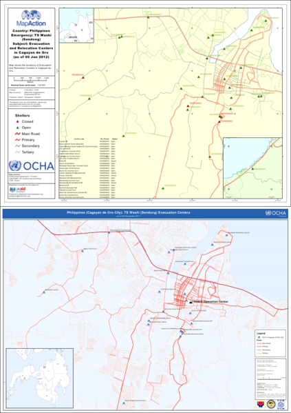
| Description | In the wake of Tropical Storm Washi (Sendong) that struck Mindanao in the Philippines in late 2011, UN OCHA and MapAction provided maps to aid in humanitarian efforts. Some of these maps, like the ones above showing locations of evacuation centers in Cagayan de Oro, use OSM road data. |
|---|---|
| Author | MapAction and UN OCHA |
| Source | MapAction (http://mapaction.org/deployments/mapdetail/2446.html) and UN OCHA (http://ph.one.un.org/response/maps/index.php) |
| Date | 2012-01-05 and 2011-12-28 |
| Permission | CC-BY-SA (due to use of OSM data) |
File history
Click on a date/time to view the file as it appeared at that time.
| Date/Time | Thumbnail | Dimensions | User | Comment | |
|---|---|---|---|---|---|
| current | 18:21, 16 January 2012 | | 924 × 1,309 (556 KB) | Seav (talk | contribs) | ==Information== {{Information |Description = In the wake of Tropical Storm Washi (Sendong) that struck the Philipines, UN OCHA and MapAction provided maps to aid in humanitarian efforts. Some of these maps, lik |
You cannot overwrite this file.
File usage
The following page uses this file: