File:Side stairs.png
Jump to navigation
Jump to search

Size of this preview: 800 × 505 pixels. Other resolutions: 320 × 202 pixels | 640 × 404 pixels | 1,024 × 647 pixels | 1,426 × 901 pixels.
Original file (1,426 × 901 pixels, file size: 103 KB, MIME type: image/png)
Summary
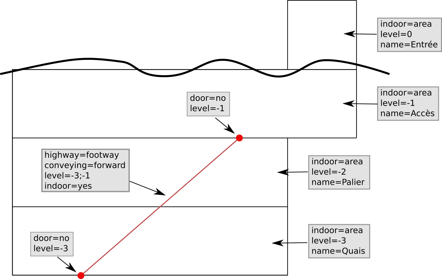
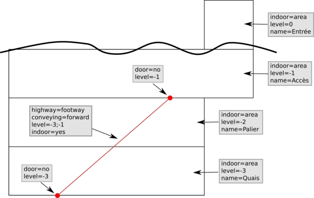
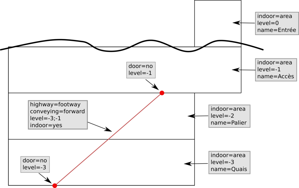
Scheme for Simple Indoor Tagging, explaining how to map stairs through levels.
Licensing
![]()
![]()
![]()
This work is licensed under the Creative Commons Attribution-ShareAlike 2.0 License.
Attribution not specified as a parameter! THIS LICENSE ALWAYS REQUIRES ATTRIBUTION! Use {{CC-BY-SA-2.0|Attribution, typically name of author}} See Template:CC-BY-SA-2.0 for full description how this template should be used.
Note, there is
There is also
Attribution not specified as a parameter! THIS LICENSE ALWAYS REQUIRES ATTRIBUTION! Use {{CC-BY-SA-2.0|Attribution, typically name of author}} See Template:CC-BY-SA-2.0 for full description how this template should be used.
Note, there is
{{CC-BY-SA-2.0 OpenStreetMap}} for files based on old OSM map data, before the license change made on 2012-09-12.There is also
{{OSM Carto screenshot||old_license}} for files based on old OSM map data, before the license change made on 2012-09-12, created using OSM Carto map style.
File history
Click on a date/time to view the file as it appeared at that time.
| Date/Time | Thumbnail | Dimensions | User | Comment | |
|---|---|---|---|---|---|
| current | 16:26, 27 February 2015 | | 1,426 × 901 (103 KB) | PanierAvide (talk | contribs) | Scheme for Simple Indoor Tagging, explaining how to map stairs through levels. |
| 21:29, 26 January 2015 | 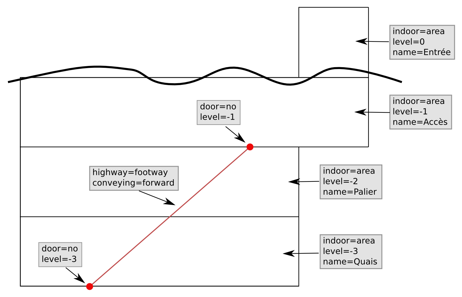 | 1,473 × 946 (97 KB) | PanierAvide (talk | contribs) | Scheme for Simple Indoor Tagging, explaining how to map stairs through levels. |
You cannot overwrite this file.
File usage
The following 4 pages use this file: