File:Siedlce-fireproof-josm.gif
Original file (3,714 × 3,128 pixels, file size: 1.41 MB, MIME type: image/gif)
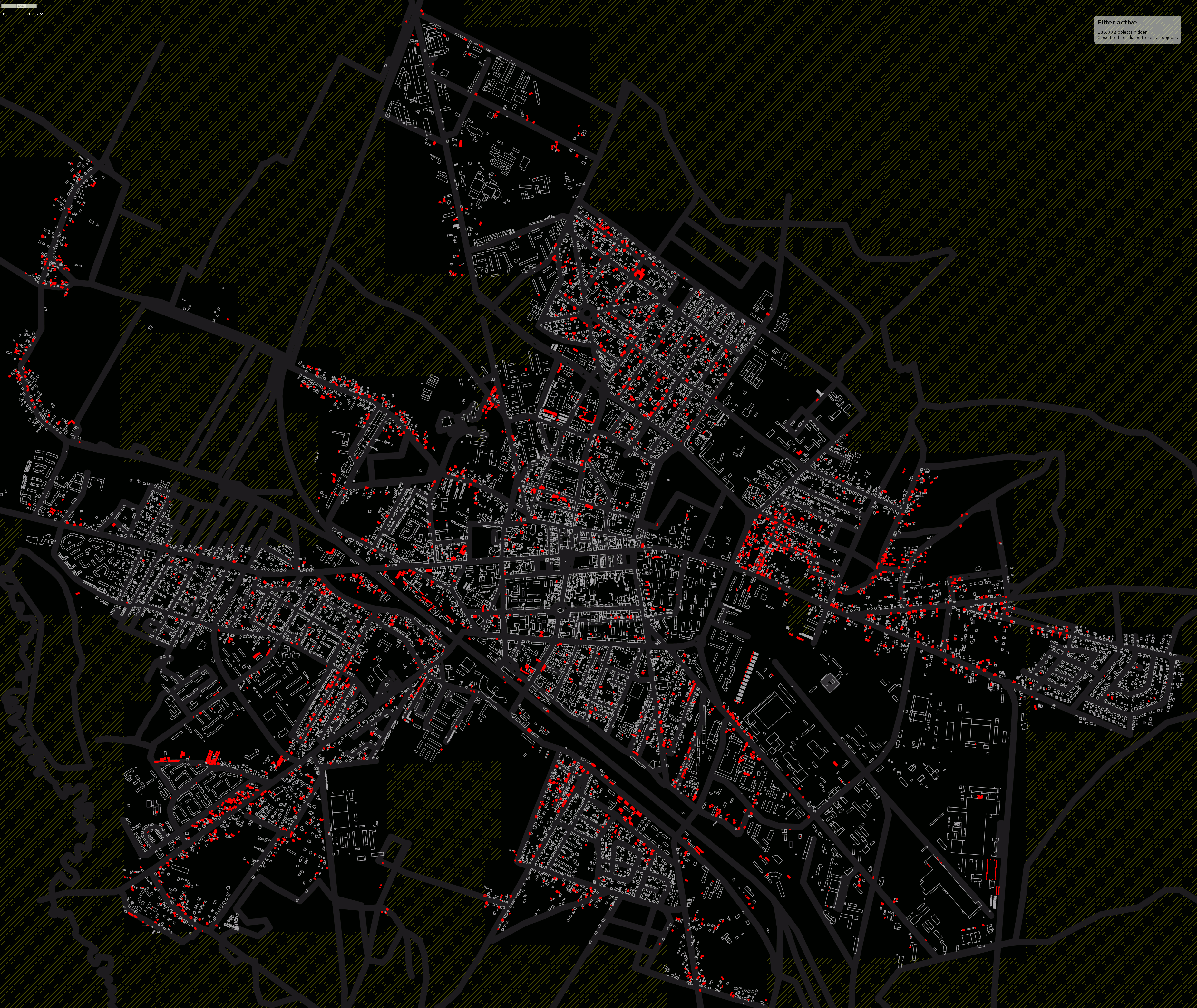
This is a simple rendering of the building:fireproof=<yes|no> tag on buildings in Siedlce. Virtually all of the data shown comes from the Siedlce municipality council's donation of geodesic data, of which some layers have been imported into OpenStreetMap. The data included many attributes, one of them being the classification of structures as fireproof or not. The town's council now uses an OSM slippymap on its website.
The rendering is done in JOSM using its newly added MapCSS support. The following stylesheet has been used along with a filter on "-type:way".
area[building:fireproof=yes] {
        z-index: 3;
        color: #a0a0a0;
        width: 1.5;
}

area[building:fireproof=no], area[building][!building:fireproof] {
        z-index: 5;
        fill-color: red;
        fill-opacity: 1.0;
        width: 3.0;
}

way[!building] {
        z-index: 0;
        width: 20.0;
        color: #303030;
}
Licensing
![]()
![]()
It may include old OpenStreetMap data (before September 12, 2012), in such case CC-BY-SA-2.0 also applies:
![]()
File history
Click on a date/time to view the file as it appeared at that time.
| Date/Time | Thumbnail | Dimensions | User | Comment | |
|---|---|---|---|---|---|
| current | 01:22, 4 March 2011 | | 3,714 × 3,128 (1.41 MB) | Balrog (talk | contribs) | This is a simple rendering of the building:fireproof=<yes|no> tag on buildings in Siedlce. Virtually all of the data shown comes from the Siedlce municipality council's donation of geodesic data, of which some layers have been imported int |
You cannot overwrite this file.
File usage
There are no pages that use this file.