File:Smaland-outline.png
Jump to navigation
Jump to search


Size of this preview: 786 × 599 pixels. Other resolutions: 315 × 240 pixels | 630 × 480 pixels | 939 × 716 pixels.
Original file (939 × 716 pixels, file size: 25 KB, MIME type: image/png)
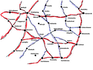
Very simple hand-drawn map outlining the major roads and towns of the provinces Småland and Blekinge in south-eastern Sweden.
File history
Click on a date/time to view the file as it appeared at that time.
| Date/Time | Thumbnail | Dimensions | User | Comment | |
|---|---|---|---|---|---|
| current | 00:59, 4 February 2006 | | 939 × 716 (25 KB) | LA2 (talk | contribs) | Very simple hand-drawn map outlining the major roads and towns of the provinces Småland and Blekinge in south-eastern Sweden. |
You cannot overwrite this file.
File usage
The following page uses this file: