File:Storkbh.png
Jump to navigation
Jump to search

Size of this preview: 665 × 599 pixels. Other resolutions: 266 × 240 pixels | 533 × 480 pixels | 852 × 768 pixels | 1,136 × 1,024 pixels | 2,273 × 2,048 pixels | 3,640 × 3,280 pixels.
Original file (3,640 × 3,280 pixels, file size: 1.88 MB, MIME type: image/png)
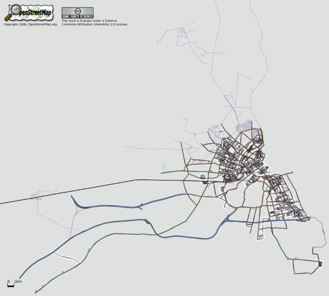
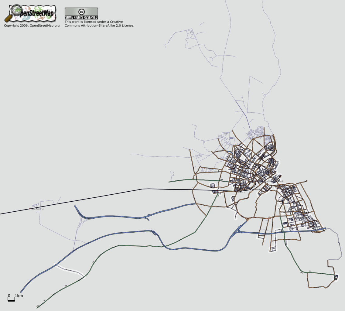
osmarendered map of greater Copenhagen, with 80% of the named ways correctly tagged with type. Remaining ways rendered as single tracks.
File history
Click on a date/time to view the file as it appeared at that time.
| Date/Time | Thumbnail | Dimensions | User | Comment | |
|---|---|---|---|---|---|
| current | 07:56, 13 July 2006 | | 3,640 × 3,280 (1.88 MB) | Dutch (talk | contribs) | osmarendered map of greater Copenhagen, with 80% of the named ways correctly tagged with type. Remaining ways rendered as single tracks. |
You cannot overwrite this file.
File usage
There are no pages that use this file.