File:Swaffham ver0.1.png
Jump to navigation
Jump to search

Size of this preview: 800 × 590 pixels. Other resolutions: 320 × 236 pixels | 640 × 472 pixels | 836 × 617 pixels.
Original file (836 × 617 pixels, file size: 96 KB, MIME type: image/png)
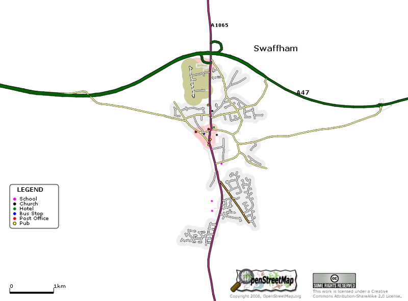
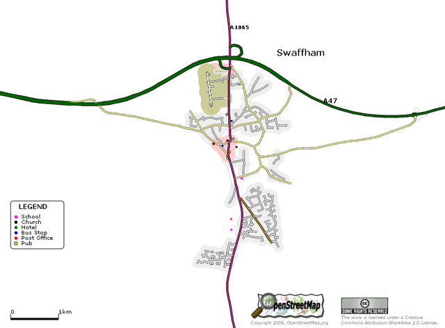
More renderings - At the beginning of the year I mapped 75% of Swaffham in Norfolk on my bike (a puncture truncating the log before I was done!).
![]()
Contains map data © OpenStreetMap contributors, made available under the terms of the Creative Commons Attribution-ShareAlike 2.0 (CC-BY-SA-2.0).
File history
Click on a date/time to view the file as it appeared at that time.
| Date/Time | Thumbnail | Dimensions | User | Comment | |
|---|---|---|---|---|---|
| current | 16:20, 27 March 2006 | | 836 × 617 (96 KB) | Blackadder (talk | contribs) | More renderings - At the beginning of the year I mapped 75% of Swaffham in Norfolk on my bike (a puncture truncating the log before I was done!). |
You cannot overwrite this file.
File usage
The following page uses this file: