File:Tactile Map Aachen.jpg
Jump to navigation
Jump to search
Size of this preview: 800 × 532 pixels. Other resolutions: 320 × 213 pixels | 640 × 425 pixels | 1,024 × 680 pixels | 1,280 × 851 pixels | 2,188 × 1,454 pixels.
Original file (2,188 × 1,454 pixels, file size: 1.23 MB, MIME type: image/jpeg)
Summary
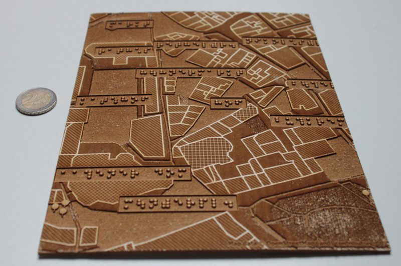
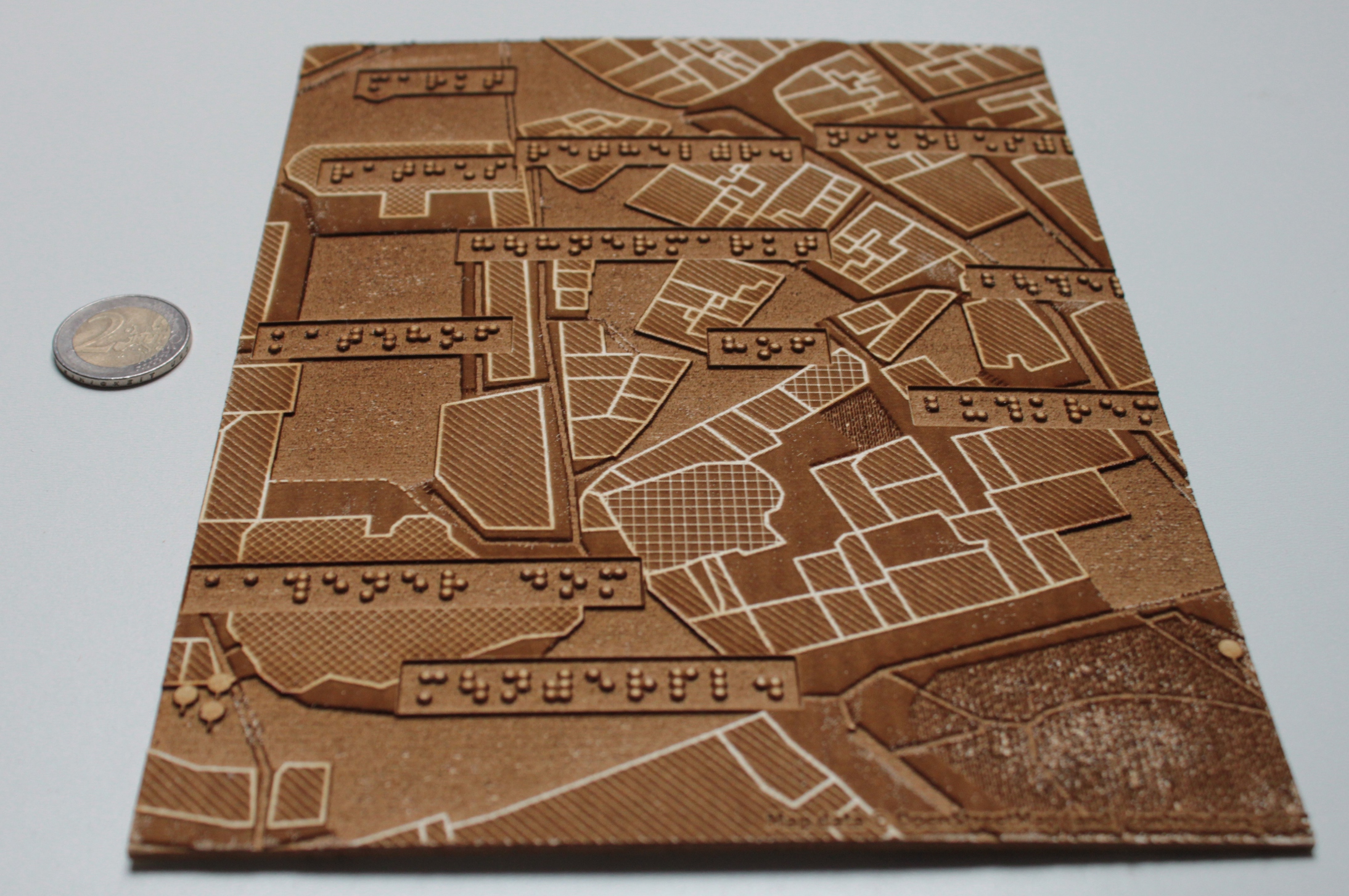
Proof-of-concept of a tactile map of Aachen. 2 Euro coin for size comparison. See User:Head/HaptoRender for description.
Map data by OpenStreetMap. Tactile map created by User:Head using Maperitive. Produced at the Fab Lab of RWTH Aachen University.
Licensing
- This media file was uploaded by author of the work and its copyright holder.
![]()
![]()
![]()
This work is licensed under the Creative Commons Attribution-ShareAlike 2.0 License.
Attribution: Head
Attribution: Head
![]()
Contains map data © OpenStreetMap contributors, made available under the terms of the Creative Commons Attribution-ShareAlike 2.0 (CC-BY-SA-2.0).
File history
Click on a date/time to view the file as it appeared at that time.
| Date/Time | Thumbnail | Dimensions | User | Comment | |
|---|---|---|---|---|---|
| current | 17:36, 15 May 2011 | | 2,188 × 1,454 (1.23 MB) | Head (talk | contribs) | Proof-of-concept of a tactile map of Aachen. See User:Head/HaptoRender for description. Map data by OpenStreetMap. Tactile map created by User:Head using Maperitive. Produced at the [http://hci.rwth-aachen.de/fablab Fab Lab of RWTH Aachen Uni |
You cannot overwrite this file.
File usage
The following page uses this file: