File:Tartu osm osmarenderer.png
Jump to navigation
Jump to search


Size of this preview: 800 × 525 pixels. Other resolutions: 320 × 210 pixels | 640 × 420 pixels | 856 × 562 pixels.
Original file (856 × 562 pixels, file size: 351 KB, MIME type: image/png)
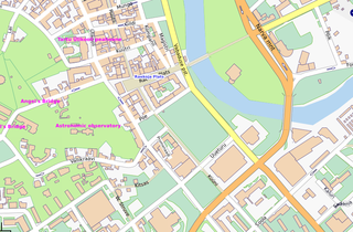
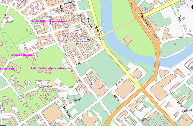
Tartu after importing City Government's data
This is a Featured image, which means that it has been identified as one of the best examples of OpenStreetMap mapping, or that it provides a useful illustration of the OpenStreetMap project. If you know another image of similar quality, you can nominate it on Featured image proposals.
Front-page image for week 5 of 2009 (26 Jan. – 1 Feb.).
- Image descriptions
- Deutsch : Karte von Tartu, die grüne Universitätsstadt in Estland wurde von der Stadtverwaltung untergestützt.
- English : Map of Tartu, the green University town in Estonia were contributed by the City Government
- italiano : Mappa di Tartu, a cui ha contribuito l'amministrazione locale della città estone
- Nederlands : Een kaart van Tartu, de groene Universiteitsstad in Estland, ter beschikking gesteld door het stadsbestuur.
- português : Mapa de Tartu, cidade universitária na Estônia com dados contribuídos pela prefeitura.
File history
Click on a date/time to view the file as it appeared at that time.
| Date/Time | Thumbnail | Dimensions | User | Comment | |
|---|---|---|---|---|---|
| current | 09:36, 20 January 2009 | | 856 × 562 (351 KB) | Jaakl (talk | contribs) | Tartu after importing City Government's data |
You cannot overwrite this file.