File:Tehran-university-persian.png
Jump to navigation
Jump to search

No higher resolution available.
Tehran-university-persian.png (681 × 522 pixels, file size: 100 KB, MIME type: image/png)
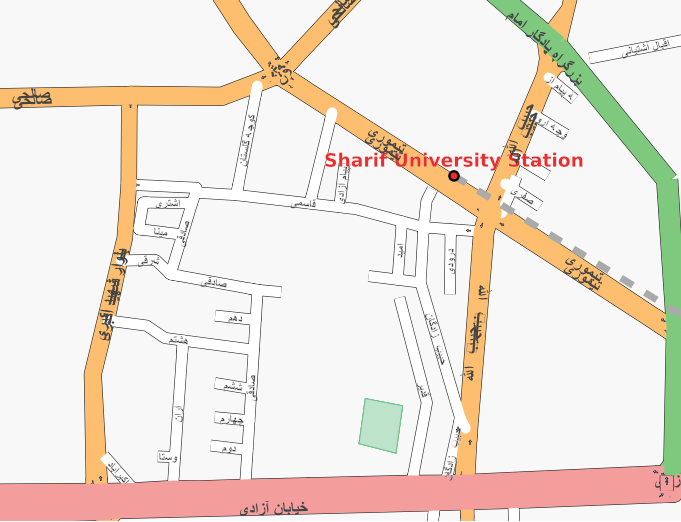
The area around the Sharif University of Technology in Tehran, rendered using the Arabic script.
This was done using a custom version of the osm-map-features-z16.xml rules file with k="name:fa" substituted for k="name" for all street names. It was then rendered using the standard tiles@home client.
![]()
Contains map data © OpenStreetMap contributors, made available under the terms of the Creative Commons Attribution-ShareAlike 2.0 (CC-BY-SA-2.0).
File history
Click on a date/time to view the file as it appeared at that time.
| Date/Time | Thumbnail | Dimensions | User | Comment | |
|---|---|---|---|---|---|
| current | 07:49, 2 March 2007 | | 681 × 522 (100 KB) | 80n (talk | contribs) | The area around the University in Tehran, rendered using arabic script. This was done using a custom version of the osm-map-features-z16.xml rules file with k="name:fa" substituted for k="name" for all street names. It was then rendered using the standa |
You cannot overwrite this file.
File usage
The following page uses this file: