File:TerpNavPedestrianMappingSystem.png
Jump to navigation
Jump to search


No higher resolution available.
TerpNavPedestrianMappingSystem.png (720 × 499 pixels, file size: 250 KB, MIME type: image/png)
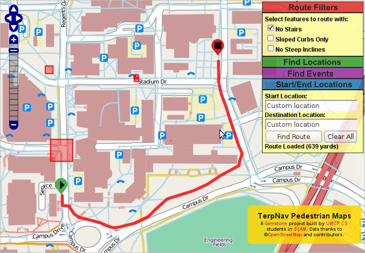
TerpNav Pedestrian Mapping System
This is a Featured image, which means that it has been identified as one of the best examples of OpenStreetMap mapping, or that it provides a useful illustration of the OpenStreetMap project. If you know another image of similar quality, you can nominate it on Featured image proposals.
Front-page image for week 12 of 2009 (16–22 Mar.).
- Image descriptions
- English : Computer Science students at the University of Maryland have created a pedestrian routing map based on OpenStreetMap data. Support is even included for wheel friendly routing, and avoiding certain areas.
- italiano : Gli studenti di informatica della University of Maryland hanno creato una mappa per il routing pedonale basata sui dati di OpenStreetMap. Gestisce anche le barriere architettoniche e le aree da evitare.
- português : Estudantes de Ciência da Computação da Universidade de Maryland criaram um mapa de roteamento para pedestres baseado nos dados do OpenStreetMap. Há até suporte para roteamento voltado à cadeiras de rodas, e para evitar certas áreas.
File history
Click on a date/time to view the file as it appeared at that time.
| Date/Time | Thumbnail | Dimensions | User | Comment | |
|---|---|---|---|---|---|
| current | 01:59, 9 February 2009 | | 720 × 499 (250 KB) | DavidDean (talk | contribs) | TerpNav Pedestrian Mapping System |
You cannot overwrite this file.