File:Theos mapwarper.png
Jump to navigation
Jump to search

Size of this preview: 800 × 574 pixels. Other resolutions: 320 × 230 pixels | 640 × 459 pixels | 934 × 670 pixels.
Original file (934 × 670 pixels, file size: 814 KB, MIME type: image/png)
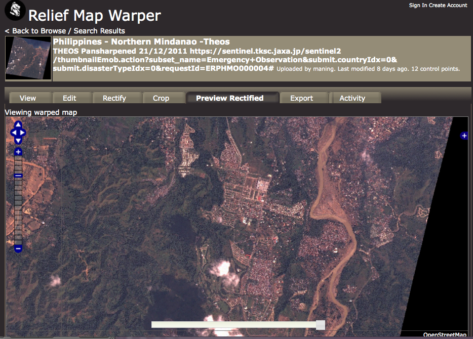
Many satellite providers allows the use of their imagery for free during disasters. This image shows rectified imagery provided by Thailand's satellite (Theos) after the floods around Cagayan De Oro in Northern Mindanao. We rectified this image and is now available for tracing in OSM. More imagery is available in our list
File history
Click on a date/time to view the file as it appeared at that time.
| Date/Time | Thumbnail | Dimensions | User | Comment | |
|---|---|---|---|---|---|
| current | 10:04, 6 February 2012 | | 934 × 670 (814 KB) | Maning (talk | contribs) | Many satellite providers allows the use of their imagery for free during disasters. This image shows rectified imagery provided by Thailand's satellite (Theos) after the floods around Cagayan De Oro in Northern Mindanao. We rectified this image and is n |
You cannot overwrite this file.
File usage
The following page uses this file: