File:Topo-extract-chin-mm.png
Jump to navigation
Jump to search
Size of this preview: 800 × 519 pixels. Other resolutions: 320 × 207 pixels | 640 × 415 pixels | 947 × 614 pixels.
Original file (947 × 614 pixels, file size: 1.25 MB, MIME type: image/png)
Summary
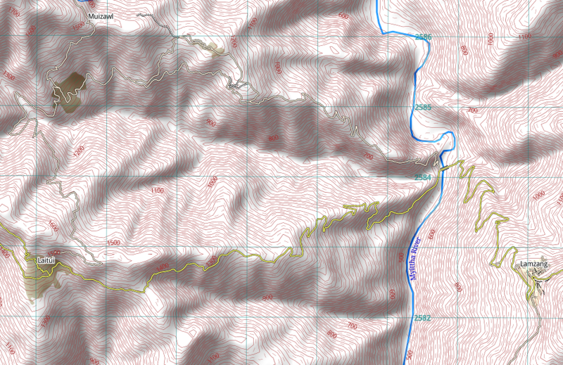
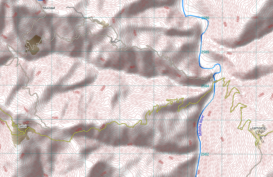
Excerpt from a 1:50000 topographic map from an area west of Tedim, Chin state, Myanmar.
Licensing
![]()
I, the creator of this work, hereby release it into the public domain. This applies worldwide.
In case this is not legally possible, I grant anyone the right to use this work for any purpose, without any conditions, unless such conditions are required by law.
Notice to creator or uploader: Please consider using {{CC0-self}} instead for your work.
"Releasing work to public domain" has some issues, as it is not well defined in some jurisdictions and/or it is not actually possible to "release to public domain". Using CC0 license achieves the intended effect while avoiding such problems and is well suited for media files.
File history
Click on a date/time to view the file as it appeared at that time.
| Date/Time | Thumbnail | Dimensions | User | Comment | |
|---|---|---|---|---|---|
| current | 13:04, 15 August 2015 | | 947 × 614 (1.25 MB) | Michael63 (talk | contribs) | Excerpt from a 1:50000 topographic map from an area west of Tedim, Chin state, Myanmar. |
You cannot overwrite this file.
File usage
There are no pages that use this file.