File:Toralf OSM surveys.png
Jump to navigation
Jump to search

No higher resolution available.
Toralf_OSM_surveys.png (720 × 540 pixels, file size: 301 KB, MIME type: image/png)
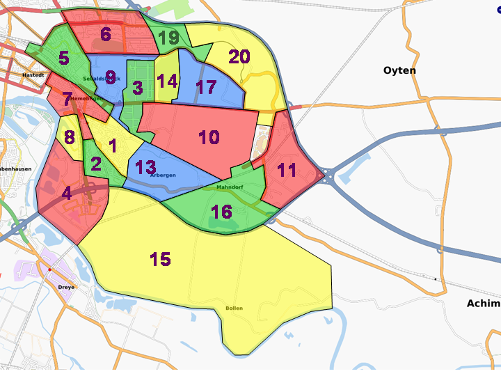
Map of different surveys in southeast of Bremen, Germany
File history
Click on a date/time to view the file as it appeared at that time.
| Date/Time | Thumbnail | Dimensions | User | Comment | |
|---|---|---|---|---|---|
| current | 19:57, 3 September 2009 | | 720 × 540 (301 KB) | Toralf (talk | contribs) | |
| 19:38, 3 September 2009 |  | 720 × 540 (301 KB) | Toralf (talk | contribs) | ||
| 13:43, 24 March 2008 | 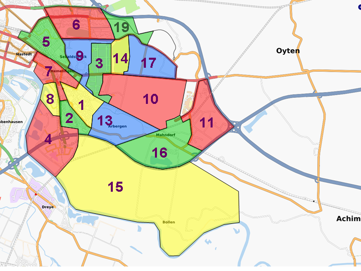 | 720 × 540 (298 KB) | Toralf (talk | contribs) | ||
| 22:12, 8 March 2008 | 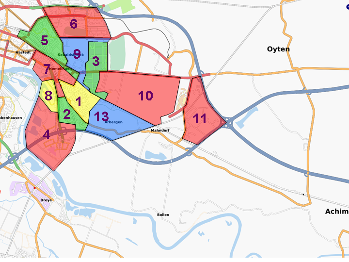 | 720 × 540 (292 KB) | Toralf (talk | contribs) | ||
| 22:47, 4 January 2008 | 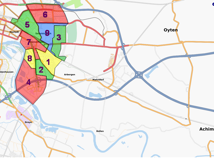 | 720 × 540 (289 KB) | Toralf (talk | contribs) | Map of different surveys in southeast of Bremen, Germany |
You cannot overwrite this file.
File usage
The following page uses this file: