File:UK-Postcodes-06-05-09.png
Jump to navigation
Jump to search
Size of this preview: 423 × 599 pixels. Other resolutions: 169 × 240 pixels | 339 × 480 pixels | 650 × 920 pixels.
Original file (650 × 920 pixels, file size: 467 KB, MIME type: image/png)
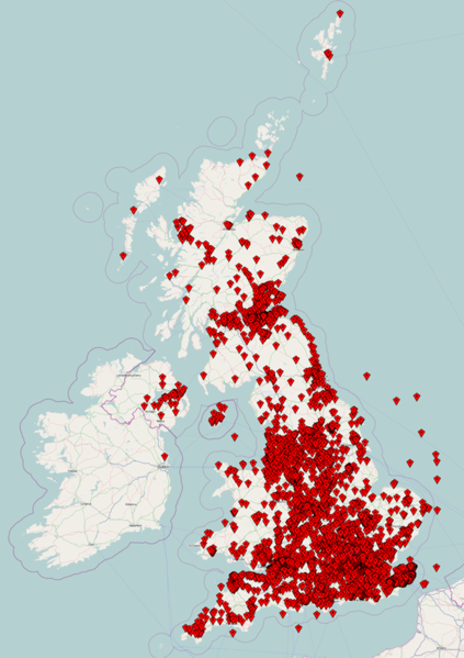
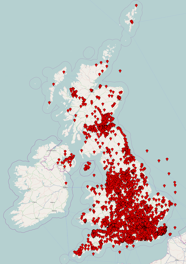
A snapshot view of the the Free The Postcode database of the UK layered over an OpenStreetMap view of the UK.
Data from 06-05-2009
Licensing
![]()
Contains map data © OpenStreetMap contributors, made available under the terms of the Creative Commons Attribution-ShareAlike 2.0 (CC-BY-SA-2.0).
File history
Click on a date/time to view the file as it appeared at that time.
| Date/Time | Thumbnail | Dimensions | User | Comment | |
|---|---|---|---|---|---|
| current | 21:54, 6 May 2009 | | 650 × 920 (467 KB) | Jackstringer (talk | contribs) | A snapshot view of the the Free The Postcode database of the UK layered over an OpenStreetMap view of the UK. Data from 06-05-2009 |
You cannot overwrite this file.
File usage
The following page uses this file: