File:UP Los Baños Campus 2010-10-31.png
Jump to navigation
Jump to search


Size of this preview: 738 × 600 pixels. Other resolutions: 295 × 240 pixels | 591 × 480 pixels | 945 × 768 pixels | 1,260 × 1,024 pixels | 1,692 × 1,375 pixels.
Original file (1,692 × 1,375 pixels, file size: 608 KB, MIME type: image/png)
Information
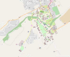
| Description | The campus of the University of the Philippines Los Baños as mapped in OpenStreetMap by Ianlopez1115 |
|---|---|
| Author | seav |
| Source | http://osm.org/go/4zgOOh7Y-- |
| Date | 2010-10-31 |
| Permission | CC-BY 2.0 |
File history
Click on a date/time to view the file as it appeared at that time.
| Date/Time | Thumbnail | Dimensions | User | Comment | |
|---|---|---|---|---|---|
| current | 04:19, 31 October 2010 | | 1,692 × 1,375 (608 KB) | Seav (talk | contribs) | ==Information== {{Information |Description = The campus of the University of the Philippines Los Baños as mapped in OpenStreetMap by Ianlopez1115 |Source = http://osm.org/ |
You cannot overwrite this file.
File usage
The following 2 pages use this file: