File:Vichy - Avenue du Pt Doumer vers gare SNCF.jpg
Jump to navigation
Jump to search


Size of this preview: 800 × 450 pixels. Other resolutions: 320 × 180 pixels | 640 × 360 pixels | 1,024 × 576 pixels | 1,280 × 720 pixels | 1,920 × 1,080 pixels.
Original file (1,920 × 1,080 pixels, file size: 579 KB, MIME type: image/jpeg)
This file and its description are from Wikimedia Commons.
Summary
| Description |
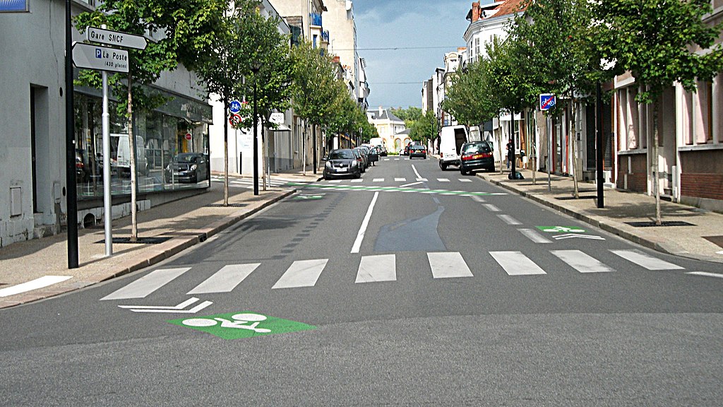
Français : L’avenue du Président Doumer en direction de la Gare SNCF. Cette rue est à deux sens de circulation, dont l’aménagement de cette avenue a été légèrement modifié suite à l’itinéraire cyclable créé fin juin 2011.
Panneaux visibles : Fabricant Lacroix signalisation, revêtement rétroréfléchissant de la classe 1.
|
| Date | |
| Source | Own work |
| Author | Tabl-trai |
| Camera location | | View this and other nearby images on: OpenStreetMap |
|---|
Licensing
I, the copyright holder of this work, hereby publish it under the following license:
This file is licensed under the Creative Commons Attribution-Share Alike 3.0 Unported license.
- You are free:
- to share – to copy, distribute and transmit the work
- to remix – to adapt the work
- Under the following conditions:
- attribution – You must give appropriate credit, provide a link to the license, and indicate if changes were made. You may do so in any reasonable manner, but not in any way that suggests the licensor endorses you or your use.
- share alike – If you remix, transform, or build upon the material, you must distribute your contributions under the same or compatible license as the original.
File history
Click on a date/time to view the file as it appeared at that time.
| Date/Time | Thumbnail | Dimensions | User | Comment | |
|---|---|---|---|---|---|
| current | 17:31, 24 August 2011 | | 1,920 × 1,080 (579 KB) | wikimediacommons>Tabl-trai |
File usage
The following page uses this file: