File:Vignoble-Openstreetmap-Nantes.png
Jump to navigation
Jump to search

No higher resolution available.
Vignoble-Openstreetmap-Nantes.png (698 × 420 pixels, file size: 121 KB, MIME type: image/png)
Summary
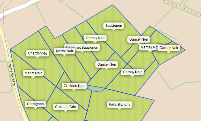
Carte Overpass du vignoble de Chéméré montrant les cépages enregistrés sous le tag grape_variety
Licensing
![]()
![]()
![]()
This work is licensed under the Creative Commons Attribution-ShareAlike 3.0 License.
Attribution not specified as a parameter! THIS LICENSE ALWAYS REQUIRES ATTRIBUTION! Use {{CC-BY-SA-3.0|Attribution, typically name of author}} See Template:CC-BY-SA-3.0 for full description how this template should be used.
Attribution not specified as a parameter! THIS LICENSE ALWAYS REQUIRES ATTRIBUTION! Use {{CC-BY-SA-3.0|Attribution, typically name of author}} See Template:CC-BY-SA-3.0 for full description how this template should be used.
File history
Click on a date/time to view the file as it appeared at that time.
| Date/Time | Thumbnail | Dimensions | User | Comment | |
|---|---|---|---|---|---|
| current | 20:13, 4 October 2015 | | 698 × 420 (121 KB) | Naomap (talk | contribs) | |
| 20:10, 4 October 2015 | 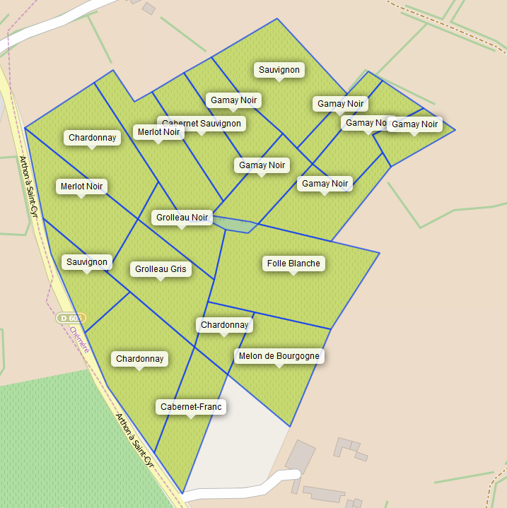 | 717 × 719 (175 KB) | Naomap (talk | contribs) | Carte Overpass du vignoble de Chéméré montrant les cépages enregistrés sous le tag grape_variety |
You cannot overwrite this file.
File usage
The following 2 pages use this file:
- Nantes/Evenements/Operation Libre Chéméré
- File:Vignoble.png (file redirect)