File:Vlv-mapping-areas.png
Jump to navigation
Jump to search


Size of this preview: 631 × 600 pixels. Other resolutions: 253 × 240 pixels | 505 × 480 pixels | 667 × 634 pixels.
Original file (667 × 634 pixels, file size: 307 KB, MIME type: image/png)
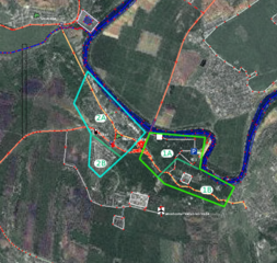
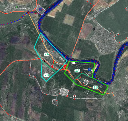
Possible division of Vadul-lui-Voda for the mapping party
File history
Click on a date/time to view the file as it appeared at that time.
| Date/Time | Thumbnail | Dimensions | User | Comment | |
|---|---|---|---|---|---|
| current | 21:13, 11 July 2009 | | 667 × 634 (307 KB) | Jekader (talk | contribs) | Possible division of Vadul-lui-Voda for the mapping party |
You cannot overwrite this file.
File usage
The following page uses this file: