Garmin/Oregon series
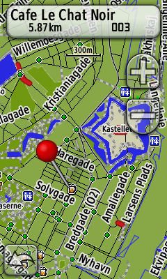
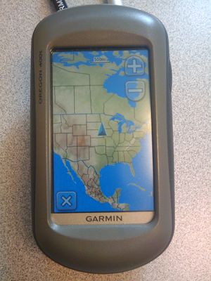
Garmin GPS with a touchscreen. There are actually two different series — the x00 and the x50 — having different firmware. The 0x50 series was introduced in the summer of 2009 and it seems that it will have a slightly longer life expectancy than the older x00 series.
The devices run the older .img map format, for which plenty of OSM maps are available. Like other newer devices, they support raster maps (aerial imagery both by subscription to Garmin Birds' Eye and via custom maps).
For details of software, trouble, etc., the independent Garmin Oregon Wiki has much more detail.
Now available with mapping for UK based on Ordnance Survey.
Oregon 200
Same as Oregon 300, but
- only 24 MB built-in memory, and without
- No "World Wide Shaded" base map.
- No unit-to-unit wireless transfer.
- No barometric altimeter.
- No electronic compass
- No audible feedback (no beeper / speaker)
- Yellow plastic inner chassis (instead of light metal of 300+)
Oregon 300
Good Things
- Plays nicely with OSM, Linux, Mac, Windows. Simply connect with USB and it will appear as a mass-storage device with GPX files ready to copy and upload.
- New touch screen interface works well
- Barometric Altimeter
- Electronic Compass
- Ample built-in memory (850 MB)
- Expandable memory (microSD card, up to 4 GB)
- Well-built unit, rugged
- Waterproof
- Profiles: Different settings for different actions, like mapping, biking, geocaching
Bad Things
- 10,000-point track log limit.
- Screen OK, but not as bright as, e.g., Vista/Legend HCx.
- Price (around US$500 - January 2009).
Compared To eTrex Vista
A subjective view from an eTrex Vista Cx user who recently bought a Garmin Oregon (in addition to points mentioned above):
Good Things
- Much improved GPS receiver
- Touch screen is much easier to use than Vista's joystick when navigating the map
- Map rendering is much faster and smoother than on Vista
- Standard support for USB external drive on Windows, without any special setup. GPX files can simply be drag&dropped from the Garmin external drive to computer disk.
Bad Things
- The screen is much less bright and difficult to see in the sunlight
- Everything is done through the touchscreen, which is sometimes cumbersome. I miss those side buttons, especially the menu button which displays a context menu on Vista; this is missing on Oregon
- Compared to Vista, the user interface is a bit oversimplified — see the previous point
- No screen cycling — you have to exit the map, choose another screen, then exit that screen and choose the map again
- I couldn't find a way to manually set my location. You have to wait for the GPS receiver to eventually figure it out on its own.
- —Breki 19:25, 2 September 2009 (UTC)
- WAAS/EGNOS works very badly or not at all, see unofficial Oregon Wiki. With Vista, you normally have accuracies of 2–3 meters, with Oregon, it is 6–8 meters (EGNOS hasn’t worked for me so far). For navigation, this is not important, but for mapping it really is.
- —Candid Dauth 03:06, 2 January 2010 (UTC)
I don't agree with the statement about WAAS/EGNOS above, I use both Vista and a 550. My experience is that 550 is more accurate, with 2-3 meters even in forests. I have WAAS/EGNOS activated on both units, but cannot confirm it ever kicked in on the 550. (Cause I haven't looked).
- —TheOddOne2 01:35, 17 March 2012 (UTC)
Oregon 400t
Same as Oregon 300, but with preloaded topographic maps (EU and U.S. editions) and more internal memory (3.7 GB, thereof 1.5 GB free)
Oregon 400i
Same as Oregon 300, but with preloaded map of U.S. inland lakes.
Oregon 400c
Same as Oregon 300, but with preloaded "BlueChart g2 coastal" map.
Oregon 450
The Oregon 450 is the successor of the Oregon 300/400 series and to be released in January 2010
- 3-axis compass
- better display (same as Oregon 550)
- no camera
Oregon 450t
Same as Oregon 450, but with preloaded topographic map of Europe, United States, Canada, Australia or Taiwan (depending on version)
Oregon 550
Same as Oregon 300, but adds:
- 3.2 megapixel camera with autofocus, 4x digital zoom. Each photo is automatically geotagged. The orientation is also saved [1].
- 3-axis compass
- Support for 10,000 points, 200 saved tracks
Oregon 550t
Same as Oregon 550, but with preloaded "US Topo 2008" map.
List price US$599.99, as of early 2010. Street prices as low as US$460.


