Gent
| V・T・E |
| latitude: 51.0838, longitude: 3.7148 boundary: 897671897671 |
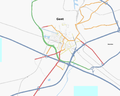
| Browse map of Gent 51°05′01.68″ N, 3°42′53.28″ E |
| Edit map |
|
External links:
|
| Use this template for your locality |
Gent is a city in Oost-Vlaanderen, Flanders, Belgium at latitude 51°05′01.68″ North, longitude 3°42′53.28″ East.

Ghent (IPA: [gɛnt]; Gent [ɣɛnt] in Dutch; Gand [gɑ̃] in French, formerly Gaunt in English) is a city and a municipality located in Flanders, Belgium. It is the capital and biggest city of the East Flanders Province. Source Wikipedia
Events
- Gent/Zomer 2013 a series of summer meet-ups for any OSM-related enthousiasts in and around Gent! Feel free to join us any time of a conversation and a drink.
OSM Coverage
Quite a few segments around the city, but not much tagged. It would be really helpfull that the creator of the gps segments would put his information about the streets online. That way more people could help tagging.
- I live in Gent and now checked out the available data. In my area I did a check with my GPS and noted that some double lane streets are only mapped in one direction and that some segments represent non-existent streets. I'll start correcting and adding just north of the railway station (where I live) and then add as I have time. Glad to join this project :-) Sebastiaan 00:22, 27 August 2007 (BST)
- I noticed new segments being added. I'm happy no longer to be alone around here. If the user who mapped the Rabotstraat and Burgstraat wants to, we could maybe join forces? Please contact me using wiki or OSM account. Thanks. (I noticed the streets being copyrighted 'xaa', but that user seems to live in the netherlands..) Sebastiaan 09:25, 22 October 2007 (BST)
Gent is slowly getting better and better: Wondelgem, Mariakerke, Sint-Denijs-Westrem are largely complete, Oostakker has been put on the map, the east of town has still some empty spots an Baarle is almost completely missing, but it is on my to do list :-) Thanks for all the marvelous help!Pietje leugenaar 21:08, 2 June 2010 (UTC)
Status
Colour and symbol legend
The status of each map region is indicated by a symbol, which describes the type of feature, and a colour, which indicates the completeness of that feature in a map region.
Usage
The status is displayed using a template Template:State
{{State|Key=progress}}- progress - 1/2/3/4/NA
Meaning of symbols
 - Street names are labelled. This means that the map can be used to find an address - Key: l
 - All housenumbers are present - Key: h
 - All footways are present - Key: fo
 - All wheelchair access is present - Key: d
 - All cycleways, and field and forest roads suitable for bicycles are present - Key: b
 - Roads for car traffic are present. One way streets and pedestrian streets are present. This means that the map can be used for car navigation - Key: c
 - All public transports are present (including name of the bus stop/station names) - Key: tr
 - All stop/station/harbour names are present - Key: ha
 - All bus lines are present (including name of the bus stop names) - Key: bu
 - All trolley/guided bus lines are present (including name of the station names) - Key: ty
 - All tram lines are present (including name of the tram station names) - Key: tm
 - All fast railway lines transports are present (including name of the train station names) - Key: tn
 - All U-Bahn (subway in Germany) lines are present (including name of the station names) - Key: u
 - All S-Bahn (regional commuter train in Germany) lines are present (including name of the station names) - Key: s
 - All steam railway lines transports are present (including name of the train station names) - Key: st
 - All ship lines are present (including name of the harbour station names) - Key: sh
 - All public institutions are present (Churches, sports facilities, venues, schools, hospitals, city hall) - Key: p
 - All emergency services (hospitals...) are present - Key: em
 - All petrol stations are present - Key: fu
 - All restaurants and hotels are present - Key: r
 - All tourist attractions are present - Key: t
 - All natural resources are mapped (e.g Water, Lakes and Woodland) - Key: n
Meaning of colours
| Background colour | Meaning | Use for navigation | To do | value |
|---|---|---|---|---|
| The map needs checking, status unknown | Availability unknown | Please check | (None) | |
| The map contains no or little data | Not to be used | Please complete | 0 | |
| The map contains partial data | Limited usability | Please complete | 1 | |
| The map is largely complete (please describe missing data) | Use with restrictions | Please complete (missing data, streets etc.) | 2 | |
| The map is complete (in the opinion of a mapper) | Suitable for use | Please check and correct any errors | 3 | |
| The map is complete (verified by 2 mappers) ; please indicate Date when checked) | Suitable for use | Please update as needed | 4 | |
| This attribute does not exist in the mapped area (e.g. no petrol stations) | Suitable for use | Please update as needed | X |
Districts
Source: Stad Gent
| Wijk | Status | Note | Mappers / Checked by |
|---|---|---|---|
| Afsnee | User:Pietje Leugenaar / - | ||
| Binnenstad | User:Pietje Leugenaar / - | ||
| Bloemekenswijk | User:Pietje Leugenaar/ - | ||
| Brugse poort | User:Pietje Leugenaar / - | ||
| Elisabethbegijnhof | User:Pietje Leugenaar / - | ||
| Gentbrugge | User:Pietje Leugenaar / - | ||
| Dampoort | User:Pietje Leugenaar / - | ||
| Drongen | User:Pietje Leugenaar / - | ||
| Kanaaldorpen | User:Pietje Leugenaar / - | ||
| Kolegem | User:Pietje Leugenaar/ - | ||
| Ledeberg | User:Pietje Leugenaar / - | ||
| Macharius | User:Pietje Leugenaar / - | ||
| Mariakerke | User:Pietje Leugenaar / - | ||
| Moscou | User:Pietje Leugenaar / - | ||
| Muide | User:Pietje Leugenaar / - | ||
| Oostakker | User:Pietje Leugenaar / - | ||
| Oud Gentbrugge | User:Pietje Leugenaar / - | ||
| Rabot | User:Pietje Leugenaar / - | ||
| Sint-Amandsberg | Good start north of N70. | Sebastiaan / - | |
| Sint-Denijs-Westrem | User:Pietje Leugenaar/ - | ||
| Sluizeken | User:Pietje Leugenaar / - | ||
| Stationsbuurt Noord | Largely completed. | User:Pietje Leugenaar / - | |
| Stationsbuurt Zuid | Largely completed. | User:Pietje Leugenaar / - | |
| Watersportbaan | User:Pietje Leugenaar / - | ||
| Wondelgem | User:Pietje Leugenaar/ - | ||
| UZ | Northern area rather well done. | User:Pietje Leugenaar / - | |
| Zwijnaarde | User:Pietje Leugenaar / - |
Parks
Source: Stad Gent
| Park | Status | Note | Mappers / Checked by |
|---|---|---|---|
| Adolf Papeleupark | |||
| Albert I park | Paths tagged. Not connected to surroundings. | ||
| Astridpark | |||
| Azaleapark | |||
| Baudelohof | Largely done. Needs checking. | ||
| Blaarmeersen | 1 Major track marked. Lots of paths missing. | ||
| Buurtpark biest | |||
| Citadelpark | Larger roads marked. Lots of paths todo. | ||
| Domein Claes Bouaert | |||
| Domein De vijvers | |||
| Domein Vyncke-Bovyn | |||
| Frans Tochpark | |||
| Kasteel Borluut | |||
| Kasteel de Pelichy | |||
| Keizerpark | |||
| La Sapiniere | |||
| Landgoed De campagne | |||
| Maaltebruggepark | |||
| Muinkpark | |||
| Nieuwewandeling | |||
| Ossemeersen | 1 large track done. A few intermittent needed. No park outline. | ||
| Paul de Smet de Naeyerplein | Paths are isles right now. | ||
| Potuit | Sebastiaan | ||
| Rommelwaterpark | |||
| Sint-Baafskouterpark | No park outline. Lots of paths missing. | Sebastiaan | |
| Sint Laurentiusstraat | |||
| Van Tieghem de ten Berghepark | |||
| Vogelenzang | |||
| Westveldpark |
Public transport
NOTE: For public transport the symbols represent the following:
- Tram/Bus: All road/rail taken by the public transport are entered into OSM with appropriate tags
- Halt: All stops have been put into place and labelled with name
- Relation: The line has been entered with a relation. Lines should have 2 children relations, for forward and backward. The children should including route, stops and platforms. Add relation ID of the mother to the table.
- Foot: The immediate surroundings of bus stops are detailed enough to navigate blind people to the correct platform
- Numbers: All stops have been added a ref as assigned by the operator.
| Tram | Status | Relation | Note | Mappers / checked by |
|---|---|---|---|---|
| 1 | 4307991 |
- / - | ||
| 2 | 10547015 |
Ever / Sebastiaan | ||
| 4 | 4307994 |
- / - |
| Bus | Status | Relation | Note | Mappers / checked by |
|---|---|---|---|---|
| 3 | 3637438 |
- / - | ||
| 5 | 4459534 |
- / - | ||
| 6 | 7488220 |
Sebastiaan / - | ||
| 8 | 7487279 |
- / - | ||
| 9 | 5107622 |
- / - | ||
| 14 | 4861904 |
- / - | ||
| 15 | 5332931 |
- / - | ||
| 16 | 10535080 |
- / - | ||
| 17 | 4863651 |
- / - | ||
| 18 | 9328721 |
- / - | ||
| 19 | 9307144 |
- / - | ||
| 20 | 4863758 |
- / - | ||
| 27 | 4451577 |
- / - | ||
| 28 | 4451579 |
- / - | ||
| 28S | 5322795 |
- / - | ||
| 34 | 10570017 |
- / - | ||
| 35 | 5011156 |
- / - | ||
| 36 | 5011110 |
- / - | ||
| 38 | 4459533 |
Sebastiaan / - | ||
| 39 | 9328321 |
Variant naar Gent Belvedereweg nog toe te voegen. | - / - | |
| 41 | 9319654 |
Richting Merelbeke variant via Merelbeke station toe te voegen. In beide richtingen variant beperkt tot Sint-Pietersstation toe te voegen. | - / - | |
| 42 | 3379789 |
- / - | ||
| 43 | 9319657 |
- / - | ||
| 44 | 3379788 |
- / - | ||
| 45 | 5306927 |
- / - | ||
| 47 | 3009191 |
- / - | ||
| 48 | 3019698 |
- / - | ||
| 49 | 3016301 |
- / - | ||
| 52 | 5118992 |
- / - | ||
| 53 | 5118991 |
- / - | ||
| 54 | 5118993 |
- / - | ||
| 55 | 3049917 |
- / - | ||
| 55S | 3058323 |
- / - | ||
| 56 | TBD | - / - | ||
| 57 | 11487916 |
Onvolledig | - / - | |
| 58 | 4456452 |
- / - | ||
| 65 | 9301409 |
- / - | ||
| 67 | 3048169 |
- / - | ||
| 68 | 11480332 |
- / - | ||
| 69 | 3047597 |
- / - | ||
| 70 | 7487139 |
- / - | ||
| 71 | 7485199 |
- / - | ||
| 72 | 7487650 |
- / - | ||
| 73 | TBD | - / - | ||
| 74 | 5119158 |
- / - | ||
| 76 | 5322826 |
- / - | ||
| 77 | 5308122 |
- / - | ||
| 78 | 5119159 |
- / - | ||
| 94 | 4870566 |
- / - | ||
| 96 | 4870567 |
- / - | ||
| N1 | TBD | - / - | ||
| N2 | TBD | - / - | ||
| N3 | TBD | - / - | ||
| N4 | TBD | - / - | ||
| N5 | TBD | - / - | ||
| N17 | TBD | - / - | ||
| N70 | TBD | - / - | ||
| N76 | TBD | - / - |
Water
- Lots to do.
Previous versions
Status on 2006.10.03
