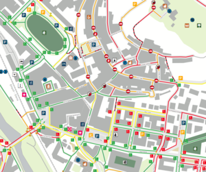
Libero Accesso...Accesso Libera Tutti!
(Redirected from IT:Libero Accesso...Accesso Libera Tutti!)
Jump to navigation
Jump to search
Project Description
Project Website:
- Pages on the municipal website (only Italian)
- Official Web site (coming soon)
- Participatory accessibility web map
The project is a participatory mapping process aimed at mapping the accessibility for persons with reduced mobility within the urban area of Castelfiorentino. It was sponsored by the Regione Toscana, the Municipality of Castelfiorentino and the Banca di Credito Cooperativo di Cambiano. The accessibility and mapping criteria, as well as the accessibility model, were defined by active citizens either participating to a series of traditional labs or contributing through web tools. A first draft of the map was realised by the June 2010 and reviewed during July 2010.
 } }
A printed paper map was issued at the end of August; the printer file is available here. |