JA:Featured images/Jan-Mar 2017
Jump to navigation
Jump to search


These are featured images, which have been identified as the best examples of OpenStreetMap mapping, or as useful illustrations of the OpenStreetMap project.
If you know another image of similar quality, you can nominate it on Featured image proposals.
| ← 2016年1月から3月まで | ← 2016年10月から12月まで | 2017年4月から6月まで → | 2018年1月から3月まで → |
注目の画像のギャラリー、2017年1月から3月まで
2017年、第1週
2017年、第2週
2017年、第3週
2017年、第4週
2017年、第5週

2017年、第6週

2017年、第7週
2017年、第8週

2017年、第9週

2017年、第10週

2017年、第11週
2017年、第12週
2017年、第13週
詳細とキャプション
第1週(2017年1月2日月曜日から2017年1月8日日曜日まで) [Edit]

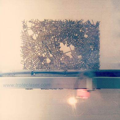
- English : The Mable is a map table, an experimental product featuring OpenStreetMap streets laser-etched into a table top design.
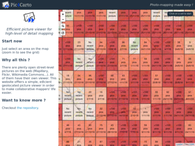
第2週(2017年1月9日月曜日から2017年1月15日日曜日まで) [Edit]

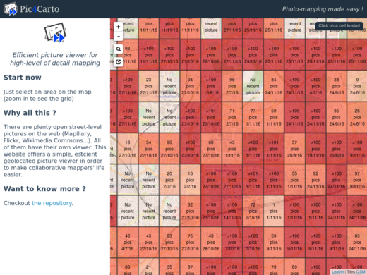
- English : Pic4Carto helps to find useful street-level photos as a source for OpenStreetMap mapping. It shows a grid with the number of open licensed photos to be found in an area.
第3週(2017年1月16日月曜日から2017年1月22日日曜日まで) [Edit]

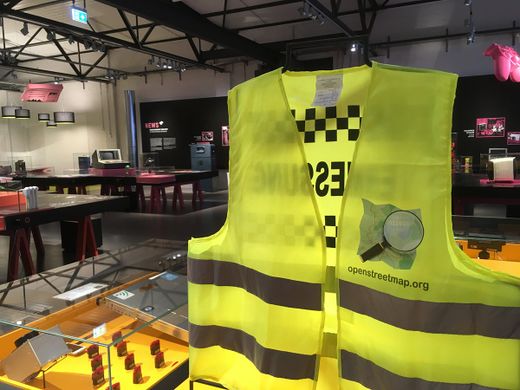
- English : An OpenStreetMap jacket on show at a “Who makes the map” exhibition at the German Museum of Technology.
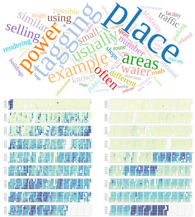
第4週(2017年1月23日月曜日から2017年1月29日日曜日まで) [Edit]

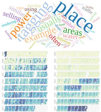
- English : OSMvis is a collection of visualizations related to OpenStreetMap. Top: Most frequent words in the OSM Wiki. Left: Daily amount of new nodes. Right: Number of new users per day. See more visualizations at http://projects.mocnik-science.net/osm-vis/.
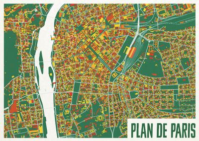
第5週(2017年1月30日月曜日から2017年2月5日日曜日まで) [Edit]

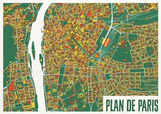
- English : A colourful map from ateljekartan.com. A variety of interesting colour choices are available there to use for ordering poster prints.
(but can you spot the mistake in this image?)
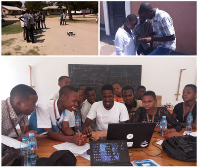
第6週(2017年2月6日月曜日から2017年2月12日日曜日まで) [Edit]

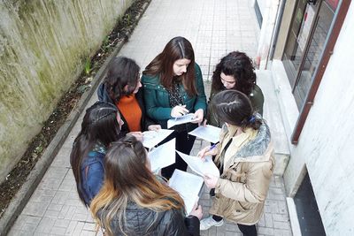
- English : High school students in Bagamoyo, Tanzania, being taught how to gather data and input add to OpenStreetMap, by the Ramani Huria team. Read more on the ramanihuria.org blog.
第7週(2017年2月13日月曜日から2017年2月19日日曜日まで) [Edit]

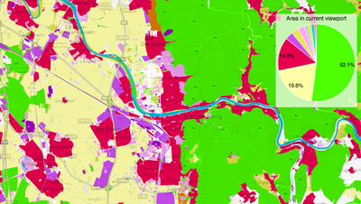
- English : OSMLanduse.org highlights OpenStreetMap's rich landuse/landcover data. The strikingly colourful map shows how our wide range of landcover tags can be broadly classified and analysed.
第8週(2017年2月20日月曜日から2017年2月26日日曜日まで) [Edit]

- English : OSM Mapathon at OpenLabs Albania, a hackerspace in the city of Tirana that are organizing a lot of activities related to OpenStreetMap, Wikipedia and FLOSS. In that mapathon they used FieldPapers.
第9週(2017年2月27日月曜日から2017年3月5日日曜日まで) [Edit]

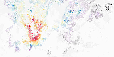
- English : Lauri Vanhala took OpenStreetMap buildings in Helsinki, analysed the location of jobs and travel times from every building, and produced this map to help decide the best place to live. Browse the full map and read more on this blog.
第10週(2017年3月6日月曜日から2017年3月12日日曜日まで) [Edit]

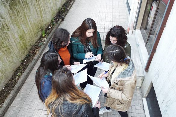
- English : Discussing river area mapping, and Notes at the OpenStreetMap Taipei meet-up. Regular events are listed on the OpenStreetMap Taiwan facebook group.
第11週(2017年3月13日月曜日から2017年3月19日日曜日まで) [Edit]

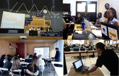
- English : March 4th was OpenDataDay and people all over the world organized small events to talk about and produce Open Data. In a lot of places we had OpenStreetMap activities, like mapping parties, mapathons and talks. Here you can see events in Xalapa (Mexico), Cotonou (Benin), Porto (Portugal) and Brasília (Brazil).
第12週(2017年3月20日月曜日から2017年3月26日日曜日まで) [Edit]

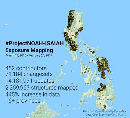
- English : The Nationwide Operational Assessment of Hazards (NOAH) coordinated a series of mapping sessions in the last 12 months that improved the map of Philippines. This data will be used in improving disaster management before, during, and after emergencies. Read more on the NOAH blog.
第13週(2017年3月27日月曜日から2017年4月2日日曜日まで) [Edit]

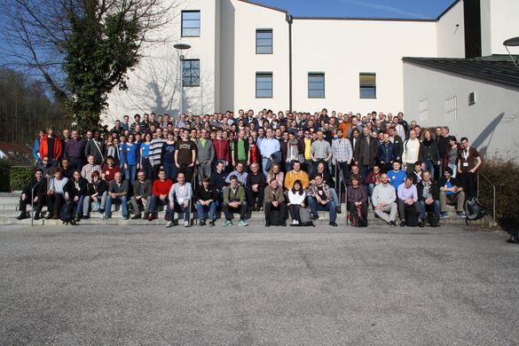
- English : FOSSGIS 2017, the German OpenStreetMap and open source GIS conference, took place last week in Passau.