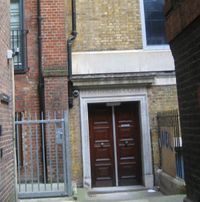
JA:Tag:building=entrance
英語版の記事の内容が分かる方は、翻訳の完成にご協力ください。このウィキの翻訳方法についての説明をお読みください。
現時点では、誰もこの記事の翻訳に取り組んでいないようですので、あなたが取り組めます。
| 説明 |
|---|
| 建物の入口の位置を示すために使います。 |
| OSM Cartoでのレンダリング |

|
| グループ: 建物 |
| 適用できる要素 |
| よく併用されるタグ |
場合によっては:
|
| 状態:非推奨 |
| ツール |
理由は Deprecated features に書かれています。 OpenStreetMap には「禁止の地物」がありませんので、使い続けたり合うように解釈したりするのは自由です。
どのような場合でも、JA:Automated Edits code of conduct による承認なしに、データベース内にあるこのタグを別なタグに自動的(または半自動的)に置き換えるべきではありません。 そのような編集は取り消されます。
building=entrance タグは建物の輪郭沿いまたは建物上のノードで、入口(つまりドア)の位置を示すために使われていました。
このタグは建物ではなく、建物の一部であるので、 building=* と競合していました。置き換えのために entrance=* が導入されました(Proposed features/entrance を参照)。 building=entrance は現在 entrance=* と併用されていますが、 entrance=* はもっと使われるようになりました。 taginfo での比較を参照してください。
統計情報:
- 2012年12月: entrance=* が building=entrance に取って代わられました
- 2014年12月: entrance=* が10倍利用されました [1]
- 2016年5月: 41.000 対 1.060.000 = 25倍以上
タグ付け
Add a node on the way tagged with building=* and give that node the tag building=entrance.
In some countries each entrance is considered to have distinct housenumber, in others a housenumber is property of the whole building.
- Where each entrance of a single building has a unique house number, tag the addr:housenumber=* on that node; for a reasoning, see the SotM session presentation.
- Elsewhere an entrance may have a unique identifier in addition to the house number; you should add that on the entrance node.
If the entrance is, say, for personnel only, you can add a access=private.
入口の位置を改善するための方法
Although the GPS accuracy is limited, you can get reasonable results by visually approximating how far along the wall the entrance is. That is, is the door exactly at the halfway point, or one third of the wall length from either end? You can also visualize any passenger car of known length along the wall and count the distance accordingly. At least JOSM will show you the distance from any selected node to aid positioning the new node a known distance from the selected corner.
Another method is to approach the building straight to the entrance to have a track that you can extend until it meets the buidling outline.
When combined with meticulously positioned aerial images the result is better than a single GPS measurement at the door could provide. Remember to align the nodes of a straight wall in a line (in JOSM: Tools - Align Nodes in Line), but also remember that not all buildings that appear to be straigt are really straight.
If you estimate the position, please add FIXME=Position estimated. Some software solutions for blind persons rely on accurate positions and give a warning message if there is a FIXME tag set.
関連項目
- addr=* for adding house numbers, the current way for that is the Karlsruhe Schema
- entrance=* as another way of tagging entrances
- barrier=entrance
