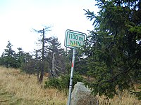
Key:ele:NHN
Jump to navigation
Jump to search
| Description |
|---|
| The elevation of a node in unit Normalhöhennull (meters) (German elevation modell). |
| Group: properties |
| Used on these elements |
| Status: in use |
| Tools for this tag |
|
The elevation of a node in unit Normalhöhennull (meters) (German elevation modell).
Precision
You may indicate the precision of the elevation value by setting the number of decimal places:
Examples
- Precision 0.1 meters: use values like 51.4, 75.0
- Precision 0.01 meters: use values like 51.43, 85.30
See also
- ele:DHHN92=* - Other key with same meaning
- Normalhöhennull on Wikipedia
