Key:format

From OpenStreetMap Wiki
Jump to navigation Jump to search
Public-images-osm logo.svg format
Description
Describes the physical shape of an object. Show/edit corresponding data item.
Group: properties
Used on these elements
may be used on nodesshould not be used on waysshould not be used on areasshould not be used on relations (except multipolygon relations)
Useful combination
Status: in use

The format key describes the physical shape of an object. format=* describes the basic form, format:top=* the form of the head/the top. Used for historic milestones (historic=milestone) or boundary stones (historic=boundary_stone), but it can also be useful for other objects. For buildings, see 3D building.

Exact dimensions can be added using height=*, width=*, length=*, diameter=*.


Values of format

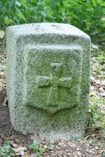
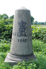
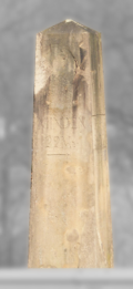
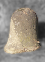
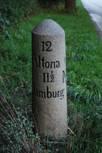
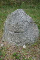
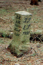
Photo Jt osm grenzstein hl tremskamp.jpg Janda at Mudot Rajapuram.jpg Jt meilenstein.jpg Meilenstein-Elspe.png Halbmeilenstein-Trockenbrueck.png Jt osm meilenstein suesel.jpg Jt osm grenzstein lübeck.jpg
format = squared_stone triangle conus obelisk bell cylindrical irregular
format =
(german)
viereckig dreieckig kegelförmig Obelisk glockenförmig zylindrisch unregelmäßig

Values of format:top

Photo Ordnance Boundary Stone at the Junior Commissariat Officer's Quarters - Butler's Barracks - Niagara Historical Park - Parks Canada - Niagara-on-the-Lake, ON Canada 05.jpg Boundary Stone along Rennsteig (11).jpg Old Boundary Marker by Parks Road, opposite Wadham Cottage, Oxford Parish (geograph 6037663).jpg Grenzstein Weiser Stein, Stöckey.jpg Jt osm stein mit satteldach.jpg Jt meilenstein.jpg Jt osm meilenstein suesel.jpg
format:top = flat rounded segment-like gable-like pyramidal pointed spherical
format:top =
(german)
flach
(ebener Kopf)
rund
(halbkreisförmig)
segmentbogig
(flacher gerundet)
giebelartig pyramidenförmig punktförmig
(spitz zulaufend)
kugelförmig