Key:lanes:bus
| Description |
|---|
| Number of lanes for buses on public transport. |
| Group: properties |
| Used on these elements |
| Useful combination |
|
| Status: de facto |
| Tools for this tag |
|
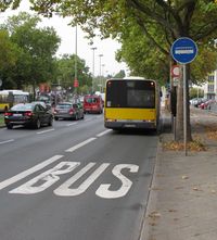
The lanes:bus=* key can be used to mark the number of lanes reserved for busse on a way.
The most common value is 1, when a bus lane exists. For a two-way road with dedicated bus lanes in both directions, the value would be 2. If the lane is for Public Service Vehicles (buses, taxis etc.), use lanes:psv=* instead.
Where a way element has a bus lane only in one direction, use lanes:bus:forward=*, and lanes:bus:backward=* when that lane is usable in the direction of the way, or against the direction of the way, respectively.
If the whole road is exclusively for busse, use regular access conditions: access=no + bus=designated ; motor_vehicle=no + bus=designated when shared by bicycles ; or else highway=busway or highway=bus_guideway where applicable.
Time restriction
A time restriction is set with lanes:bus:conditional=1 @ Time dependency
