Leicester Mapping
Leicester can be complete with a final push to get all the roads done, so we can get on working on the POIs etc.
Results
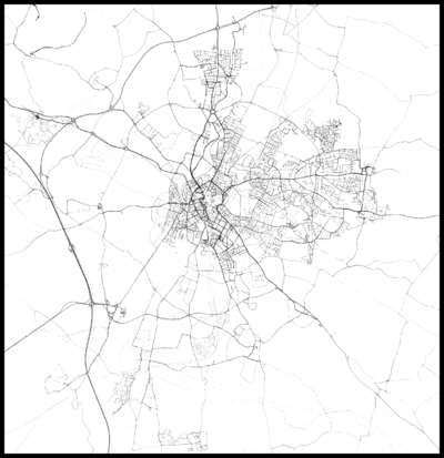
State of The Leicester Map
| Current Map | Current Data |
|---|---|

|
At the moment the centre of the town is done, and those parts that are done are very well done, however massive gaps are clearly visible in Highfields, Claredon Park, Knighton etc. The main aim of this mapping party is to get all areas close to the city centre. Main areas to be completed are
- Clarendon Park
- Highfields
- Spinney Hills
- Aylestone
This mapping party will also be special as it will be done jointly as an event with the University of Leicester Computing Society, the idea being we can introduce new people into OSM and it's ideals etc.
When/Where is it?
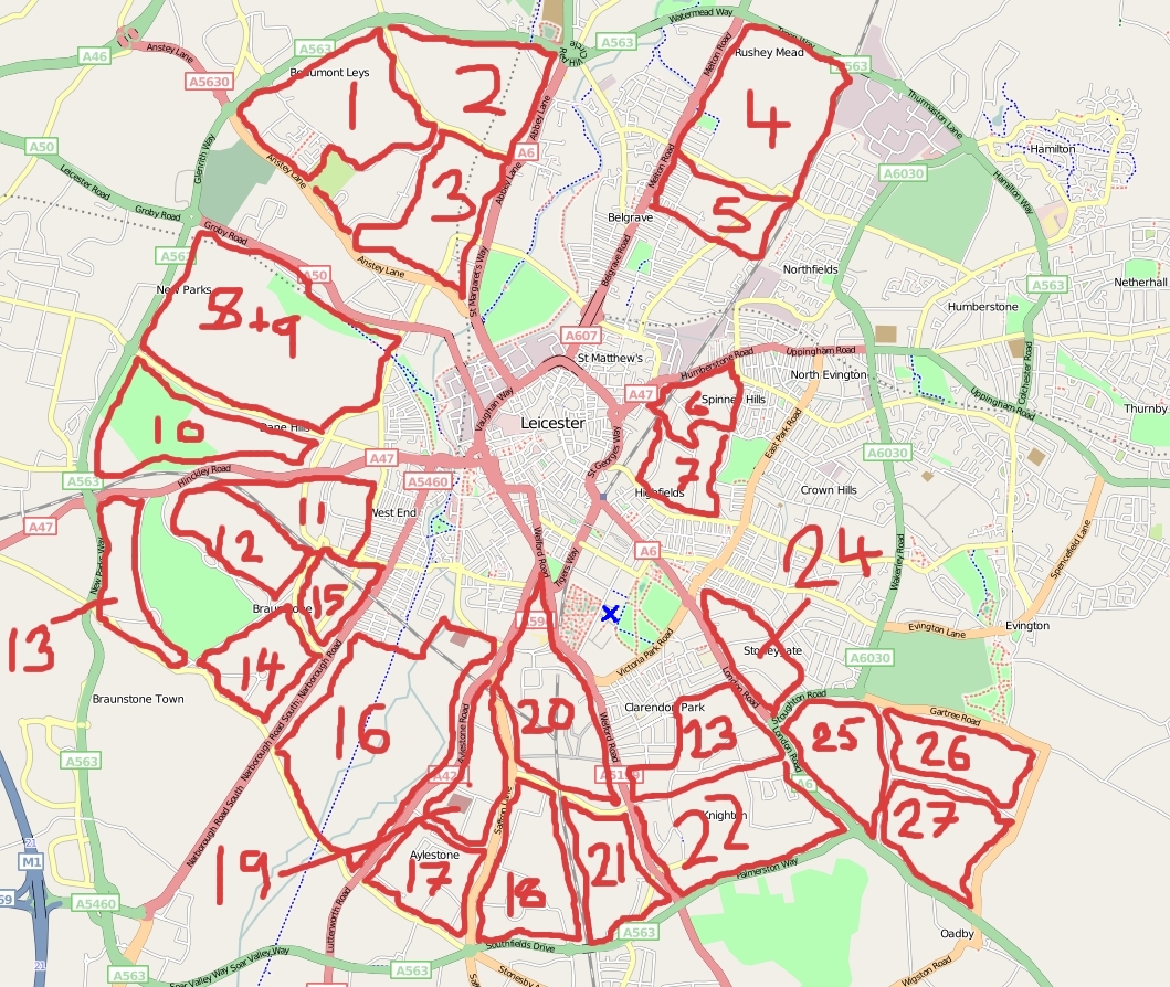
Saturday 7th of March at 0900 - At the foyer of the Leicester University Charles Wilson Building at 52.626785, -1.123406. Marked by the blue cross on the cake map. From the train station, walk left onto London Road for about 600/700 meters then turn right at Leicester Central Church onto University Road. Walking along for about a kilometer, then turning left at the University's entrance number 2, Mayors Walk. In front of you there is the Charles Wilson Building. If you arrive late, not to worry we'll be on the third floor (use the lifts on the right side of the building) and room 307.
Mapping from 1000-1600 then we'll all meet back at the University for a crash course in JOSM and uploading to OSM database and nibbles
Areas
This cake may seem rather large, and it is! However we'll concentrate on those areas close to the city centre, though in doing a cake of this size, it shows the progression of the Leicester mapping cause. Please add your name and what area of the cake you want below...
- Slices 6 and 7 - Mark Iliffe
- Slices 18, 17, working west - Ben 16:59, 4 January 2009 (UTC)
- Slices 19 to 24 - Members of the University of Leicester Computing Society
Slices 1, 2, and 3 - GregorywSlices relinquished- Slice 23 - Chris Elston
- Your name here
Who will be there
- Mark Iliffe - Organiser - Phone 07549928802
- Simon Ward, probably. I prefer to map somewhere by bicycle.
- Ben, Probably
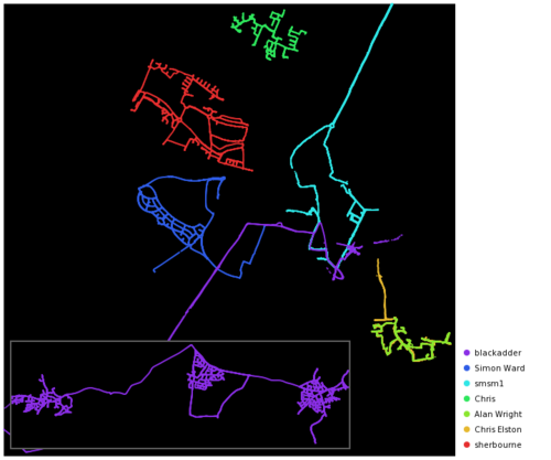
Morwengoing to have to back out sorry- Blackadder. Will hope to map some of the villages off the B585 & B582 to the west of Leicester. See here for results
- Chris Parker. Will be coming from the morning!
- Smsm1
Gregoryw. May do some mapping on Sunday as well.Unfortunately far too busy to make it. I was really looking forward to this one. Sorry.- Firefishy - Most likely.
- Chris Elston - Would like to steal slice 23 from under the noses of ULCSoc because I live in it :)
- Ainsworth - Probably
- sherbourne
Chippy- cant make it after all, sorry.- Alan Wright - Complete newbie, hoping to learn as much as possible.
- John Pit
Facebook Event Link
Follow this link to join/ view the facebook event for this mapping party! Facebook Mapping Party Leicester
Evening Entertainment
When we've finished mapping, as there is the students union on site we can also 'enjoy' a good few drinks and worse dancing in the night. For those that do come, bring your GPS and we'll map the 'amenities' that Leicester has to offer!
Accomodation
If you would like to come, however have no accomodation for the night, please put your name below and we'll try and find you accommodation. Likewise if you are local and can offer a mapper a bed/sofa/floor for the night leave your details below. That being said, the cheap hotel Etap is on the ring road if you have a car for about £30...
- Mark Iliffe - I have a floor which can fit about two people on, confortably...


