MTB map Europe
(Redirected from MTB map Czech Republic)
Jump to navigation
Jump to search
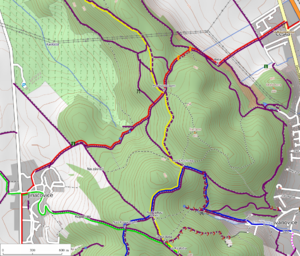
Mountain bike map of Europe is a project from (User:MattesCZ). It shows mountain bike, cycling and hiking tracks in Europe. Originally, it only covered Czech Republic and surrounding regions, but it has been extended recently to cover the whole Europe. Since June 2013 we offer configurable online routing service for planning MTB and hiking trips (Czech Republic only).
News
- English and Czech localization (2013-09-13)
- Project source code moved to GitHub (2013-09-04)
- Rendering area extended 15 degrees to the East - Turkey, Ukraine, west Russia (2013 August)
- New feature: MTB and hike routing with configurable parameters (2013 June)
- Bunch of new features: map legend, GPX support, high resolution map export (2012 December)
Major features
- Mountain bike tracks difficulty: Mountainbike
- Hiking tracks rendering based on Key:osmc:symbol
- Map legend for each zoom level
- MTB and hiking tracks routing configurable with track parameters (Currently covers Czech Republic only)
- Topographic base layer
- Relief: shading, hypsometry, contours based on SRTM 90m DEM v4.1
- Export of the map into PNG images in print resolution
- Creating of altitude profiles from GPX files, routed tracks, user-defined tracks
Notes for users
- Please, be patient with the rendering of tiles in high scales (higher zoom levels).
- We use OpenStreetMap data (of course). If you miss something in the map, start collecting and contributing your geographic data too.
Notes for mappers
- Beginners should follow Beginners' guide
- Follow instructions on Mountainbike and especially Key:mtb:scale
- Use Key:osmc:symbol for hiking tracks
- Your recent changes will not render immediately after data import. Use "export" function to see your changes.
- Consider tagging importance of map features Key:importance
TODO
Feel free to contact User:MattesCZ if you have solutions for following issues or new ideas.
Map style
- Hiking
- Show hiking tracks difficulty based on Key:sac_scale
- Render highway='bridleway' differently from routes for hiking and biking
- Other
- Update map icons according to Cs:WikiProjekt Česko/OTM_značkový_klíč
- Tunnels rendering with offset line parameters
- Show end points of bridges and tunnels
- Add natural='cliff', natural='stone' for points, lines and polygons
- Show waterway='weir' nodes perpendicularly to river direction
Mapnik
- Needed support for contour text placement (Mapnik Harfbuzz branch)
- Include contours as transparent images, not render from database every time
Web page
- Altitude profiles
- Show directly in browser window, interactively, with image export
- Allow SVG export
- Add info to start point, end point etc. from Nominatim
- Layers
- Add another topographic base layer without thematic overlays and labels
- Add thematic overlays - text labels, MTB tracks, hiking tracks, cycleways,...
- Add GeoJSON overlays: info about signposts, photos from [openstreetmap.cz]...
- Routing
- Speed up routing queries to enable Europe coverage
- Localization
- Support more languages, English and Czech are available
Technical references
- Project GIT repository - feel free to add issues, comments, stars
- Mapnik 2.2.0 renderer
- Tirex rendering backend
- Leaflet JavaScript library
- HowTo make a hiking map: OpenTrackMap experience, many thanks to Radek Bartoň
