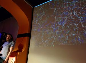
Mapscii

mapscii is a fun "ASCII art" zooming panning view of OpenStreetMap.
mapscii github repo (instructions to run it and videos of it in action)
Viewing
You can view the map in terminal window either telnetting to the Mapscii server or running the nodejs app yourself.
telnet mapscii.me
should work. If your connection unexpectedly drops, try reconnecting with "telnet -E mapscii.me".
No images are transferred by the session, only plain text. Navigate the map simply using your keyboard:
- ↑, ↓, ←, → – scroll around;
- a or z – zoom in and out;
- c – switch between Unicode Braille and raw ASCII mode;
- q – quit the session.
Or, if your terminal supports mouse events, you can drag the map and use your scroll wheel to zoom in and out. The map will center on any location you click.
Terminal requirements
This just requires a terminal supporting an Xterm-compatible emulation (most telnet client softwares support it), and Unicode characters (with UTF-8 encoding) for symbols (including Braille dot patterns) rendered with suitable monospaced fonts installed on your system.
For now the default telnet client of Windows is not supported (no compatible Xterm emulation, it supports only the "ANSI.SYS" legacy terminal emulation inherited from DOS and all past versions of Windows), but you can use the open source client PuTTY to connect. If you are using Windows 10, you can run the native Linux telnet client from the "Ubuntu Bash" optional feature, supported by Microsoft. After connecting press c to activate the raw ASCII mode as otherwise some symbols will not be rendered if your system does not have fonts to render them with suitable monospace metrics. Instead they will be shown as squared "?" symbols (not allowing you to see the distinctive Braille dot patterns or other symbols).
Installation
To run it yourself as a Node.js app, see How to install it locally on Linux.