Newcastle
This page is about Newcastle upon Tyne. You may also want Newcastle under Lyme
| V・T・E |
| latitude: 54.95, longitude: -1.60 |
| Browse map of Newcastle 54°57′00.00″ N, 1°36′00.00″ W |
| Edit map |
|
External links:
|
| Use this template for your locality |
Newcastle is a city in Tyne and Wear at latitude 54°57′00.00″ North, longitude 1°36′00.00″ West.

Welcome to Newcastle!
There's plenty of different areas of mapping to do in Newcastle - including railway and Metro infrastructure, residential areas, universities, shops and retail, cycling and road networks. As always follow the Good practice guidelines and if you're tracing from aerial imagery check that the imagery isn't outdated. Feel free to contact a local mapper for help or just leave a note on the map and someone will look out for it.
Users
The following users have, or do, actively contribute to the map of Newcastle.
Users can copy and paste into their user page to add themselves to the Users in Newcastle category.
Events
Upcoming events
Nothing has been planned lately (at least not on this wiki page!)
Past events
- 2016-2018: FoMSF Newcastle hosted more mapathons! (And Northumbria Uni held one too)
- 21st April 2016: FoMSF Newcastle Missing Maps Mapathon, Newcastle University (Details: https://www.facebook.com/events/201384543563995/)
- 16th February 2016: Friends of MSF Newcastle held their second Missing Maps Mapathon
- 17th December 2015: Friends of MSF Newcastle held their first Missing Maps Mapathon on .
- 8-9th December 2007: The Newcastle Mapping Event 2007 was held
Places around Newcastle
- Tynemouth
- Northumberland
- Durham - home to Living With Dragons project.
Maps
Some funny old map images from very early in the project:
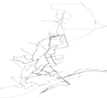
2006 GPS tracks
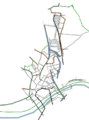
2006 Osmarender of the map so far

