Oakham
Jump to navigation
Jump to search
| V・T・E |
| latitude: 52.67, longitude: -0.74 |
| Browse map of Oakham 52°40′12.00″ N, 0°44′24.00″ W |
| Edit map |

|
|
External links:
|
| Use this template for your locality |
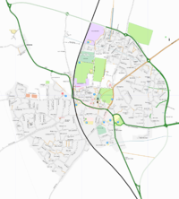
Oakham is a town in Rutland, England, United Kingdom at latitude 52°40′12.00″ North, longitude 0°44′24.00″ West.
Still to do
- The road round the back of Somerfield is missing (between High Street, South Street and the railway line), and street names here are unlabelled.
- Gaol Street (from High Street/Church Street junction to South Street, fairly newly pedestrianised) is missing.
- The track out to Dog Kennel Cottage from the bypass is incomplete.
- The course of the Oakham Canal is worth mapping. Done all the way from Wharflands out to Langham's Burley road. Beyond Burley road it needs doing.
- Feedback from user paul on the Rutnet forum:
Cold Overton Road isn't marked. It's the straight-ish road that goses past the hospital & disused factories.Marked in OSM, label is cropped out of this image. Ojw 00:16, 24 October 2006 (BST)
The road you have marked as 'Braunston Road', where it joins Cold Overton Road, is actually 'West Road'. Braunston Road continues over a junction round to join Long Row and Derwent Drive.OJW's waypoint 159, should mark "Clifton Court, off West Road" (Clifton Court is just a block of flats + garage, probably not marked on our map) so we can add that- Fixed
- John St (which loops around the back of the closed-down supermarket facing on to the High St) is missing.
- Feedeback from user Mike on Rutnet:
- You could spell cemetery correctly.
- Some park areas are still hidden behind the landuse=residential rendering. Blackadder 10:55, 25 October 2006 (BST)
- Change the colour of cycle paths to stand out better alongside the bypass route. Blackadder 10:55, 25 October 2006 (BST)
- Schools are not showing up. The are there in the data and tagged with amenity=school so I guess it just needs an icon link or name display.
Area spotting
Can anyone spot the areas in housing-estate road names?
Mark what you see:
- Palaces
- Buckingham road
- Holyrood Close
- Windsor Drive
- Sandringham Close
- Rivers
- Severn Close
- Shannon Way
- Welland Way
- Dove Close
- Tyne Road
- Trent Road (I used to live here ;) -- Richard )
- Forth Close
- People
- Churchill Road
- Alexander Crescent
- Mountbatten Road
- Kennedy Close
- Browning Road
- Mountains
- Grampian Way
- Cheviot Close
- Alpine Close
- Trees
- Ash Close
- Cedar Close
- The Beeches
- Orchard Close
- Hawthorn Drive
- Bramble Close
- Birds
There's a whole estate of roads named after Birds.
- Cities in Alberta, Canada
- Edmonton Way
- Banff Close
- Camrose Close
- Lethbridge Close
- Jasper Road
