RU:Windows Phone
Jump to navigation
Jump to search
Этот раздел нацелен на сбор любой полезной информации об использовании устройств Windows Phone для целей OpenStreetMap.
Полный список приложений
Основная информация
| Name | Screenshot | Display map | Navigate | Make track | Monitor | License | Price | Languages | Version | Description |
|---|---|---|---|---|---|---|---|---|---|---|
| GPS Navigator aSpass [1] | 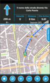
|
да | да | да | нет | nonfreeproprietary | nonfree3.99 € | EN | 2011-10-24 1.5.0.0 |
Navigator |
| maloo outdoor [2] | да | нет | да | да | nonfreeproprietary | nonfree2.99$;2.99€ | EN | 2013-11-16 2.0.0.0 |
Outdoor App designed for hiking and other activities like biking or jogging. | |
| MapStalt Mini [3] | 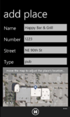
|
нет | нет | ?
|
?
|
nonfreeproprietary | nonfreefree as in beer | EN | 2011-08-01 1.0.0.0 |
"MapStalt puts to power to complete the map into the hands of the mobile user" (grammar by Microsoft) |
| More Maps [4] | 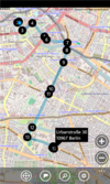
|
да | да | ?
|
нет | nonfreeproprietary | nonfree0.99 € | DE,EN | 2012-06-06 2.1.0.0 |
|
| Multi Map [5] | 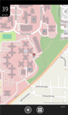
|
да | нет | нет | нет | nonfreeproprietary | free | EN | 2011-10-19 1.0 |
Very simple map viewer |
| NaviComputer [6] | 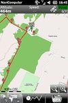
|
да | нет | да | нет | nonfreeproprietary | free | 7 | 2010-11-24 0.95 |
|
| Offline Maps [7] | 
|
да | нет | ?
|
?
|
nonfreeproprietary | nonfree1.49 € | EN | 2011-06-23 1.3.0.0 |
|
| OpenBusMap [8] | 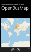
|
да | нет | нет | нет | nonfreeproprietary | free | EN | 2012-04-10 1.1.0.0 |
Public Transport map viewer |
| OSM [9] | 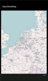
|
да | ?
|
?
|
нет | nonfreeproprietary | free | EN | 2012-01-13 1.1.0.0 |
Map viewer |
| OSMLogger [10] | 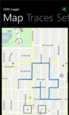
|
да | нет | да | нет | nonfreeproprietary | free | EN | 2012-04-07 0.9.0.0 |
Record GPX traces |
| OsmSharp [11] | 
|
?
|
?
|
?
|
?
|
GPLv3 | free | EN | 2013-04-06 3.1 |
OSM routing and optimisation library. |
| QuoVadis Mobile [12] | 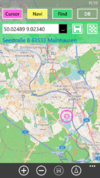
|
да | да | да | да | nonfreeproprietary | nonfree19.99 € | DE; EN | 2014-02-27 1.0.3.3 |
QuoVadis Mobile ist Ihre "Alles-Inklusive-App", wenn es um Navigation, GPS und Karten geht. On- und Off-Road, zu Fuß, mit dem Fahrrad oder Auto, immer dabei und kinderleicht in der Bedienung. Tracking ermöglicht Live-Übertragung und Darstellung von Positionen. |
| Simple OSM [13] | 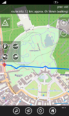
|
да | да | да | да | nonfreeproprietary | nonfree1.99€ | EN | ? 2.13.0.0 |
OpenStreetMap for Windows Phone. Displays online maps, record tracks and provides several OSM unrelated features. |
| Vectorial Map [14] | 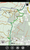
|
да | нет | да | нет | nonfreeproprietary | nonfreedepends on platform | EN | 2014-03-15 1.0 |
Vectorial Map is map viewer and track logger for Mapsforge offline vector maps (*.map) with support for custom XML styles like provided by OpenAndroMaps.org. It is based on a platform independent custom render engine. |
| Wisepilot [15] | 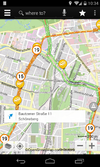
|
да | да | нет | нет | nonfreeproprietary | nonfree€1.79 monthly | EN; DE; ES; FR; SV; and much more | 2014-04-03 5.0.2 |
online turn-by-turn navigation |
| xMaps [16] | 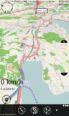
|
да | да | ?
|
нет | nonfreeproprietary | free | DE,EN | 2011-01-18 1.2 |
Very simple map viewer |
This page describes a historic artifact in the history of OpenStreetMap. It does not reflect the current situation, but instead documents the historical concepts, issues, or ideas.
This table in the past was generated automatically by a bot. Learn more.
Возможности отображения карты
| Name | Shows map as vector | Shows map as bitmap | Stores map-data on-board | Stores map-data off-board (downloads from internet) | Rotate map | 3D view |
|---|---|---|---|---|---|---|
| GPS Navigator aSpass | нет | да | да | да | ?
|
нет |
| maloo outdoor | нет | да | да | да | да | нет |
| More Maps | нет | да | да (cache) | да | ?
|
?
|
| Multi Map | нет | да | да (cache) | да | ?
|
нет |
| NaviComputer | нет | да | да (cache) | да | нет | нет |
| Offline Maps | нет | нет | да | да | ? | ?
|
| OpenBusMap | нет | да | нет | да | ?
|
нет |
| OSM(Nonexistent) | нет | да | нет | да | ?
|
нет |
| OSMLogger | нет | да | нет | да | ?
|
нет |
| QuoVadis Mobile | нет | да | да | да | да | нет |
| Simple OSM | нет | да | нет (cache) | нет | нет | ?
|
| Vectorial Map | да | да | да | да | нет | нет |
| Wisepilot | да | да | нет | да | да | да |
| xMaps | нет | да | да (cache) | да | ?
|
да |
This page describes a historic artifact in the history of OpenStreetMap. It does not reflect the current situation, but instead documents the historical concepts, issues, or ideas.
This table in the past was generated automatically by a bot. Learn more.
Возможности навигации
| Name | Navigate to point | Find location | Find nearby POIs | Navigate along predefined route | Create route manually | Calculate route | Calculate route without internet | Car routing | Bike routing | Foot routing | Turn restrictions | Navigation with voice | Keep on road | Works without GPS |
|---|---|---|---|---|---|---|---|---|---|---|---|---|---|---|
| GPS Navigator aSpass | да | да | да | ?
|
?
|
?
|
?
|
?
|
?
|
?
|
да | да | ?
|
нет |
| More Maps | да | ?
|
?
|
?
|
?
|
?
|
?
|
?
|
?
|
?
|
?
|
нет | ?
|
нет |
| QuoVadis Mobile | да | да | да | да | ?
|
да | да | да | да | да | да | да | да | yes;no |
| Simple OSM | да | да | да | ?
|
?
|
?
|
?
|
да | нет | да | да | нет | нет | нет |
| Wisepilot | да | да | да | ?
|
?
|
?
|
?
|
да | нет | да | да | да | ?
|
нет |
| xMaps | да | ?
|
?
|
?
|
?
|
?
|
?
|
?
|
?
|
?
|
?
|
нет | ?
|
нет |
This page describes a historic artifact in the history of OpenStreetMap. It does not reflect the current situation, but instead documents the historical concepts, issues, or ideas.
This table in the past was generated automatically by a bot. Learn more.
Возможности создания треков
| Name | Customizable log interval | GPX format | KML format | NMEA format | All formats | Geo-tagged notes | Geo-tagged photos | Geo-tagged audio | Fast POI buttons |
|---|---|---|---|---|---|---|---|---|---|
| GPS Navigator aSpass | нет | ?
|
?
|
?
|
?
|
?
|
?
|
?
|
?
|
| maloo outdoor | да | да | нет | нет | gpx | ?
|
?
|
?
|
нет |
| NaviComputer | ?
|
да | нет | нет | gpx | ?
|
?
|
?
|
?
|
| OSMLogger | нет | ?
|
?
|
?
|
?
|
?
|
?
|
?
|
?
|
| QuoVadis Mobile | да | да | нет | нет | online-map;qmz;gpx | ?
|
?
|
?
|
да |
| Simple OSM | да | да | нет | нет | gpx | ?
|
?
|
?
|
нет |
| Vectorial Map | да | да | да | нет | jpg;png;gpx;kml;kmz | да | нет | нет | да |
This page describes a historic artifact in the history of OpenStreetMap. It does not reflect the current situation, but instead documents the historical concepts, issues, or ideas.
This table in the past was generated automatically by a bot. Learn more.
Возможности мониторинга
| Name | Show current track | Open existing track | Altitude diagram | Show DOP value | Satellite view | Show live NMEA data | Send current position via SMS | Upload current position |
|---|---|---|---|---|---|---|---|---|
| maloo outdoor | да | да | да | да | нет | нет | нет | нет |
| QuoVadis Mobile | да | да | да | да | нет | нет | да | да |
| Simple OSM | да | да | нет | да | нет | нет | нет | да |
This page describes a historic artifact in the history of OpenStreetMap. It does not reflect the current situation, but instead documents the historical concepts, issues, or ideas.
This table in the past was generated automatically by a bot. Learn more.
Возможности редактирования OpenStreetMap
| Name | Add POIs | Edit / Delete POIs | Edit arbitrary tags of existing OSM objects | Edit geometries | Support imagery offset DB | Upload to OSM |
|---|---|---|---|---|---|---|
| MapStalt Mini | ?
|
?
|
?
|
?
|
?
|
?
|
| Offline Maps | ?
|
?
|
?
|
?
|
?
|
?
|
This page describes a historic artifact in the history of OpenStreetMap. It does not reflect the current situation, but instead documents the historical concepts, issues, or ideas.
This table in the past was generated automatically by a bot. Learn more.
Сбор данных
Ряд программ, доступных для сбора GPS-треков:
Бесплатные приложения/Open Source
Некоммерческие
Бесплатные
Коммерческие
- Simple OSM (simpleosm.net) GPX track logging
