See the tagging sequence of Keypad-Mapper 3 in JOSM
Sometimes you got bad or no gps signal during tagging with Keypad-Mapper 3. This can result in clustered housenumbers and the house assignement is complicated. If you remember the sequence you tagged the questionable houses, the display of the tagging sequence of the housenumbers can help. There are two possibilities:
Alternitive 1 - Display of the IDs with the mappaint style "ShowID"
- Overlay the mappaint style "ShowID" (in JOSM menu:View -> Map Paint Styles -> Map paint preferences -> add ShowID).
- You should use for this the unchanged .osm file from Keypad-Mapper 3 and not the working layer, otherwise the IDs can get mixed up.
- The IDs start normally not at 0, but at a number which can be different.
- The IDs are always even, so the sequence is for example: 66, 68, 70, 72,...
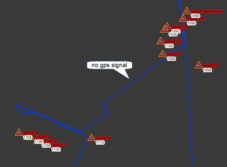
The design of "ShowID" orientates on the mappaint style "Coloured Streets". Both styles can be used at the same time. This looks like on the following picture. Because of the bad gps signal the housenumbers (highlighted red) are not at the correct position. The IDs (highlighted white) can help for the house assignement. ("street?" is displayed here at every housenumber, because there is no addr:street. This comes from the mappaint style Coloured Streets.)
Alternitive 2 - Transformation into a .gpx file
- Create a copy of the Keypad-Mapper 3 .osm file
- Change the file extension to .gpx
- Open the file in a text editor
- Replace at the beginning of the file the line <osm version='0.6' generator='Keypad-Mapper 3'> by <gpx> <trk> <trkseg>
- Replace at the end of the file the line </osm> by </trkseg> </trk> </gpx>
- Use the search and replace function of the text editor and replace all node by trkpt
- Load the .gpxfile and the original Keypad-Mapper 3 .osm file in JOSM
- The so created .gpxfile should of course not get uploaded to the OSM server, because it is no real gps track!
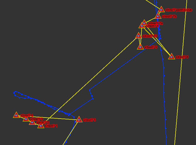
The result looks like on the following picture. The recorded gps track is blue, housenumber are highlighted red and the from the .osm file self created "gps track" is yellow.
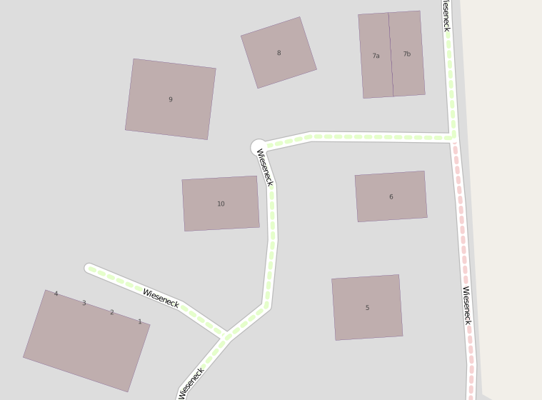
The same map extract after adding the housenumbers to the osm database (mapnik):


