Uploads by Joto
Jump to navigation
Jump to search
This special page shows all uploaded files.
| Date | Name | Thumbnail | Size | Description | Versions |
|---|---|---|---|---|---|
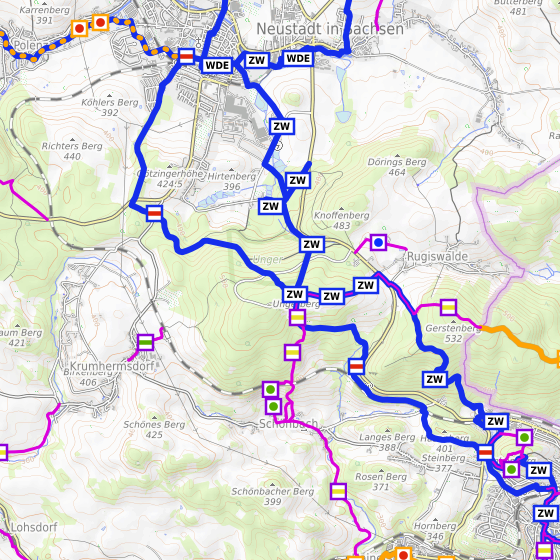
| 14:39, 10 September 2017 | Elbe-Labe-Meeting 2017-Trail Map after.png (file) |  |
444 KB | Screenshot of map from Waymarkedtrails.org after Elbe-Labe-Meeting 2017. | 1 |
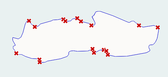
| 14:39, 10 September 2017 | Elbe-Labe-Meeting 2017-Trail Map before.png (file) |  |
449 KB | Screenshot of map from Waymarkedtrails.org before Elbe-Labe-Meeting 2017. | 1 |
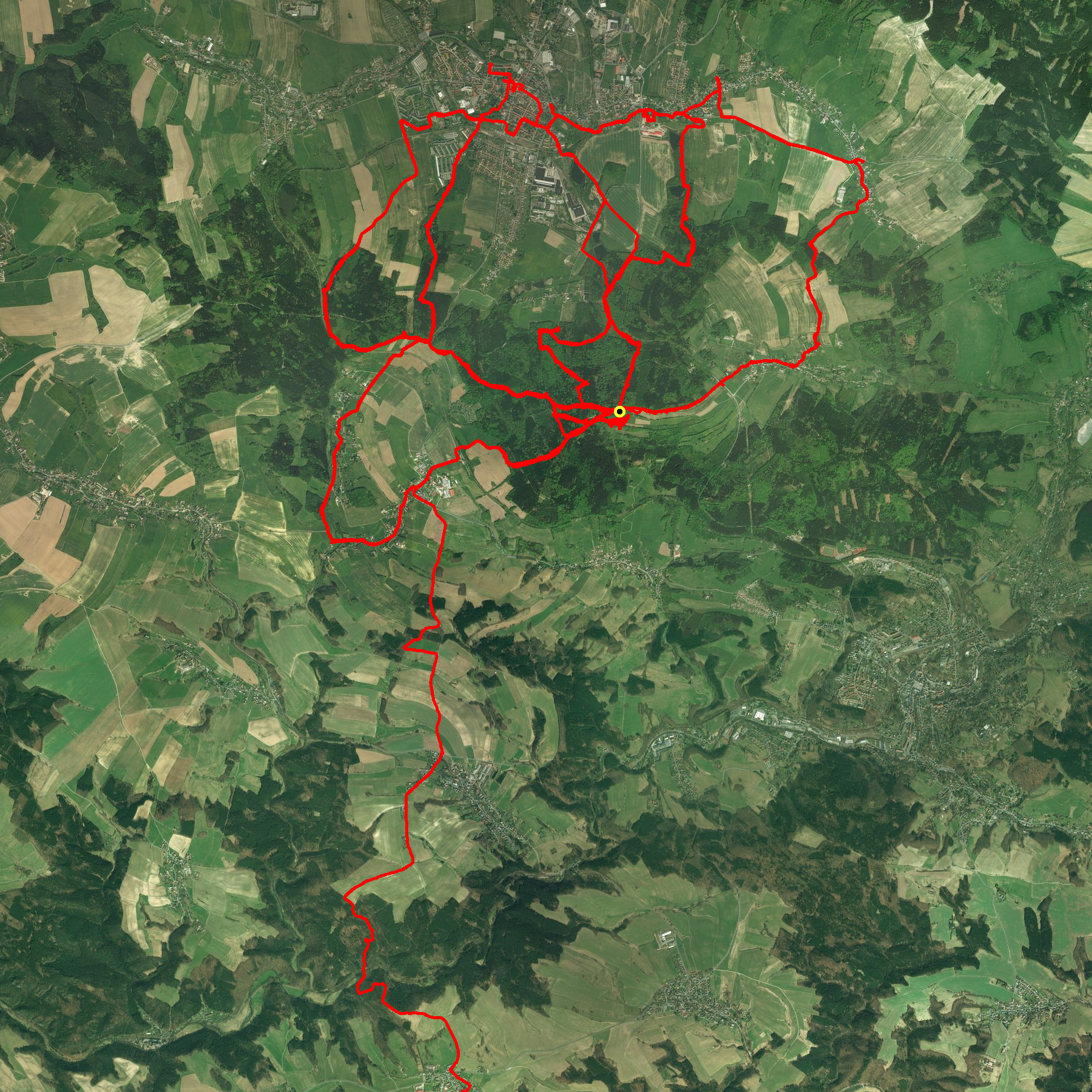
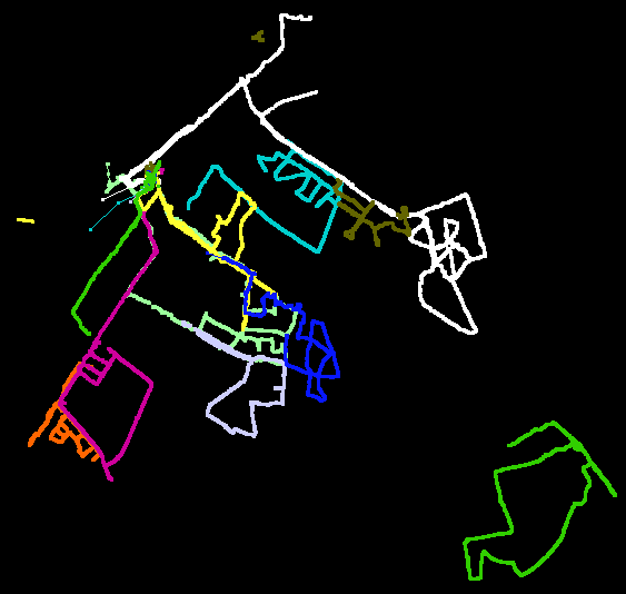
| 14:35, 10 September 2017 | Elbe-Labe-Meeting 2017-Tracks.png (file) |  |
5.52 MB | GPS tracks from Elbe-Labe-Meeting 2017. | 1 |
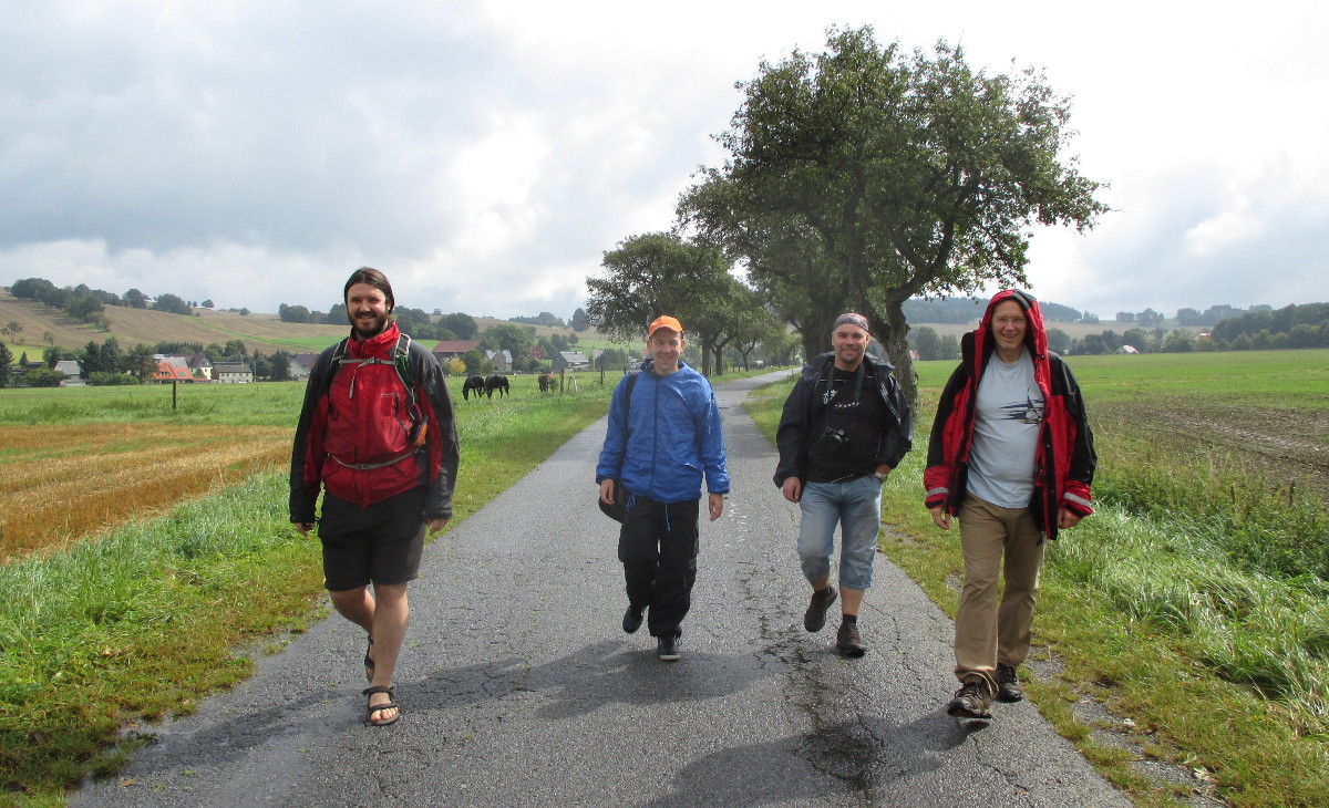
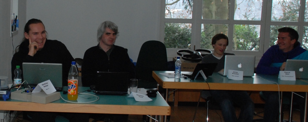
| 14:33, 10 September 2017 | Elbe-Labe-Meeting 2017-Hikers.jpg (file) |  |
308 KB | Hikers at the Elbe-Labe-Meeting 2017. | 1 |
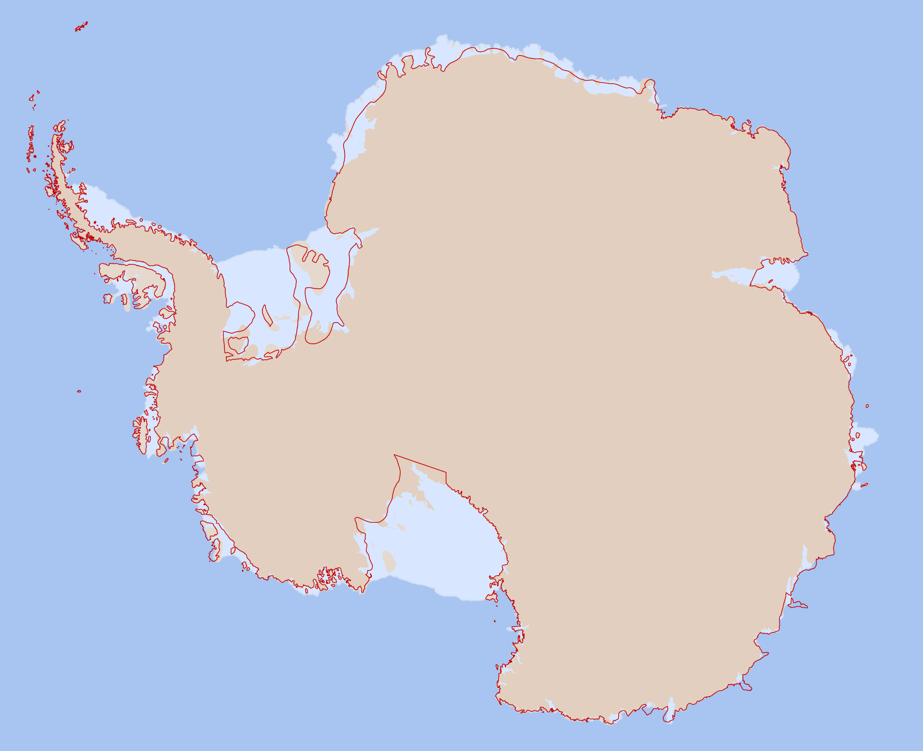
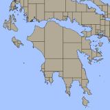
| 14:05, 4 March 2013 | AntarcticaMapOldAndNewData.png (file) |  |
254 KB | This map shows the current (February 2013) OSM coastline as thin red line and MOA-derived data that is proposed to be imported into OSM. | 1 |
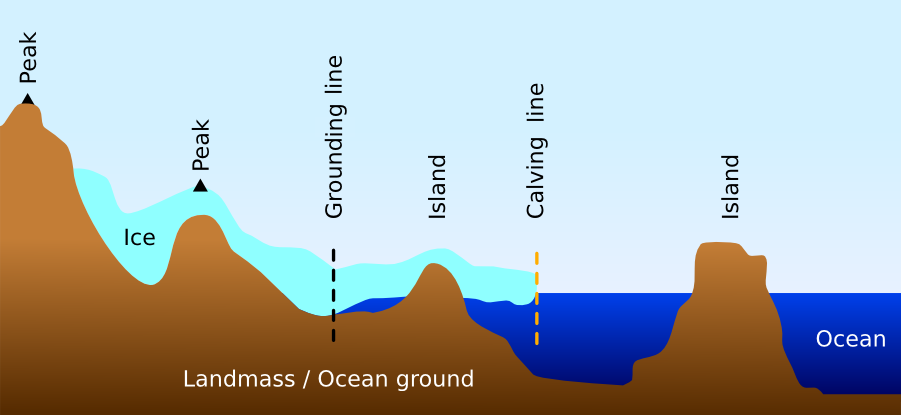
| 14:02, 4 March 2013 | Antarctica terrain profile.png (file) |  |
43 KB | Fixed labelling, removed iceberg. | 2 |
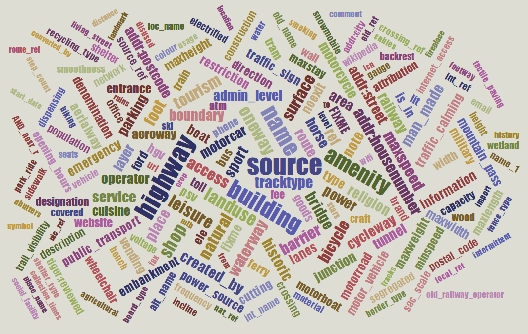
| 14:50, 21 January 2013 | Taginfo-tag-cloud.png (file) |  |
545 KB | Taginfo shows a cloud of the most important OSM tag keys. | 1 |
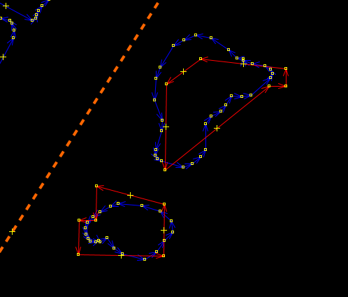
| 19:23, 15 September 2012 | Coastline-error-overlap.png (file) |  |
17 KB | 1 | |
| 19:19, 15 September 2012 | Coastline-error-old-and-new-islands-josm.png (file) |  |
16 KB | 1 | |
| 19:19, 15 September 2012 | Coastline-error-old-and-new-islands-osmi.png (file) |  |
19 KB | 1 | |
| 19:16, 15 September 2012 | Coastline-error-overlapping-ways.png (file) |  |
10 KB | 1 | |
| 20:02, 29 August 2012 | Mlm-designdoc.pdf (file) |  |
146 KB | Design Document for the Multilingual maps Wikipedia project. | 1 |
| 15:33, 4 June 2012 | Osmcoastline-world.png (file) |  |
273 KB | 1 | |
| 12:41, 30 May 2012 | Osmcoastlines-lang-polygons.png (file) |  |
17 KB | Example of coastline polygons created with OSMCoastline program. | 1 |
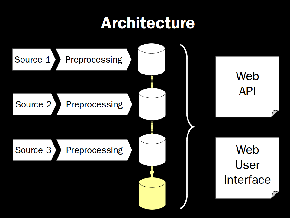
| 17:01, 12 July 2011 | Taginfo-architecture.png (file) |  |
56 KB | 1 | |
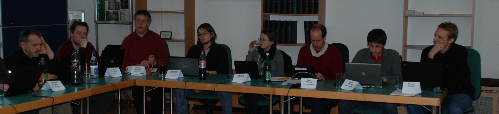
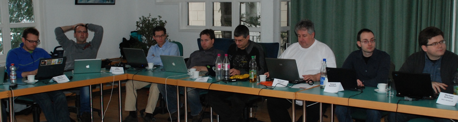
| 19:35, 7 December 2010 | Osm-koordinierungstreffen-dez2010-tln3.jpg (file) | 296 KB | 1 | ||
| 19:35, 7 December 2010 | Osm-koordinierungstreffen-dez2010-tln2.jpg (file) | 309 KB | 1 | ||
| 19:34, 7 December 2010 | Osm-koordinierungstreffen-dez2010-tln1.jpg (file) |  |
199 KB | 1 | |
| 13:32, 5 July 2010 | Osmbook-cover-german-3rd-edition.png (file) |  |
17 KB | Cover for the 3rd German edition of the OSM book. | 1 |
| 08:54, 28 May 2010 | Tirex-example-map.png (file) |  |
6 KB | Simple Tirex example map. | 1 |
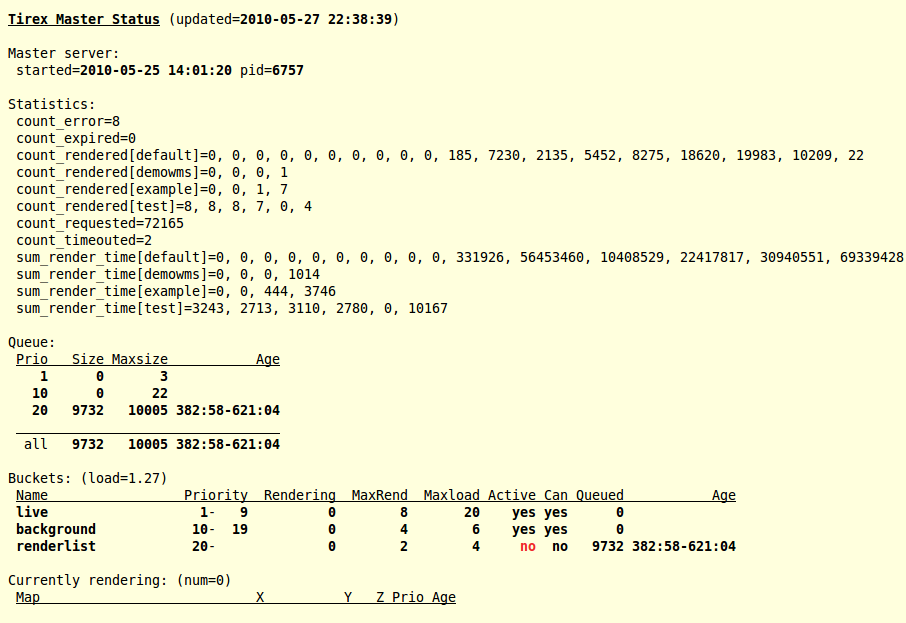
| 20:41, 27 May 2010 | Output-tirex-status.png (file) |  |
73 KB | Example output of the tirex-status command showing what is currently going on in the Tirex system. | 1 |
| 20:30, 27 May 2010 | Test-pattern.png (file) |  |
3 KB | The checkerboard test pattern created by the test rendering backend helps you verifying that your Tirex install went well. | 1 |
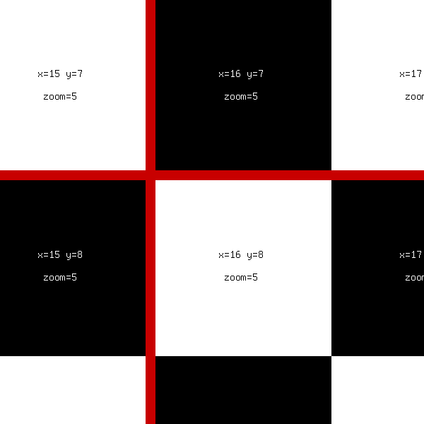
| 19:48, 27 May 2010 | Example-image-available-tiles-on-tileserver.png (file) |  |
158 KB | 1 | |
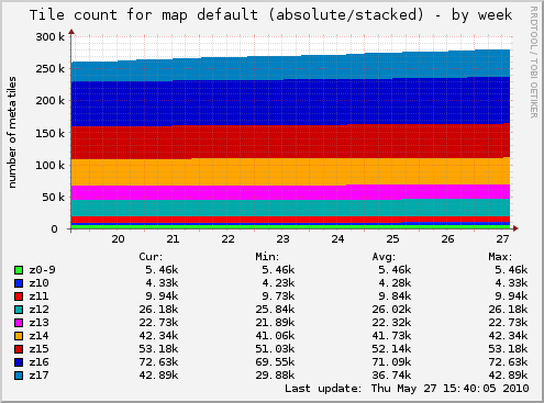
| 13:55, 27 May 2010 | Example Tirex Munin Graph.png (file) |  |
23 KB | Example Tirex Munin graph showing tile counts for different zoom levels. | 1 |
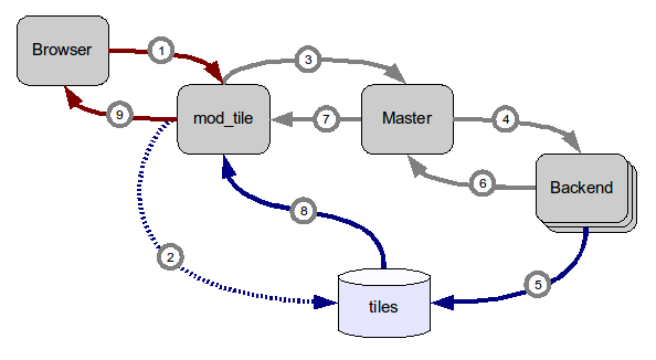
| 14:46, 12 May 2010 | Tirex-request-handling-overview.png (file) |  |
12 KB | 2 | |
| 06:56, 11 July 2009 | OSM-Sightwalk.pdf (file) |  |
19 KB | 1 | |
| 12:26, 17 April 2009 | OSM-Buch-Auflage2-cover.png (file) |  |
17 KB | Cover of the 2nd edition of the German language OpenStreetMap book. | 1 |
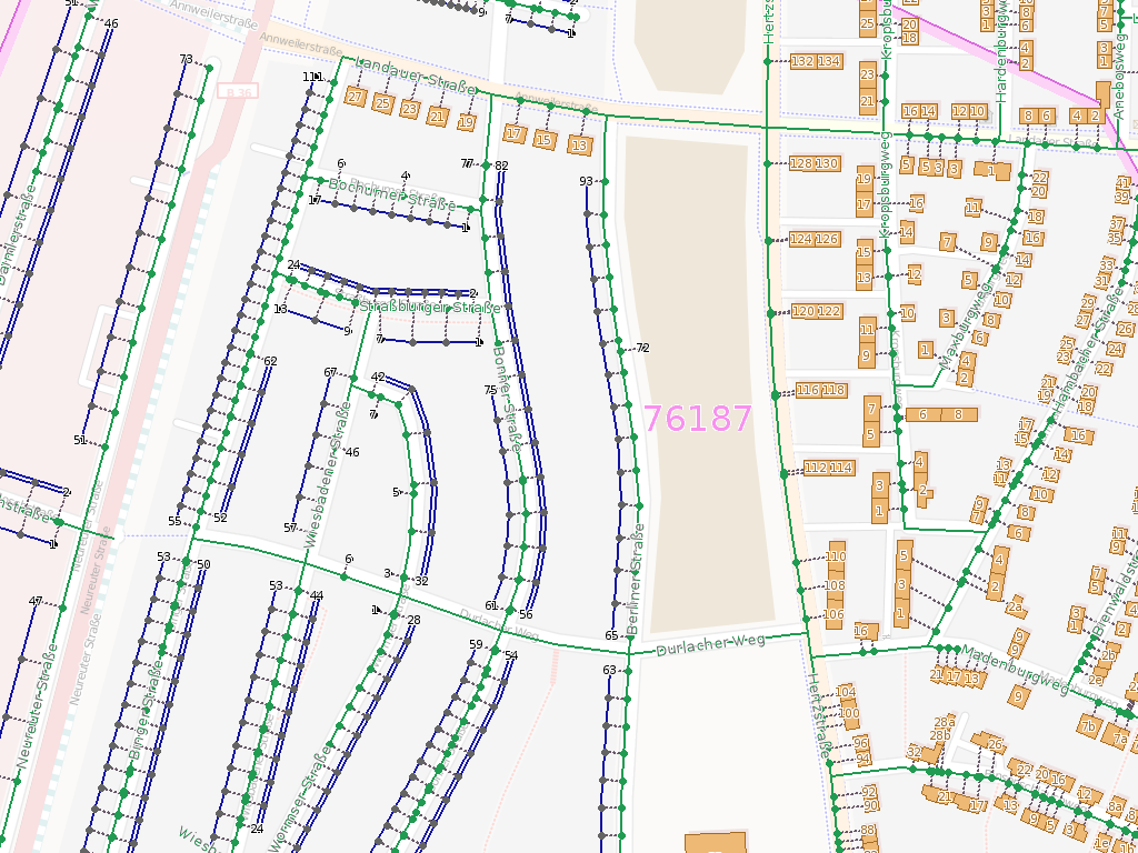
| 08:43, 4 November 2008 | OSM Inspector Addresses View.png (file) |  |
310 KB | A part of Karlsruhe in the Addresses view of the OSM Inspector. | 1 |
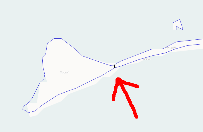
| 09:51, 23 May 2008 | EVTG-Mapping-Aktion-Tracks.png (file) |  |
12 KB | 1 | |
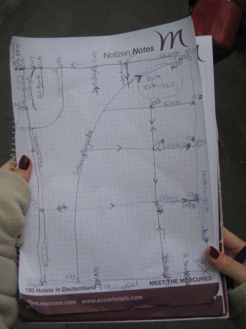
| 09:43, 23 May 2008 | EVTG-Mapping-Aktion-Skizze.jpg (file) |  |
39 KB | 1 | |
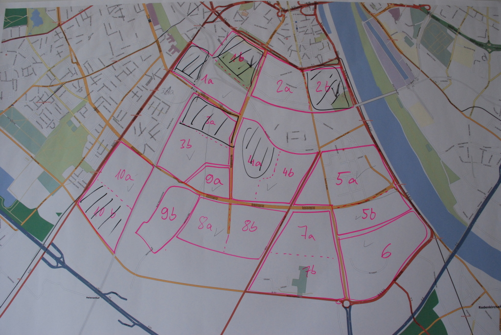
| 09:43, 23 May 2008 | EVTG-Mapping-Aktion-Bereiche.jpg (file) |  |
428 KB | 1 | |
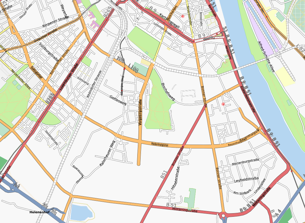
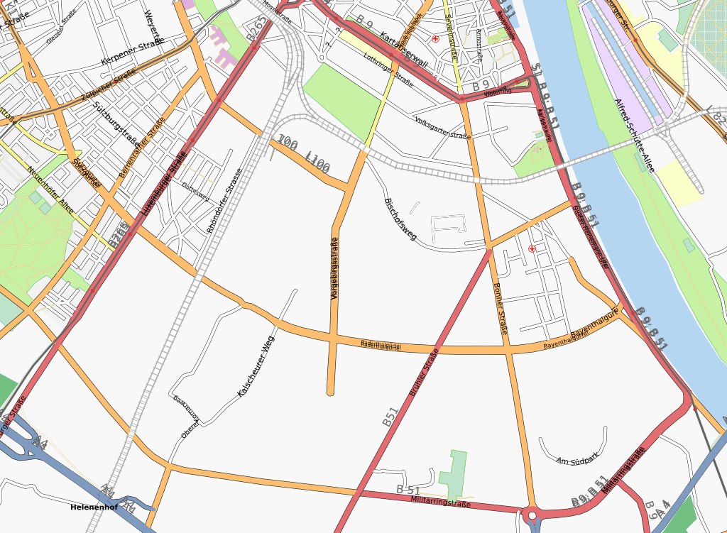
| 08:35, 23 May 2008 | EVTG-Mapping-Aktion-KoelnSuedOst-nachher.png (file) |  |
672 KB | Map of Cologne after the Mapping Event at the Elisabeth-von-Thüringen highschool. Karte von Köln nach der Mapping-Aktion am Elisabeth-von-Thüringen-Gymnasium. | 1 |
| 08:33, 23 May 2008 | EVTG-Mapping-Aktion-KoelnSuedOst-vorher.png (file) |  |
571 KB | Map of Cologne before the Mapping Event at the Elisabeth-von-Thüringen highschool. Karte von Köln vor der Mapping-Aktion am Elisabeth-von-Thüringen-Gymnasium. | 1 |
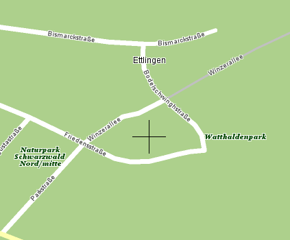
| 14:21, 10 June 2007 | 2007-06-08-teleatlas-ettlingen-winzerallee.png (file) |  |
23 KB | 1 | |
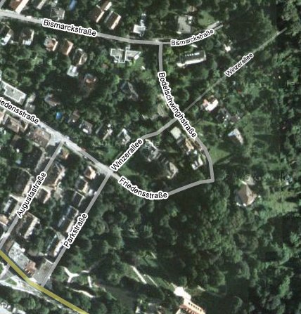
| 14:20, 10 June 2007 | 2007-06-08-googlemaps-ettlingen-winzerallee.jpg (file) |  |
59 KB | Possibly intentional bug in Google Maps. "Winzerallee" doesn't exist. | 1 |
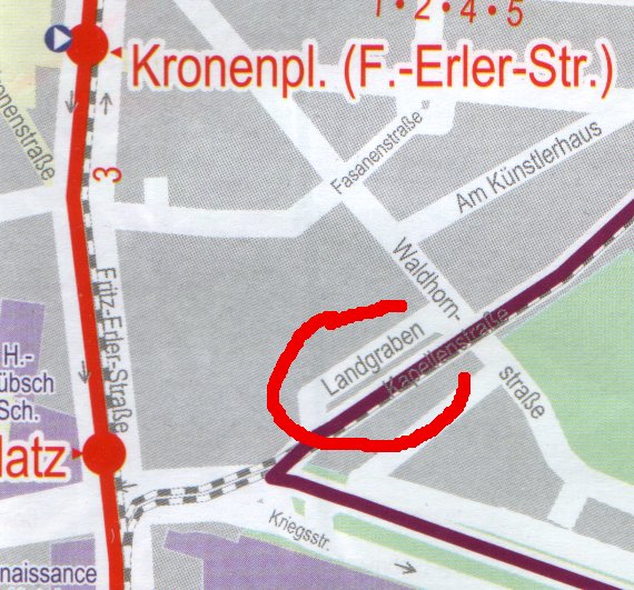
| 14:17, 10 June 2007 | 2007-06-10-kvv-bahn-und-bus-landgraben.jpg (file) |  |
88 KB | Possible intentional bug in map | 1 |
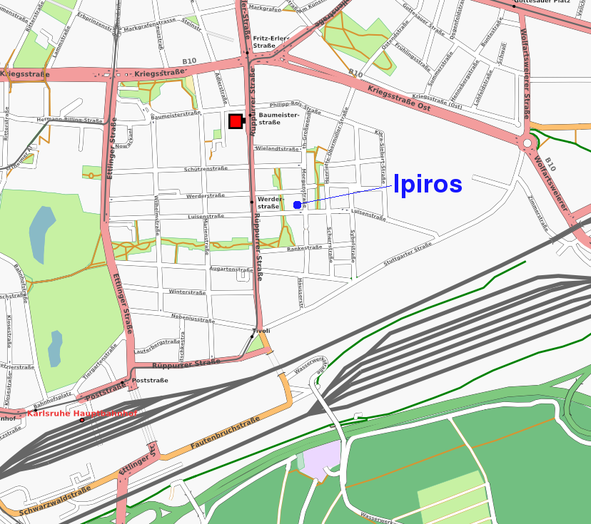
| 10:34, 30 March 2007 | Ka-mapping-1.png (file) |  |
381 KB | Added restaurant Ipiros | 2 |
| 15:38, 13 February 2007 | Symbols-catalogue-closeup.png (file) |  |
11 KB | Closeup of part of the symbol catalogue for Osmarender | 2 |
| 15:33, 13 February 2007 | Airport-symbol.png (file) |  |
3 KB | Airport symbol | 1 |
| 21:09, 10 February 2007 | Mapping-Features-Roundabout-Secondary-Ends.png (file) |  |
4 KB | Roundabout where a secondary road ends. | 1 |
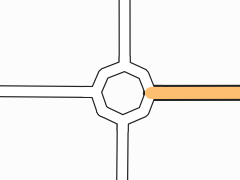
| 21:08, 10 February 2007 | Mapping-Features-Roundabout-Flare.png (file) |  |
7 KB | Roundabout with flares at connecting roads. | 1 |
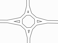
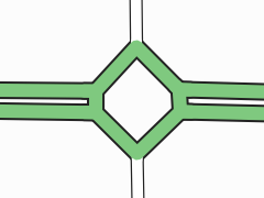
| 21:05, 10 February 2007 | Mapping-Features-Roundabout-Double-Carriageway.png (file) |  |
8 KB | Roundabout where primary road with dual carriageway and unclassified road meet. The roundabout itself is also tagged as primary road. | 1 |
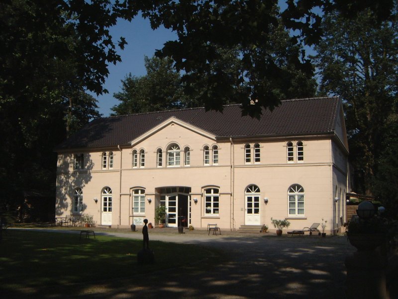
| 17:45, 8 February 2007 | Villa-vogelsang.jpg (file) |  |
103 KB | Location for Essen Developers Workshop | 1 |
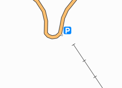
| 17:41, 8 February 2007 | Villa-vogelsang.png (file) |  |
7 KB | Location for developers workshop in Essen. | 1 |
| 16:06, 7 February 2007 | Mapping-Features-Aerialway.png (file) |  |
6 KB | Cable car as rendered in Osmarender. | 1 |
| 10:44, 6 February 2007 | Mapping-Features-Road-Tunnel.png (file) |  |
13 KB | Osmarender rendering of a road tunnel under a motorway. | 1 |
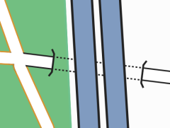
| 10:44, 6 February 2007 | Mapping-Features-Road-Bridge.png (file) |  |
28 KB | Osmarender rendering of a road bridge over a trunk road. | 1 |
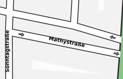
| 10:42, 6 February 2007 | Mapping-Features-Oneway.png (file) |  |
14 KB | Osmarender rendering of oneway streets with small arrows. | 1 |
| 10:40, 6 February 2007 | Mapping-Features-Forest.png (file) |  |
38 KB | Osmarender rendering of a forest/woods as a darkk green area. | 1 |
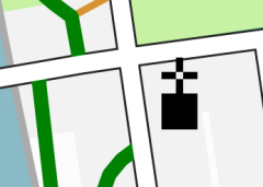
| 10:39, 6 February 2007 | Mapping-Features-Church.png (file) |  |
13 KB | Osmarender rendering of a church. | 1 |