Uploads by T99
Jump to navigation
Jump to search
This special page shows all uploaded files.
| Date | Name | Thumbnail | Size | Description | Versions |
|---|---|---|---|---|---|
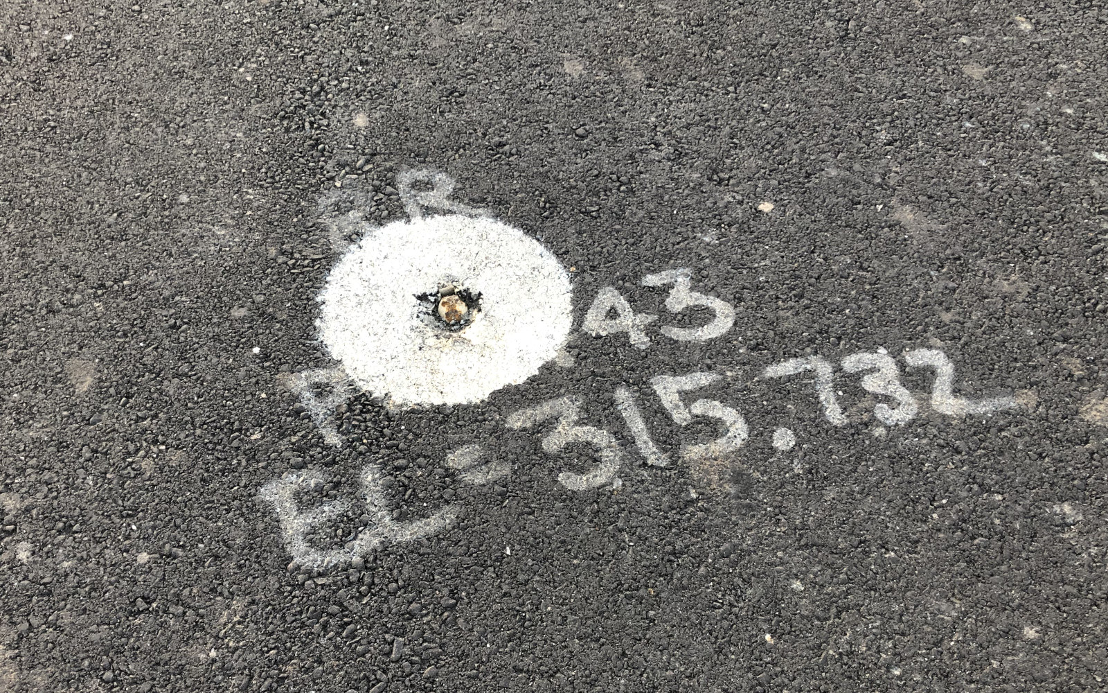
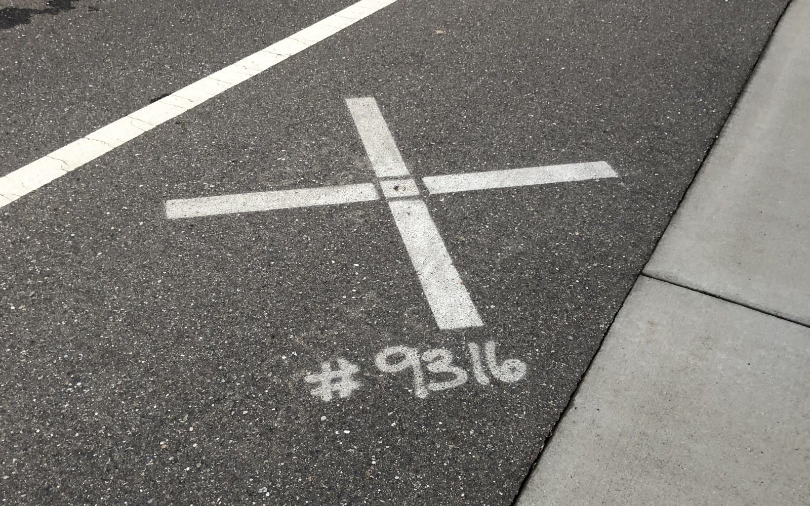
| 06:26, 8 April 2020 | Rebar-marker-painted.jpg (file) |  |
845 KB | A piece of rebar driven into the center line of a new street, marked with a large white dot and elevation in thousandths of a foot. | 1 |
| 06:23, 8 April 2020 | Boundary-marker-capped.jpg (file) |  |
505 KB | An engraved metal plate capping a a metal bar or spike marking the corner of two residential lots. | 1 |
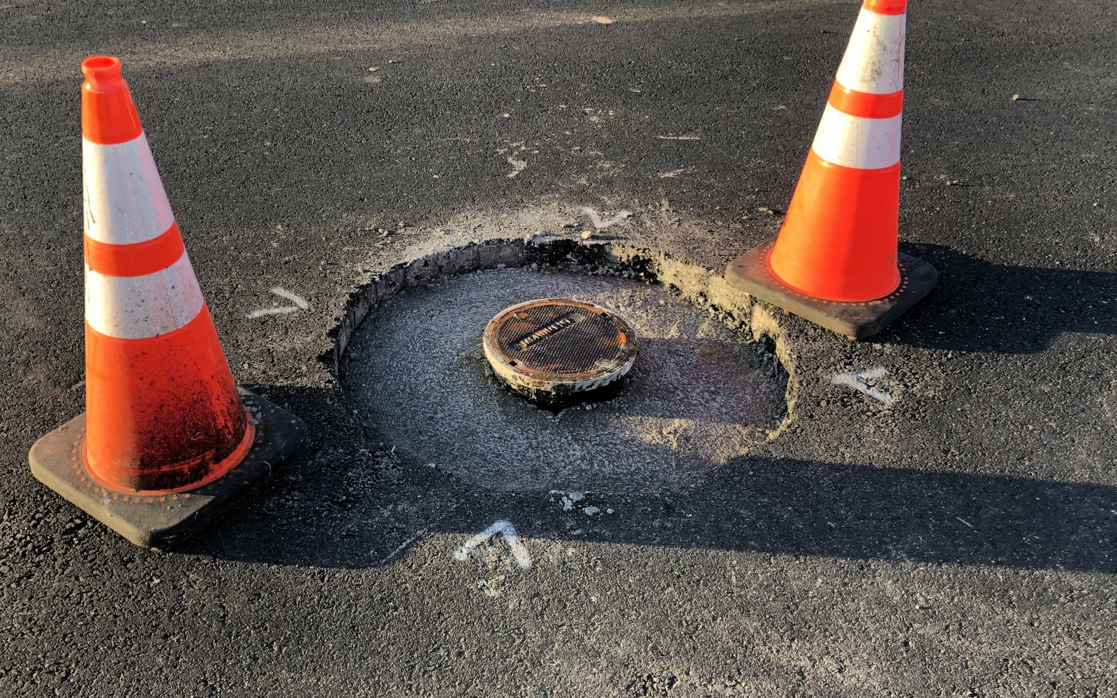
| 08:42, 16 February 2020 | Monument-well-finished.jpg (file) |  |
867 KB | A newly finished monument well (a cylinder used to protect a permanent survey monument) in the center of a new street. | 1 |
| 08:41, 16 February 2020 | Monument-well-construction.jpg (file) |  |
792 KB | A monument well (a cylinder used to protect a permanent survey monument) under construction in the center of a new street. | 1 |
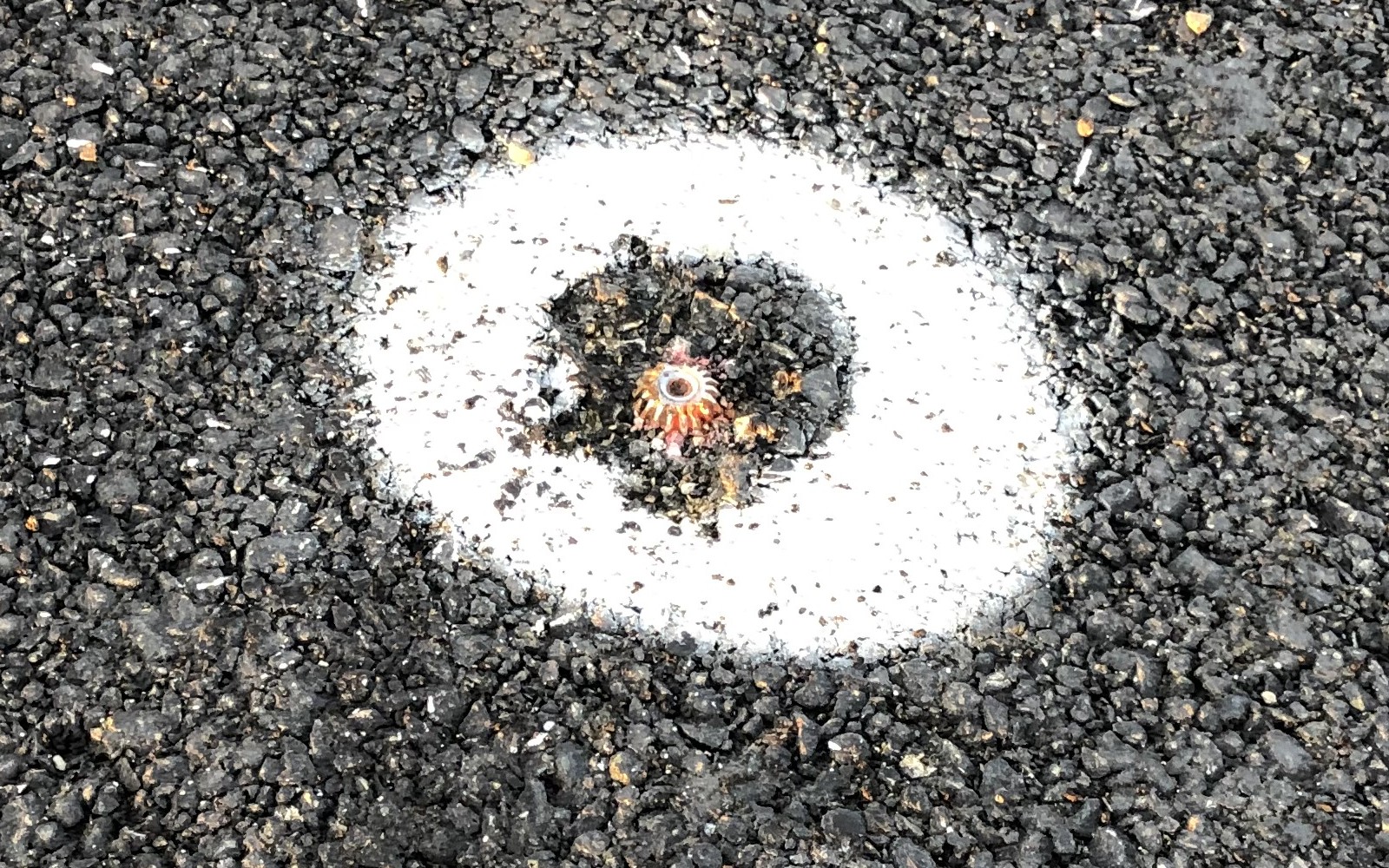
| 08:37, 16 February 2020 | Temporary-marker.jpg (file) |  |
288 KB | A metal spike driven into a street under construction to mark a point. | 1 |
| 08:36, 16 February 2020 | Cotton-spindle-spike.jpg (file) |  |
679 KB | An old cotton picker spindle reused as a survey marker. | 1 |
| 08:34, 16 February 2020 | Aerial-marker.jpg (file) |  |
691 KB | A survey marker designed to be clearly visible in aerial photography. | 1 |
| 21:13, 24 August 2019 | Yardage-marker.jpg (file) |  |
290 KB | Metal plate in an asphalt cart path on a disused golf course, marking the distance to the former green in yards. | 1 |
| 21:05, 18 November 2018 | Carnotrec.jpg (file) |  |
69 KB | Sign: low-clearance vehicles not recommended (Tahoe National Forest, CA, USA) | 1 |
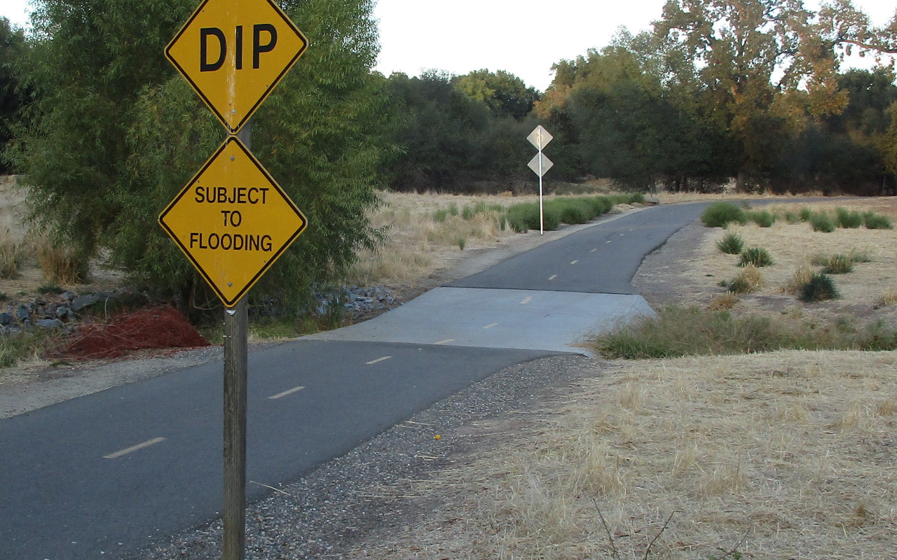
| 06:02, 30 October 2017 | Bike path dip swale.jpg (file) |  |
308 KB | A bike/pedestrian trail with a dip where it crosses a swale (a drainage ditch). | 1 |
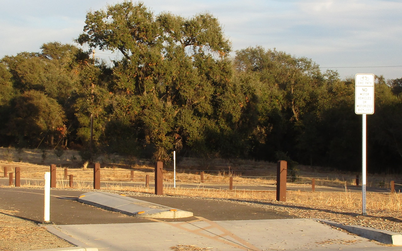
| 05:59, 30 October 2017 | Bike path barriers.jpg (file) |  |
312 KB | A bicycle/pedestrian trail with a raised median and a cable fence. | 1 |
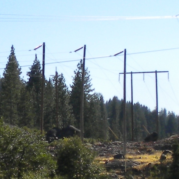
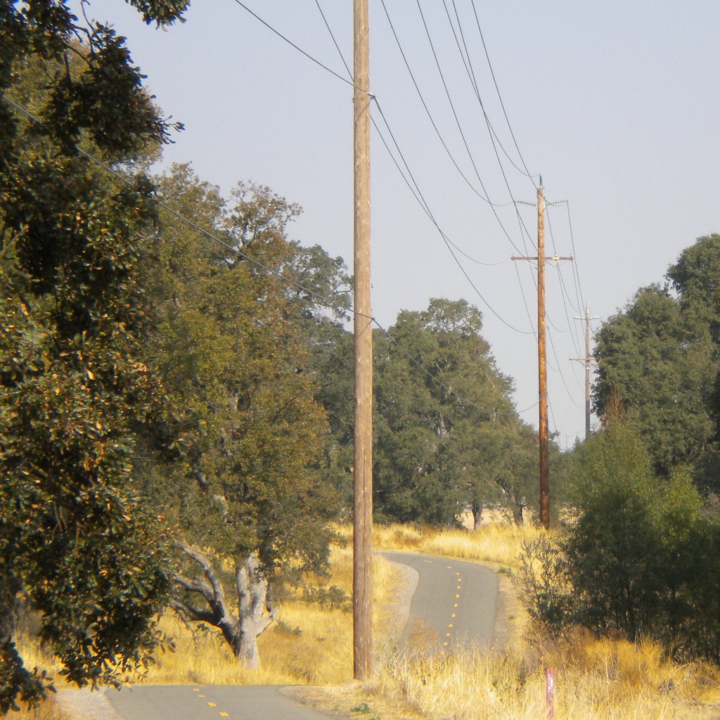
| 19:26, 21 August 2011 | Triplepole.jpg (file) |  |
140 KB | Bends of older power lines in this area are typically constructed this way: each of the three cables is carried on a separate guyed pole (OSM node [http://www.openstreetmap.org/browse/node/90109480 90109480]). | 1 |
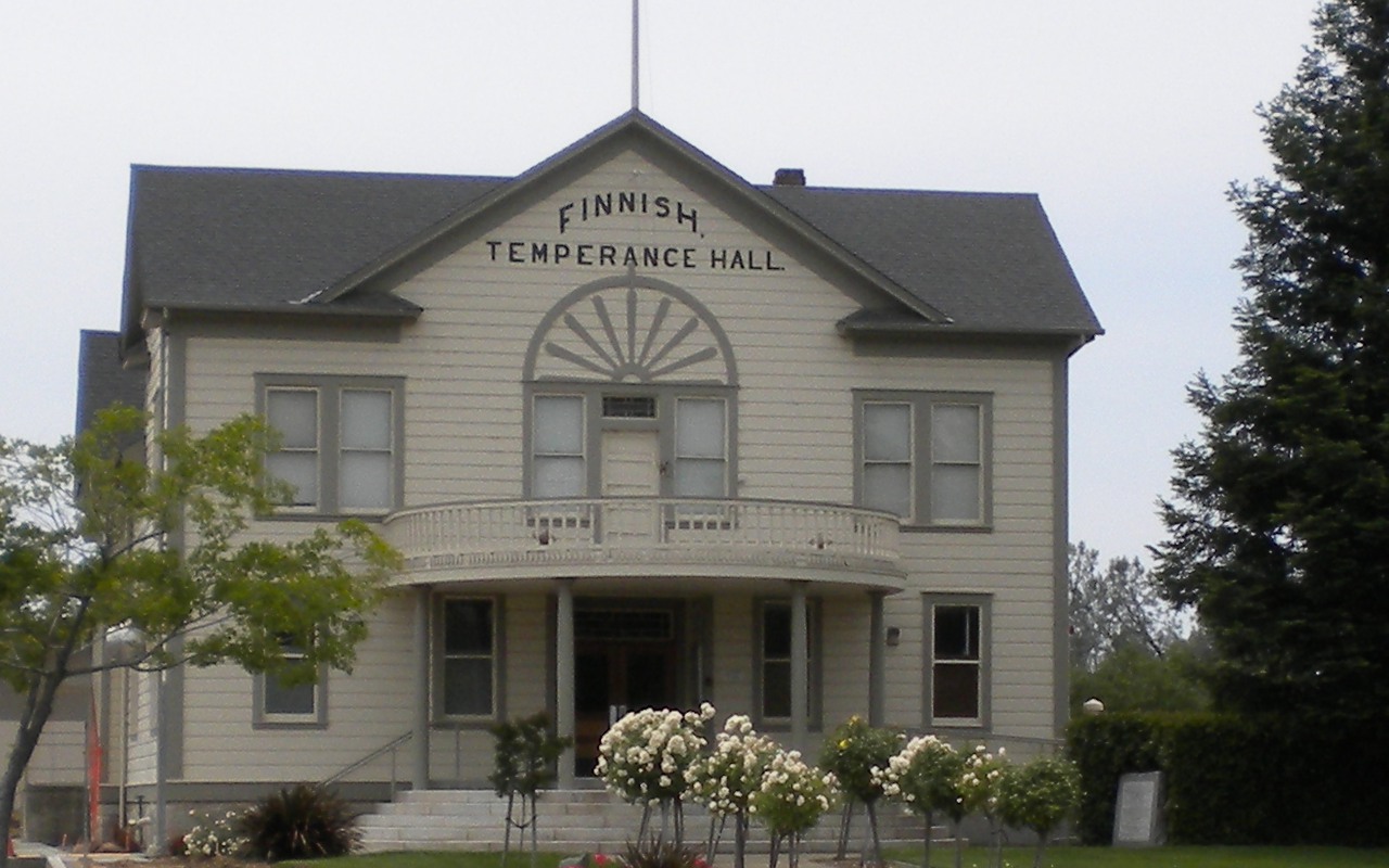
| 09:45, 27 May 2011 | Hallfin.jpg (file) |  |
206 KB | A building owned by the city and rented for various meetings and events (private or public). OSM way [http://www.openstreetmap.org/browse/way/96341996 96341996]. | 1 |
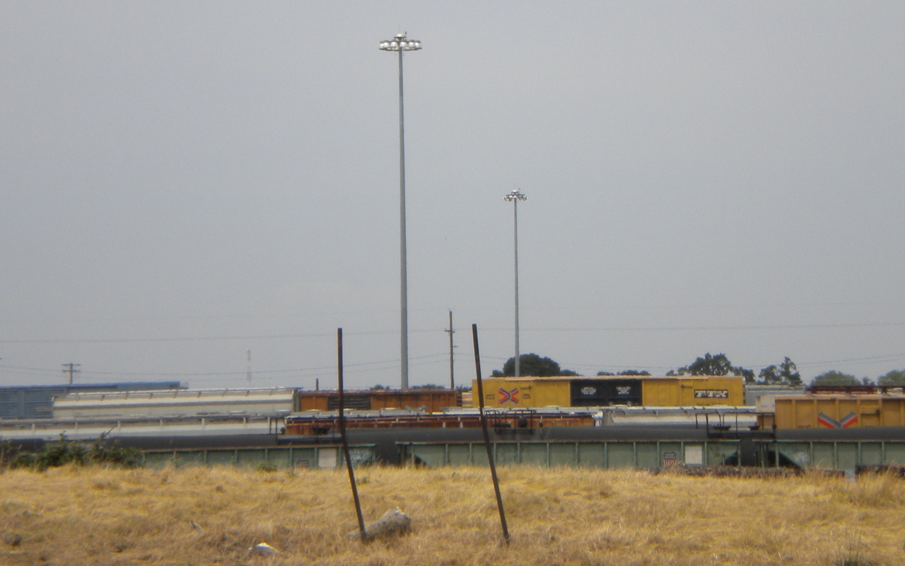
| 09:39, 27 May 2011 | Lightingtowers.jpg (file) |  |
263 KB | Man-made towers for the purpose of lighting (in this case, a rail yard). OSM nodes [http://www.openstreetmap.org/browse/node/1152426091 1152426091] (nearer) and [http://www.openstreetmap.org/browse/node/1142653698 1142653698]. | 1 |
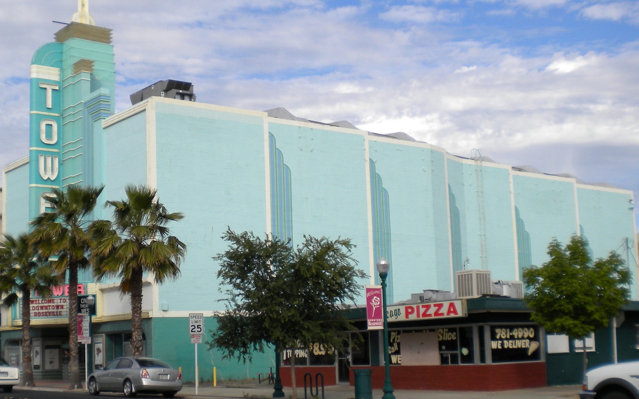
| 00:01, 15 May 2011 | Theatert.jpg (file) |  |
313 KB | A theater, OSM way [http://www.openstreetmap.org/browse/way/99278873 99278873]. | 1 |
| 23:42, 14 May 2011 | Gazebodk.jpg (file) |  |
347 KB | A gazebo, OSM way [http://www.openstreetmap.org/browse/way/112770313 112770313]. | 1 |
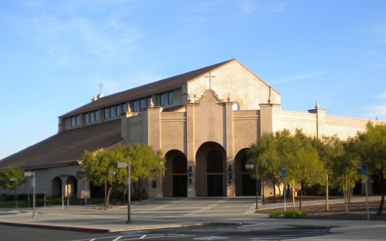
| 23:35, 14 May 2011 | Churchstcl.jpg (file) |  |
262 KB | A church building, OSM way [http://www.openstreetmap.org/browse/way/86368800 86368800]. | 1 |
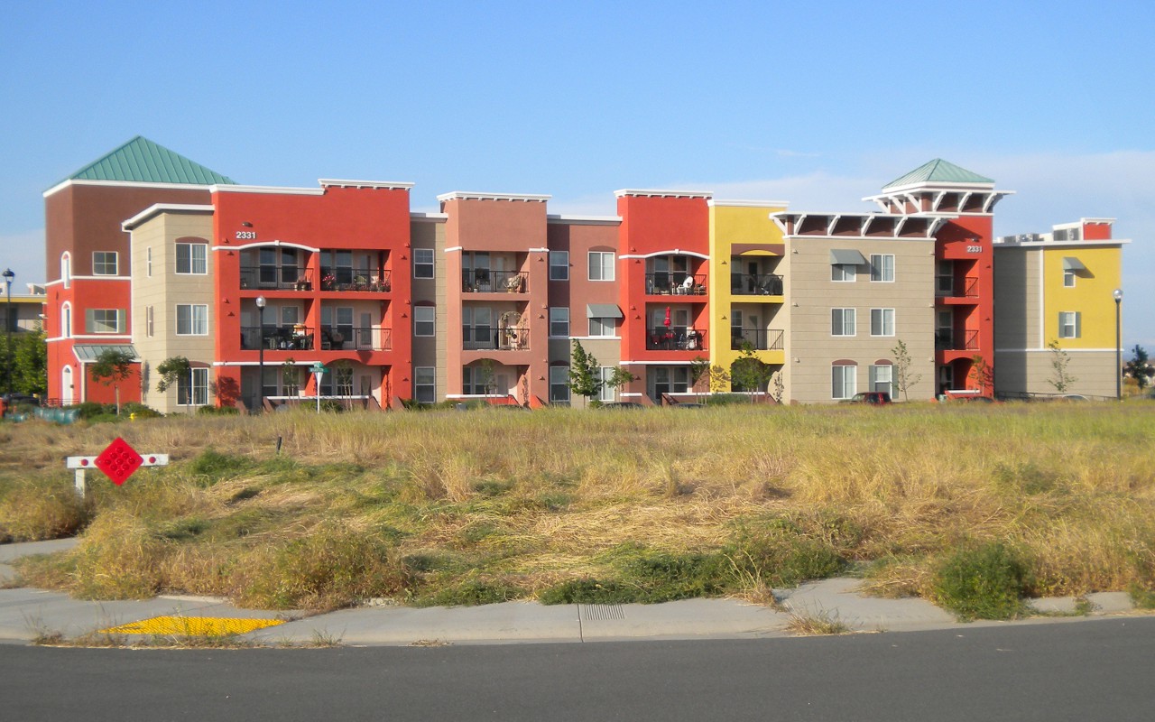
| 23:04, 14 May 2011 | Aptvintsq.jpg (file) |  |
249 KB | An apartment building, OSM way [http://www.openstreetmap.org/browse/way/102133971 102133971]. | 1 |
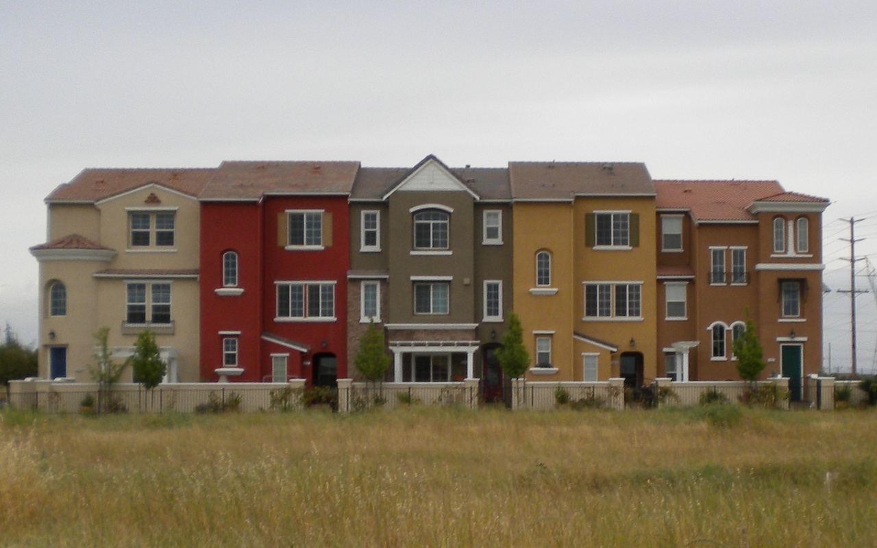
| 09:22, 11 May 2011 | Townhome4.jpg (file) |  |
184 KB | A "row of linked residential houses". In this case, each house has its own lot and its own roof, but the side walls are conjoined. I tagged each house separately as {{tag|building|terrace}}. OSM way [http://www.openstreetmap.org/browse/way/983089966 98308 | 1 |
| 23:10, 8 May 2011 | Townhome5.jpg (file) |  |
272 KB | A "row of linked residential houses". In this case, each house has its own lot and its own roof, but the side walls are conjoined. I tagged each house separately as {{tag|building|terrace}}. OSM way [http://www.openstreetmap.org/browse/node/1173790458 117 | 1 |
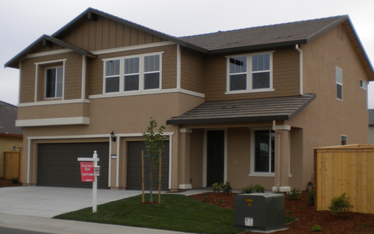
| 22:53, 8 May 2011 | Emptyhouse.jpg (file) | 258 KB | This building is not "a house where a family lives". It is empty, brand new, and for sale by the builder. Nevertheless, I think it's a {tag|building|house}. OSM node [http://www.openstreetmap.org/browse/node/1173790458 1173790458]. | 1 | |
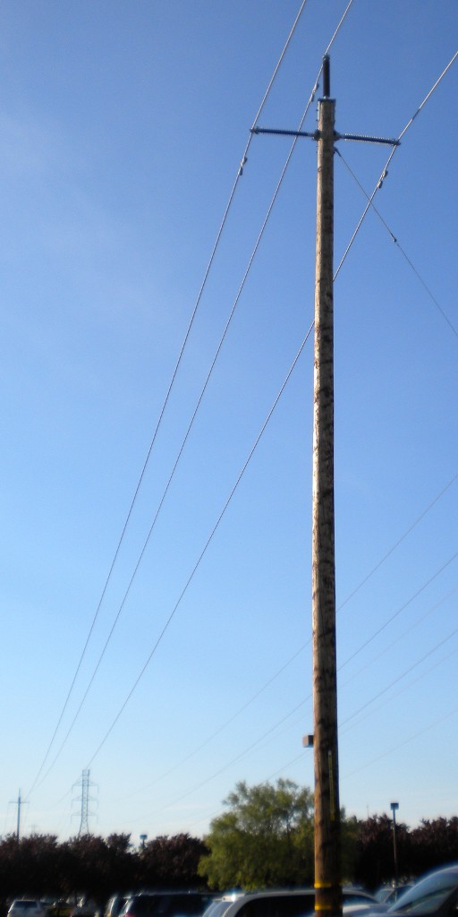
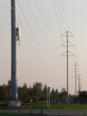
| 21:29, 23 April 2011 | Pge115.jpg (file) |  |
68 KB | A simple wooden pole rated at 115 kV / 60 Hz. OSM node [http://www.openstreetmap.org/browse/node/973497910 973497910]. | 1 |
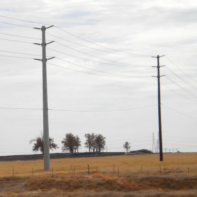
| 00:37, 20 April 2011 | Rose60k.jpg (file) |  |
512 KB | Roseville Electric powerline north of OSM node [http://www.openstreetmap.org/browse/node/959189157 959189157]. The voltage of the main circuit is 60 kV based on [http://www.roseville.ca.us/electric/about/distribution/engineering/cip/60kv_improvement.asp p | 1 |
| 01:34, 17 April 2011 | Polecat.jpg (file) |  |
638 KB | The base of a large tubular steel power pole, constructed on site from sections of tubular polygonal steel tubes and attached to a concrete base with bolts. This pole, OSM node [http://www.openstreetmap.org/browse/node/1247829312 1247829312], is apparent | 1 |
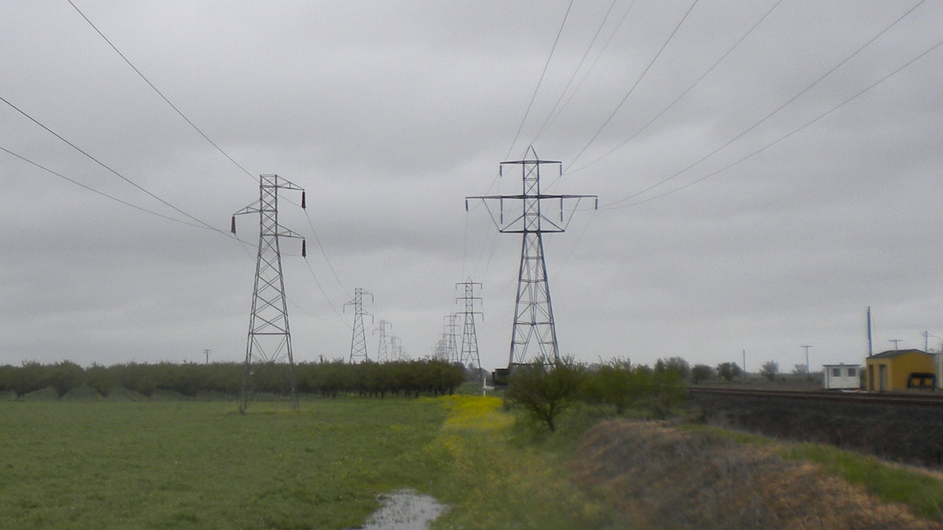
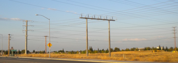
| 00:15, 17 April 2011 | Pgelines.jpg (file) |  |
295 KB | Steel lattice power poles, apparently carrying one (left line) and two (right line) 115 kV three-phase 60 Hz circuits and operated by PG&E; the nearest towers are OSM nodes 975628733 and 441502881. | 1 |
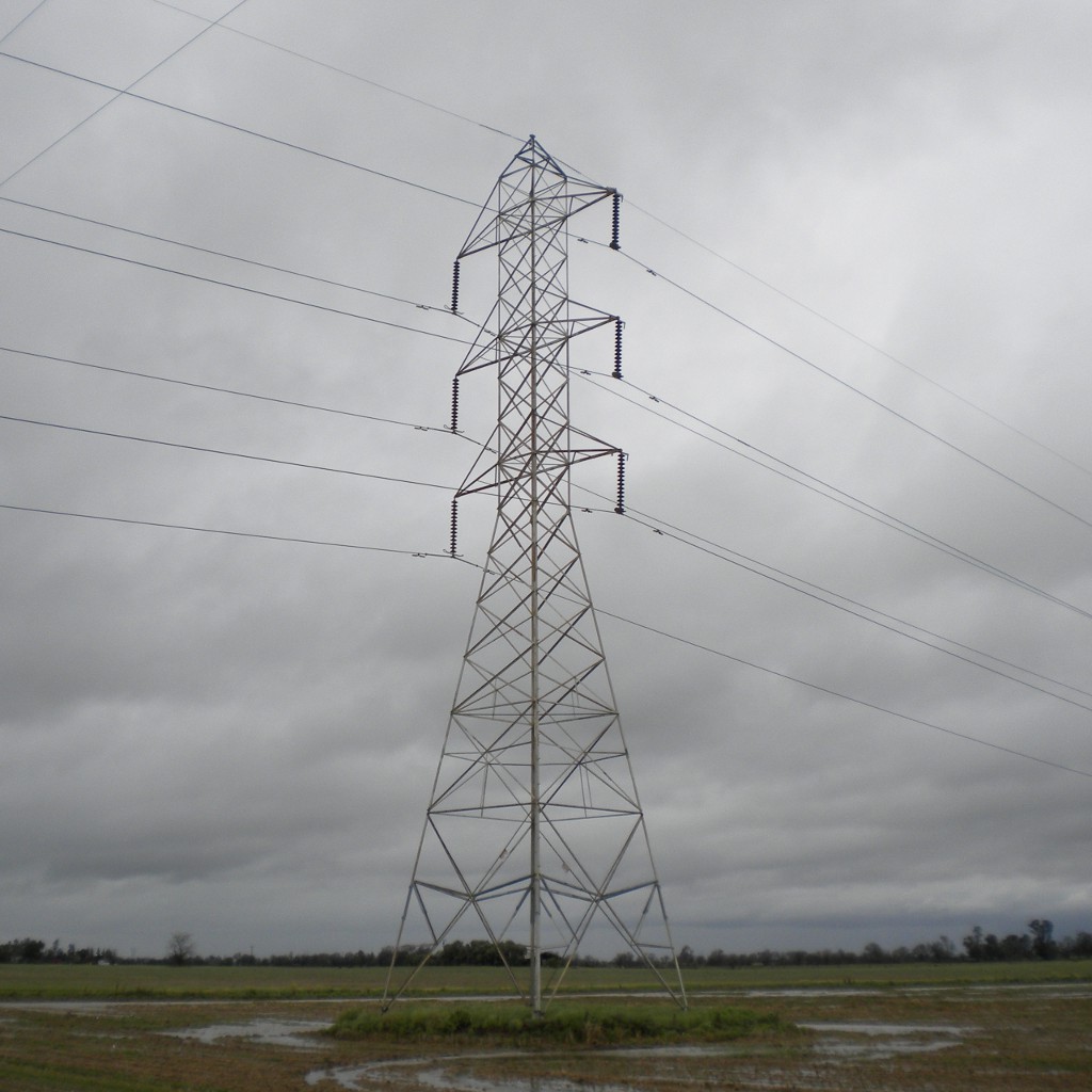
| 23:42, 16 April 2011 | Pgetower.jpg (file) |  |
147 KB | A typical steel lattice power tower, apparently carrying two 230 kV three-phase 60 Hz circuits and operated by PG&E (OSM node 370466847). | 1 |
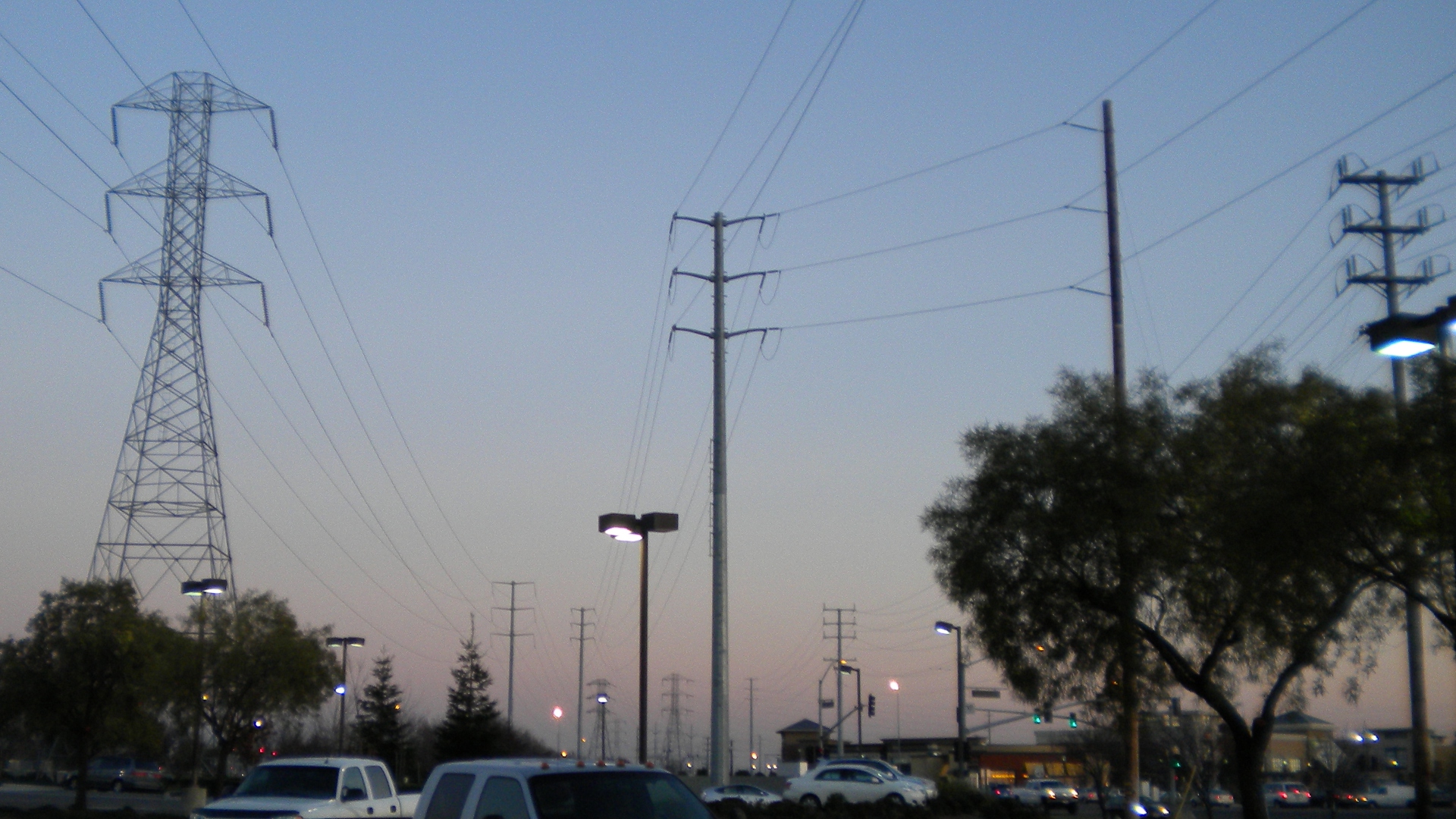
| 22:42, 16 April 2011 | Powerlines4.jpg (file) |  |
971 KB | 2 | |
| 22:40, 16 April 2011 | Smudtiny.jpg (file) |  |
20 KB | 2 | |
| 22:39, 16 April 2011 | Polematl.jpg (file) |  |
26 KB | 2 | |
| 22:38, 16 April 2011 | Lowtower.jpg (file) |  |
37 KB | 2 |