Tag:amenity=payment_centre
| Description |
|---|
| A non-bank place, where people can pay bills of public and private services and taxes. |
| Group: financial facilities |
| Used on these elements |
| Useful combination |
| Status: in use |
| Tools for this tag |
|
A payment centre is a non-bank place, where people can pay bills of public and private services and taxes. It is usually attended by a (human) teller.
Usually, a payment centre it's an exclusive place to provide this service of collecting, although it can also be inside a supermarket, kiosk, gas station, etc. It is composed of several boxes, operated by a human cashier, where people are arranged in rows and when is his turn pays for their services and taxes.
How to map
Tag it with amenity=payment_centre, combined with brand=* or network=* (with "Rapipago", "Pago Fácil", "Cobro Express", or other values).
Tags used in combination
- name=*
- opening_hours=*
- brand=*
- website=*
- phone=*
- addr=*
- operator=*
- wheelchair=*
Rendering
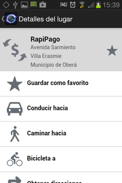
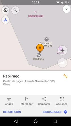
The apps for Android "Magic Earth" and "OsmAnd", shows an icon for payment centre and could be used in Mapnik.
Examples for Rapipago, Magic Earth and OsmAnd apps for Android:
Similar tags
- amenity=payment_terminal an automatic payment terminal.
- amenity=money_transfer places that offers money transfers
- amenity=bank a financial establishment
- amenity=atm an automated teller machine


