Tag:amenity=sanitary_dump_station
 |
| Description |
|---|
| Place for depositing human waste from a toilet holding tank. |
| Group: waste processing |
| Used on these elements |
| Useful combination |
| See also |
| Status: approved |
| Tools for this tag |
|
Facility for depositing human waste from a toilet holding tank, intended for use by land based users such as operators of motorhomes and long haul trucks.
If the facility is open to both marine and land based users, double tag waterway=sanitary_dump_station + amenity=sanitary_dump_station.
See Toilet Holding Tank Disposal for details.
How to map
If known, considering adding the following tags:
- sanitary_dump_station:suction=yes/no
- sanitary_dump_station:gravity=yes/no
- fee=* - tag yes if there is a direct (or indirect) charge to use this facility. Some services might be free, and others paid. If this is the case, you could clarify by using water_point:fee etc.
- access=network/customers/destination/yes - network - regional networks where a key or code can be obtained in advance. destination or customers - restricted to registered guests of a facility only.
privatePlease do not tag private dump stations: tag only stations a member of the public can use.publicis deprecated, use access=yes instead. - network=* - Name the network, if needed.
- opening_hours=* - if different from the enclosing area
- composting=* - if the waste disposed of is composted on site.
You can also mark an existing feature as having a dump station:
- sanitary_dump_station=yes/no - for the presence of a sanitary dump station at a feature such as a campsite or caravan site
Sample pictures
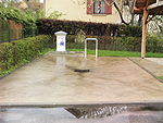
A place to emptying the toilets. Felletin, France.

Dumping at an RV campground in Canada.
Camper service near gas station, "San Zenone" service area, A1, Italy.

Supply and disposal station on the motorhome parking space. Itzehoe, Germany.

Fully automatic disposal station. Bad Durkheim, Germany.


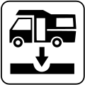
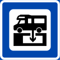
Traffic signs

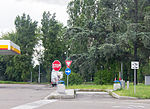
Australia

Australia

Bosnia and Herzegovina
Croatia
Slovenia

France

Iceland

Italy
Italy
Norway

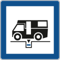
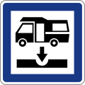
USA

USA

USA

USA
.svg)


See also
- MapComplete theme - thematic map in MapComplete to show (and edit) tourism=caravan_site and sanitary dump stations