Tag:crossing=uncontrolled
| Description |
|---|
| A generic crossing with road markings, but no traffic-signals of any type |
| Group: crossings |
| Used on these elements |
| Useful combination |
| Status: approved |
| Tools for this tag |
|
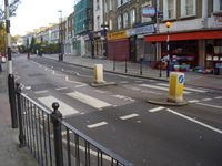
A generic crossing with no traffic signals of any type, just road markings; e.g., zebra-crossings. Which means mostly used in combination[1] with highway=crossing (and crossing_ref=zebra) as mentioned in an approved proposal[2]. Despite the name, this tag is not for uncontrolled crossings: for unsignalized, unmarked crossings, use crossing=unmarked.
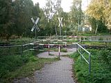
It is also used for pedestrian level crossing without barrier or light signal. It maybe indicated by a St. Andrew's cross.
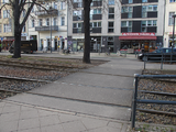
This tag is also used for pedestrian crossings of tramway crossing.
When used as a railway level crossing, if the railroad crossing has barriers add crossing:barrier=yes instead.
If the railroad crossing has a warning light add crossing:light=yes instead.
For pedestrian crossings on a street, there is another proposed scheme available which seems to be more specific. The used tags are:
- crossing=marked - A generic crossing with no traffic-signals of any type, just road markings
- crossing=unmarked - A crossing without road markings or traffic lights
Terminology
uncontrolled is a misnomer in the context of pedestrian and bicycle crossings along roadways. In reality, "uncontrolled crossing" is a legal term or traffic engineering jargon that varies in meaning by region but never carries the same semantics documented above:
- In the United Kingdom, an uncontrolled crossing very often has a pedestrian island (traffic_calming=island), although it can be as simple as the presence of dropped kerbs with tactile paving if the road is too narrow for an island or not busy enough to merit an island. It is never accompanied by specific road markings on public roads, except diagram 1026.1 to indicate the presence of a dropped kerb or diagram 1029 to show the direction to look for approaching traffic, although non-standard road markings may occur on private roads.[3][4] In UK terminology controlled crossings on public roads are crossings controlled by their road markings. Controlled crossings include zebra, parallel, pelican, puffin, pegasus and toucan crossings.
- In most of the United States, an uncontrolled crossing at an intersection of two roads may or may not have road markings, but an uncontrolled crossing mid-block is required have either road markings or traffic signs, or else it is not a crossing at all.[5][6][7] In some states, such as California, an uncontrolled crossing may or may not have road markings. An uncontrolled crossing is implied at any intersection where one is not visibly marked or signposted, even if it would be a very unsafe place to cross.[8]
Data consumers should be aware that this tag may have been used on a variety of crossing types and avoid making strict assumptions when encountering it. The crossing=marked / unmarked tagging scheme is intended to resolve this discrepancy in conjunction with crossing:signals=*.
How to map
Set a node on the junction where the transition is and add
- at the highway
- at the railway
- by the tram
If the crossing is also mapped as a way, tag it as highway=footway footway=crossing crossing=uncontrolled, highway=cycleway cycleway=crossing crossing=uncontrolled, etc. as appropriate.
Tags to use in combination
- bicycle=yes/no - Access permission for cyclists
- tactile_paving=yes/no - Indicate if a specific place can be detected or followed with a blindman's stick
- wheelchair=* - Indicate if a special place can be used with wheelchairs
Tag growth evolution
Graphs of different schemes (uncontrolled / marked) are show on following page link:
Examples
Software support
Editors
There is an implementation of a JOSM preset, which is using tags highway=crossing + crossing=uncontrolled + crossing_ref=zebra for a zebra-crossing (crosswalk) object.
Renderers
osm2streets (see AB Street) draws parallel white bars, equating the tag with crossing=marked.
Routers
OsmAnd penalizes the crossing by less time than crossing=unmarked and crossing=traffic_signals. [1]
MOTIS Per Pedes Routing indicates whether the crossing is marked [2][3] and can calculate a detour that avoids unmarked, unsignalized crossings. [4]
OpenSidewalks converts this tag to crossing=marked. [5]
See also
- crossing=marked - A generic crossing with no traffic-signals of any type, just road markings
- crossing_ref=zebra - A zebra crossing
- crossing=zebra - A zebra crossing
- crossing_ref=* - Used to reference a specific type of crossing
- crossing:markings=* - The existence and style of pedestrian crossing markings
- highway=crossing - Pedestrians can cross a street here
- railway=crossing - Pedestrians can cross a railway here
- railway=tram_crossing - Pedestrians can cross a tramway here
- railway=level_crossing - A crossing between a railway and a road
References
- ↑ taginfo: crossing=uncontrolled combinations
- ↑ Approved_features/Road_crossings/Usage
- ↑ “London Cycling Design Standards” (PDF). London: Transport for London. 2014. p. 8. Retrieved November 7, 2022.
- ↑ “Pedestrian crossings”. London: Merton London Borough Council.
- ↑ Blackburn, Lauren; Zegeer, Charles; Brookshire, Kristen (January 2018). “Guide for Improving Pedestrian Safety at Uncontrolled Crossing Locations” (PDF). Washington, D.C.: Federal Highway Administration Office of Safety. p. 1. Retrieved March 1, 2022.
- ↑ Zegeer, Charles V.; Stewart, J. Richard; Huang, Herman H.; Lagerwey, Peter A. (February 2022). “Safety Effects of Marked vs. Unmarked Crosswalks at Uncontrolled Locations: Executive Summary and Recommended Guidelines” (PDF). McLean, Virginia: Federal Highway Administration Office of Safety Research and Development. p. 2. Retrieved March 1, 2022.
- ↑ Wickert, Gary L. (October 29, 2018). “Why Did the Plaintiff Cross the Road? Understanding Pedestrian and Crosswalk Laws in All 50 States”. Hartford, Wisconsin: Matthiesen, Wickert & Lehrer, S.C.. Retrieved March 1, 2022.
- ↑ “Uncontrolled Crosswalk Safety” (PDF). San Rafael, California: Marin County Department of Transportation. October 1, 2012. Retrieved March 1, 2022.


