Tag:historic=wayside_shrine
| Description |
|---|
| A shrine often showing a religious depiction. Tag is used also for modern shrines. |
| Rendering in OSM Carto |
| Group: historic |
| Used on these elements |
| Useful combination |
|
| See also |
| Status: de facto |
| Tools for this tag |
|
The tag historic=wayside_shrine is used to map a shrine showing a religious depiction, usually placed by a road or pathway.
This tag is also used to mark shrines created in modern times (not just "historic" ones).
How to map
Tag a node ![]() or draw the area
or draw the area ![]() and add historic=wayside_shrine
and add historic=wayside_shrine
Note: If the shrine has a roof and is large enough for a person to enter, the building can be mapped and tagged with building=* (e.g. building=chapel, building=shrine, or building=wayside_shrine).
- name=* if it has a name
- religion=* (e.g. religion=christian, religion=shinto, religion=hindu)
- denomination=* - (e.g. denomination=roman_catholic, denomination=russian_orthodox, denomination=tibetan)
All of these additional tags are optional:
- amenity=place_of_worship if it is a place of worship
- inscription=*
- tourism=attraction if it is a tourist attraction
- ruins=yes if it's a ruin
- start_date=* erection/sacrification date
- support=* mounted on pedestal/tree/ground/etc.
If possible one may map this object as an area and use additionally building=wayside_shrine.
A shrine where religious services are conducted is also an amenity=place_of_worship and that tag also should be added. Note that only some shrines qualify for that.
See also
- Wayside shrine on Wikipedia
Examples
| Picture | Tags | OSM object |
|---|---|---|
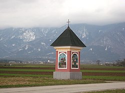
|
historic=wayside_shrine |
https://www.openstreetmap.org/node/9900303388 |
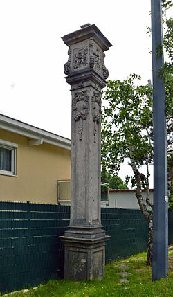
|
historic=wayside_shrine
|
https://www.openstreetmap.org/browse/node/2181029774 |
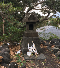
|
||

|
||
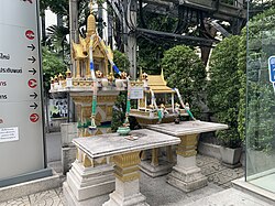
|
||

|
||

|
https://www.openstreetmap.org/search?query=성황당 such as https://www.openstreetmap.org/node/5258912231 (example of https://en.wikipedia.org/wiki/Seonangdang ) | |
|
historic=wayside_shrine |
https://www.openstreetmap.org/node/3916612660 |
Tag history
historic=wayside_shrine, historic=wayside_cross were intended for tagging old shrines and old crosses. But introducing them was done without proposing a tagging scheme for modern crosses and modern shrines. As result tags changed meaning and are used for any shrine and any cross. Including ones that are neither historic nor wayside.
Similar tags
- historic=wayside_cross
- summit:cross=yes summit cross
- man_made=cross modern cross
- building=shrine, building=wayside_shrine
