Tag:landuse=quarry
| Description |
|---|
| An area of land used for surface extraction (open-pit mining). |
| Rendering in OSM Carto |

|
| Group: landuse |
| Used on these elements |
| Useful combination |
| Status: de facto |
| Tools for this tag |
|
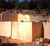
A quarry is an area of land used for surface extraction (open-pit mining) of mineral or organic resources like rocks, gravel, sand, soil, clay, ore, coal or peat.
How to map
Place a node ![]() or draw an area
or draw an area ![]() around the quarry, and tag it as landuse=quarry.
around the quarry, and tag it as landuse=quarry.
When used on areas this tag should only be applied to the area in which actual mining is performed. Connected areas like ore processing facilities or machine maintenance areas should usually be tagged landuse=industrial.
Additional tags
- name=* - the name of the quarry
- operator=* - the company operating the quarry
- resource=* - the resource being extracted
Rendering
area symbol in OSM Carto
Inactive and former quarries
Quarries that are out of use but still carry many characteristics of a quarry (e.g., bare earth and prominent quarry debris) may be tagged as landuse=quarry + disused=yes.
Quarries that have not been in use for a longer period of time, and are no longer clearly recognised as a quarry (e.g., with substantial vegetation growth), may be tagged as abandoned:landuse=quarry.
There are two tagging schemes which tend to be used when mapping inactive and former quarries, namely the prefix and status tagging schemes (see the life cycle page for more info). However, the status tagging scheme (e.g., landuse=quarry + disused=yes) is much more popular than the prefix scheme (e.g., disused:landuse=quarry). Additionally, quarries are explicitly listed in both the disused:*=* and abandoned:*=* pages as an example of when not to use this prefix scheme, since landuse=quarry is used to describe a landscape feature.
disused:landuse=quarry and landuse=quarry + disused=yes in theory mean the same, but nearly all data consumers will not process lifecycle prefixes at all, so mappers tend to use for features like abandoned:shop=*/disused:shop=* where object no longer fulfils typical expectation of place (you will be unable to buy anything in abandoned:shop=convenience) and use disused=yes/abandoned=yes where usage status is less important - and inactive quarry and active quarry will be very similar as far as reference location, terrain shape and difficult access goes.
The scarps of the abandoned quarry may be mapped with man_made=embankment if desired. Some mappers may also tag abandoned quarries as historic=quarry and some also chose to use note=*, description=* or the like to provide further information, e.g. that this structure was once a quarry.
Note that "quarry" in English language refers not only to active quarries - see for example "A place, typically a large, deep pit, from which stone or other materials are or have been extracted." at Lexico.
See also
- man_made=embankment - an artificial slope often encircling a quarry
- man_made=spoil_heap - a pile of waste material removed during mining
- man_made=tailings_pond - area used for storing tailings - leftovers of mineral processing
- Proposed features/Surface mining
- industrial=mine
- For underground mining, see:
Possible tagging mistakes
| ||||||||||||||||||||||||||||||||


