Tag:seamark:type=dredged_area
Jump to navigation
Jump to search
| Description |
|---|
| An area of the bottom of a body of water which has been deepened by dredging. |
| Group: marine navigation |
| Used on these elements |
| Status: in use |
| Tools for this tag |
|
An area of the bottom of a body of water which has been deepened by dredging.
How to map
Draw the outline of the area ![]() and add
and add
- seamark:type=dredged_area
- seamark:name=* - name
Symbol in OpenSeaMap

Example in OpenSeaMap
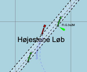
Click to open the map