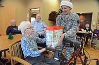
Tag:social_facility=assisted_living
Jump to navigation
Jump to search
| Description |
|---|
| A residential facility like group_home, but the occupants are more independent. Usually conceived for people with minor disabilities. |
| Group: social facilities |
| Used on these elements |
| Requires |
| Useful combination |
| Status: approved |
| Tools for this tag |
|
Assisted living is a residential facility like group_home, but the looked after are more independent (e.g have own flats). Usually conceived for people with minor disabilities (e.g. retirement home for elderly people)
How to map
Set a node at the center or draw as an area along the outline of the feature. Add the tag amenity=social_facility + social_facility=assisted_living, and the target group, typically social_facility:for=senior or social_facility:for=disabled.
Tags used in combination
- name=* - the name of the feature
- operator=* - indicates the operator or name of the company operating the feature
- addresses - the address of the feature
- opening_hours=* - hours when the feature is open
- phone=* - phone number of the feature
- website=* - website of the feature
- wheelchair=no/yes/limited - whether the feature is suitable for wheelchairs
- social_facility:for=*
- social_facility:for=senior
- social_facility:for=disabled
Facilities that might fit this tag
- Retirement home
- Assisted care living facilities
- Supported living
- Extra care living
- Sheltered home
Similar facilities
- amenity=social_facility + social_facility=day_care - A non-residential facility that provides nursing services on a daily basis to people
- amenity=social_facility + social_facility=group_home - A residential facility providing more support with basic daily activities (e.g. eating, dressing, toileting) than assisted living
- amenity=social_facility + social_facility=nursing_home - A nursing home provides permanent (24/7) skilled nursing care to elderly, ill or disabled people
