Talk:ILOE
Dieter
Kleine Wünsche zum Programm:
Nach dem netten Mailkontakt mit Johannes dem Proggiman, fasse ich mal meine Ideen zur Verbesserung zusammen.
Änderungen durch das Verschieben von notes sollte man aber sofort sehen. (Wurde als Vorschlag schon angenommen)
Wenn man auch ways selektieren könnte um z.B. den Strassennamen zu korrigieren oder Hausnummern zu ergänzen. (Ist auch ein Projekt von Jo.)
Da das Display vom iphone klein ist, eventuell mehrseitig arbeiten.
Also, weiter so....
Dieter
Andi
Wenn ich die App auf meinem alten iPod touch installieren möchte, wird das durch die Anforderung eines Mikrofons verhindert. Ich denke diese Dependency kannst du streichen - damit deine App rückwärtskompatibel ist. Ich würde sie nämlich echt gerne testen. Selbiges gilt für Leisure. (Andi)
Es läuft auf einigen iPods, bei einigen nicht. Ich habe noch nicht herausgefunden warum das so ist. Softeis 17:33, 28 November 2009 (UTC)
Demi
Ich finde diese App super! Habe unterwegs schon ein paarmal etwas hinzugefügt. Schreibe hier noch ein kurzes Feedback:
- Hallo Demi, danke fürs Feedback, ich schreib mal direkt unter die Punkte.
Leider stürzt bei mir die aktuelle Version ziemlich häufig ab. Meist gleich nach dem Start. Manchmal hilft ein Neustart, manchmal auch nicht. Habe noch nicht genau herausgefunden wann es auftritt (Habe ein 3G).
- Ist mir leider auch schon passiert, wenn ich im log nachschaue, irgendwo ein "memory leak" bei der Kartendarstellung. Diese benutze ich auch nur als "Framework". Aber das schau ich mir noch genauer an. siehe auch weiter unten
Was ich etwas mühsam finde ist die atomatische GPS Lokalisierung zu Beginn. Die dauert in einem Gebäude manchmal nämlich ziemlich lange und man kann während dieser Zeit nichts machen... Kann man die nicht manuell per Knopfdruck starten wenn man sie braucht? Meistens bin ich nämlich auch sonst schneller wenn ich von Hand zur gewünschten Position navigiere ;)
- Ist mir auch schon aufgefallen. Und das das GPS von Anfang an mit voller Power läuft, ist auch wahrscheinlich manchmal schuld an den Abstürzen. Da läuft zuviel parallel (Position bestimmen, Karte neu ausrichten, parallel neue Pos, Karte etc.) . Aber ich glaube das übernehm ich: GPS nur auf Anforderungen. DANN aber, Merken der letzten Position (nicht immer München :-) des users)
- Ja das wäre eine sinnvolle Erweiterung
Mit der neuen Version hat sich auch das Interface ziemlich verbessert. Es gefällt mir schon viel besser! Ich habe jedoch noch eine Idee gehabt wie man das Interface weiter Verbessern könnte, es ist meiner Meinung nach immernoch etwas überladen. Habe dazu kurz ein Mockup in Photoshop erstellt weil ich so am besten zeigen kann was ich meine: http://www.holderegger.org/div/iloe_mockup.png Wie man sehen kann habe ich die Liste und den Balken oben weggelassen (-> mehr Platz für die Karte). Wenn man bei den POI's direkt in dem "Popup" (oder wie man die Beschriftung nennen kann) auf bearbeiten klicken kann, braucht man die nämlich die Liste nicht mehr :) (und der button "Edit" unten kann man somit auch streichen, oder einfach in "Save Changes" umbenennen).
- Oben die Leiste ist die Standard apple Navigation für vor/zurück. Anklickbare marker gbt es auf jedenfall in der nächsten Version. Mit der Liste muss ich noch schauen. Im Moment kann ich nicht höher zoomen, als wie du siehst. Und wie soll man dann hier noch navigieren? [1] :-) . Die Grundidee war/ist erstmal alles bearbeiten können und dann nach und nach Komfort. (btw. schonmal copy/paste von tags ausprobiert [2]). Liste wegklappen, geht auf jeden Fall und mach ich dann.
- Ja zum navigieren ist es dann schon ein bisschen mühsam, das stimmt... Wenn die Leiste schon oben bleibt dann kann man sie ja auch nutzen und rechts und links ein Button reinmachen (z.b GPS-Button). Siehe hier: [3] Was meinst du mit alles editieren können = auch Wege, Relationen etc? Das wär natürlich auch cool :D PS: Auf die klickbaren Marker freue ich mich :)
![[3]](http://www.holderegger.org/div/iloe_mockup2.png)
Ich hoffe du kannst damit etwas anfangen, ich weiss nicht wie schwierig das ist umzusetzen, vielleicht kannst du ja bei der "OpenMaps" Applikation von CloudMade was abgucken (finde die sehr gut gemacht) :)
- Danke für Dein feedback, schau mer mal :-)
--Demi 21:41, 23 November 2009 (UTC)
From the blog:
New iLOE 1.6 uploaded
Uploaded a new Version of iLOE (iPhone OSM Editor) which is now in review by apple. (http://bit.ly/A1KMt) After testing with friends, which never put in a node in OSM before, I took their suggestions and built it in. So the user interface should be improved by now. I also put in a new function to copy all tags from a node to paste it to a node. So it should be easy to tag addr:* for a hole street.
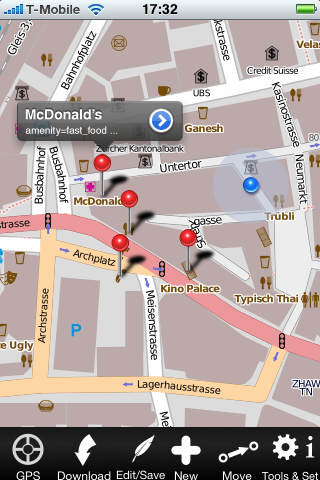
A screenshot of the new user interface can be seen here: http://twitpic.com/ovqb5
Hopefully apple's review is faster than the last time.
Greetings, Johannes
Johannes, You invite feedback on you website, but there's no obvious email address to and them too.
I tried the app (1.5). It's rather unpolished, but I guess I have to wait for the update.
One major problem that makes it more or less unusable in the US is that all nodes of a way that's imported from the tiger data set (99% of all nodes) have extensive (meaningless) tags.
So on your app, only those show up, not actual points of interest. There really should be an option to filter out those TIGER nodes.
Kommentar von wallclimber21 am Montag, 16. November 2009, 22:07 Uhr
Other things:
- the current version of RouteMe is WAY better when zooming in or out in that it will magnify an existing texture is a high resolution one doesn't exist. Use that one.
- show the spinning circle when your downloading something
- make it possible to remove the node display
- I found myself tapping the node rows to update or download them, instead of tapping the download button. Why not put a button there when there are no nodes loaded instead of repeating the same text 3 times? And add a refresh button there too.
Hello wallclimber21, thank you very much for feedback. To get feedback on one position I decided to use http://wiki.openstreetmap.org/wiki/Talk:ILOE for it. please allow me to put this cooments there. To give you a better better insight I'll try to explain the roadmap:
- I just tried a version just for my own, because I wanted to edit on my iPhone :-). I had in mind more josm than potlatch: You can do all with it, but problem you have to know how to use. So the first 2 versions are very technical. One has to read the documents, and needs some OSM background.
- At the moment you own V1.1, I decided to draw 1.5 back in favor of 1.6 which has a lot more of improvements (apple allows only one update per app).
- I see the problems with the TIGER nodes (doing a lot of testing in Cupertino, this is where the iPhone simulator takes me :-) ). This was asked by some people: Please filter, I only wan't to see, ... At the moment I thinking over it. May be a few words to the workflow about that:
- Workflow: Let GPS find your position, it turns off automatically, or turn it off by yourself. Download nodes, to see if "your" node is not already there. ...
Other things:
- zooming: built in 1.6
- spinning circle: built in V1.6
- make it possible to remove node display: -> wishlist, will come in 2.0; but wait for 1.6. maybe it's better there.
- tapping node rows: V1.6: colors for nodes, bring node to front, map only moves when out of sight.
- maybe we could talk about the details, so you can explain me better?
Thanks again for feedback, Johannes
Kind of a review, perhaps
Plain-text password, eh?--bit discerning, if that's the word to use--which I doubt. Finally got 'round to using the app for its purpose: added a cycle parking node at Histon & Impington busway station. Worked somewhat, although the cold and GPRS made it difficult. It's alright, I guess; quite a lot of work to be done though. Looking forward to the future. Kevin Steinhardt 08:49, 26 November 2009 (UTC)
- Thanks Kevin: For GPS there will be a better solution in the next version. I know lot of work to do. The plan for iLOE is, that you can do as much as possible on the iPhone, so it's a little bit tricky to make a simple UI and putting a lot of features in it. Thanks for feedback, Johannes
New to iLOE
I reciently Dowloaded the App. I can not Download Nodes although I can create them but cant even download the one I created. I am on an iTouch w/wifi. Any suggestions?
- Download didn't work anymore because of a change in the OSM interface. With the new Version 1.8 download works again.
Export new POIs for offline use
First of all, thanks for this app. My main problem is that I'm using it on an iPod Touch 3G, and it works like a charm, until I disconnect the iThing from the wifi. If you're walking in the streets with an iPodTouch you don't expect to have a mobile internet connection ready for upload data (like in iPhone). So, I've two chances:
- try to keep the application on, without closing it until I'm back home and upload data (on a jailbreaked device could run it in background);
- try to find the nearest free-wifi access point to connect to for data uploading.
I think the better guess should be:
- make possible to download data at home and storing it somewhere
- make possible to store modified data somewhere and upload as OSM file from JOSM at home
Thanks again, for any suggestion feel free to contact me ;) --fradeve11 22:38, 23 February 2010 (UTC)
Right Offline-use would be nice. Not only for the iPod touch also for using the iPhone in other countrys. HaaseD 15.08.2010
Suggestions for adding (lots of) addresses
I took iLOE for a walk, and added some addresses in my neighborhood. Thanks to the copy/paste of tags it's an excellent tool - much more usable than mapzen poi collector. It's also more effective than other options I have, like walking papers or Motion X GPS, because there is no "postprossesing" in JOSM.
I have a couple of suggestions for making it even more efficient for adding house numbers (in order of importance):
- make it possible to batch-upload new nodes, instead of uploading one by one. This now requires a few taps, and having to wait a few seconds for every housenumber added.
- make the current GPS position visible at all times, preferably with accuracy indication. This would save me from having to click the GPS-button to update position on every other house number.
- make a special mode for adding house numbers: Automatically paste in a pre-selected tag set immediately after creating a node, and then open editing of the house number. This would save quite a few taps.
Thanks for creating the app, and keep up the good work :) --Geogossamer 19:20, 21 March 2010 (UTC) Thanks for creating the app! I missed the ability to edit on the go that I had with OSM2Go on N800. Keep up the good work! :) Also, I second fradeve11 on the offline editing mode, it'd be a great add-on. --Nighto 17:41, 13 April 2010 (UTC)
Move node function doesn't work.
Hi, very nice app. Move node function doesn't work, when push "move" button - goes to "edit". iLOE 1.8. I can draw new buttons for this app, if you allow.
- Move: so it is meant: choose a node, so it is marked. Then put crossline to the new position and upload. Finished. I would be glad having new buttons. I'm a terrible painter :-), Johannes
- You are right. I found a bug. Shame. There is an workaround: Choose a key-value pair for edit, after that you can move. The whole move process will be easier in the next version. Softeis
iPad
Hatte den Wunsch zwar schon per Mail mitgeteilt, aber vielleicht interessiert es hier ja noch einige. Eine speziell an den größeren Screen des iPads angepasste Version wäre schön. Wenn möglich, wie bereits von fradeve11 vorgeschlagen, wäre es sehr hilfreich, wenn man sich die OSM-Daten bereits im Voraus laden könnte für die Offline-Nutzung. Dann könnte man den ganze Tag draussen arbeiten und am Abend die neuen Daten auf den Server laden. HaaseD 15.08.2010
- Werd ich machen, wenn mir mein Job etwas "Frei"zeit lässt. (Ist beides wirklich fest eingeplant und schon angefangen). Johannes
"An Error occurred: bad URL"
Auch per E-Mail an den Autor gesendet, aber vielleicht kennt hier jemand dieses Problem: Bei meinem ersten Versuch, einen Weg mit iLOE zu editieren, erscheint beim Upload nach "Trying to close changeset" die Fehlermeldung "An Error occurred: bad URL". Woran liegt das wohl? Mein OSM-Benutzername und Passwort sind richtig eingegeben. Berner-Bär 22:25, 29 August 2010 (BST)
Das sind Umlaute im Passwort. Werd ich mit nächstem release angehen.- Das ist eine härtere Nuss als ich dachte, um mal einen Zwischenstand zu geben. Softeis
name=
super app, ich habe aber bisher nur die Ergebnisse gesehen (Android-user). Ist es nicht auch möglich, das bei POI zwingend auch ein Name eingegeben werden muss? Bei den Navis tauchen sonst nur Einträge auf wie "Namenloser Nachbaschaftsladen". Unter "Edeka" kann ich mir dann zumindest was vorstellen bzw erleichtert dann auch die suche ;-)
Gruß Jürgen Fuss-im-Ohr 09:49, 10 February 2011 (UTC)
Two bugs
I have used iLOE 1.9.4 a bit this summer. One bug I have experienced is that when the network I am connected to is disconnected from the internet, the app closes/crashes without any explanation. I used the app during the holidays, where the iPhone would often be connected to hotel wlans which from time to time (sometimes way too often) required me to enter my credentials on a web page before getting access to the internet. The best would be if iLOE could make this rederected login page pop up when needed. Failing that, a message that the internet connection failed would be nice.
Another thing I noticed is that iLOE is quite excessive in slapping iLOE tags on both changesets and nodes/ways when edited in iLOE. It seems to me that even for small edits like correcting the spelling of a tag value or moving a node, the object will get the tags created_by=iLOE 1.9. It is okay to have tags in the changeset saying that the changes was made with iLOE. See Key:created_by. --Gomyhr 11:08, 16 September 2012 (BST)