Talk:Ohio
Ref rendering
I think it would be nice if, as a small first step anyway, renderers would take multi-valued "ref" tags and display them in a multiline format on the map, one route per line. It seems like that's probably the best way to go about it in the absence of network-specific shields or widespread route relation coverage. As it is, Mapnik seems to render either the ref or the name (not both) for motorways, and I'm not sure how it decides which — but it does seem that longer ref values are less likely to be rendered, which is a bit of a disincentive to use US:OH or especially US:OH:FRA or something similar. (You know ODOT has a unique three-letter abbreviation for every county, right? I think we could use that to distinguish different counties' networks without making the refs ridiculously long. And then there's the township roads...) Vid the Kid 07:02, 20 April 2009 (UTC)
- Some states (including Ohio) also numbers the counties alphabetically. But the three-letter codes are pretty intuitive, and I'd prefer them to the license plate codes. I don't know if every state has such a system; in the absence of one, I guess the FIPS county code (unique across states) could be used. I honestly don't intend to place township roads in relations. The vast majority of them will always consist of only one way, which can have a simple
refon it. – Minh Nguyễn (talk, contribs) 08:08, 20 April 2009 (UTC)
Vid the Kid 08:34, 20 April 2009 (UTC)

Network-specific shields and signage
I have some more info for you on county road signage. Madison county uses the pentagon in isolated spots, probably as a result of contractors going "above and beyond" for their projects. Fairfield County uses the rectangular county route shields liberally. Finally, Madison, Franklin, Licking, Delaware, and Union counties all specify county (or township) route numbers on their blade signs, though Franklin county's newer (since the late 90's) blade style puts the route number much smaller than they used to be.
And I once saw a book with maps of bike routes around Ohio, and it always used the correct shield shape for state routes in Ohio, and all surrounding states where applicable. Vid the Kid 07:02, 20 April 2009 (UTC)
- For county routes, maybe it's best to have the renderer (eventually) default on the blue pentagon and rely on
symbolfor other designs. That's probably the way California's U.S. route design is going to be handled, anyways.
- State bike routes have ad-hoc signage mostly, because they're maintained by county authorities or ODNR, rather than ODOT. (Do you happen to know if the Ohio state government has officially sanctioned the route numbering scheme?) In Southwest Ohio, there are three styles of signage:
- In the main section of the Little Miami Bike Trail (SBR 1), maintained by ODNR, the predominant shield is the Ohio-to-Erie Trail's logo, which may be trademarked or copyrighted. Occasionally you'll find the standard elliptical shield too. [1]
- The non-standard lozenge design is used by Clark and Greene counties on the LMST. [2][3][4][5]
- But Greene County uses the standard elliptical design on its maps and on the Prarie Grass Trail. [6][7] Montgomery County uses this design too. [8][9][10]
![[6]](http://www.miamivalleytrails.org/images/creekside1.jpg)
![[8]](http://www.miamivalleytrails.org/images/creeks13.jpg)
![[9]](http://www.miamivalleytrails.org/images/creeks26.jpg)
![[10]](http://www.miamivalleytrails.org/images/creeks28.jpg)
- It's quite a mix of signage, really. My guess is that the counties will be moving toward the elliptical design, since it's more common nationally and easier to draft. Miami Valley Trails is a great resource on Southwest Ohio's bike trails. Pennsylvania seems to use a text-heavy version of the elliptical design, by the way.
– Minh Nguyễn (talk, contribs) 08:31, 20 April 2009 (UTC)
- The last time I saw discussion of a tag to specify what variation of route marker to use, people didn't seem to like that idea. That is, as long as the network is right, it should be close enough. (On the other hand, if each county has its own network, a smart enough renderer can choose the appropriate route marker style.) Can you point me to a proposal regarding this "symbol" tag concept? Vid the Kid 08:43, 20 April 2009 (UTC)
- The idea of specifying SVG URLs from Wikimedia Commons in
symbolcomes up every now and then on the mailing list, always with lukewarm reception.symbolwas originally intended as a human-readable description, not a URL. But it's used this way pretty widely, as a stopgap solution, since it's not exactly wrong. (Chicago has them, and see the guidelines at Interstate Highways Relations and United States Numbered Highway Relations). There's still debate if this system should be used on the entire U.S. route network in California, though. – Minh Nguyễn (talk, contribs) 09:13, 20 April 2009 (UTC)
- The idea of specifying SVG URLs from Wikimedia Commons in
- Around here, the only bike route signs I see are the little green rectangular ones with the bike icon and (usually) a number. Those numbers seem to follow a citywide numbering system. In fact, I don't think I've seen them outside the City of Columbus. Vid the Kid 08:43, 20 April 2009 (UTC)
- Those are for local routes (
lcn). I'm talking about state routes (rcn), which mostly link cities together. Here are the state routes in Franklin County – the Prarie Grass Trail is part of the Ohio-to-Erie Trail (Route 4). – Minh Nguyễn (talk, contribs) 09:13, 20 April 2009 (UTC)
- Those are for local routes (
Cool, I didn't realize ODOT publishes its own MUTCD. Page 2D-7 shows that the blue pentagon style is preferred, though the white square style is allowed as an alternative. Township routes can be signed with that alternative style – do you know of any townships that do this? – Minh Nguyễn (talk, contribs) 02:57, 29 June 2009 (UTC)
- I've seen at least one pentagon-style for a township road, but it was not the norm for the area and I doubt it was erected by the township. I'd expect to see square township road signs in Fairfield County, probably erected by the county and not the townships. Also, I'm pretty sure the exit guide signs for Beech Rd from SR 161 in western Licking county use square township route markers on them, though I haven't actually exited there to see if that type of marker is used on the road itself. Vid the Kid 00:49, 17 July 2009 (UTC)
Primary/Secondary promotion
There seems to be some pressure in OSM to use highway=primary and highway=secondary a bit more liberally than what resulted from the TIGER import. United States roads tagging does not specifically limit usage of primary and secondary to US and state routes, respectively; rather, it allows for promotion under conditions that aren't well-specified. The talk page there has people suggesting liberal promotion, and I've weighed in with a more moderate opinion. I think I'll make minor adjustments to the Tagging Suggestions section of this page; these adjustments represent a baby step in the direction people seem to want to go. Vid the Kid 01:02, 15 July 2009 (UTC)
- I can think of a few roads in my area that should be promoted to secondary, based partially on the fact that they're separated roads and have higher speed limits (such as 50–55 MPH) than the surrounding roads. The presence of on- and off-ramps also matters here. The largest of these roads are already being promoted to
trunk. It's fine with me, just as long as we don't follow California's example and mark all the non-alleyssecondaryand higher. Too liberal.:^P– Minh Nguyễn (talk, contribs) 02:54, 15 July 2009 (UTC)
- My main concern is that upgrades to secondary should be considered on a systematic basis, connecting to other secondary or higher roads on each end. They should be treated as if there might actually be a state route there, and they shouldn't just stop where the road's physical properties change. Similarly, state routes upgraded to primary should be considered on a systematic, city-to-city basis. I've uploaded a map of the routes I think make sense for upgrade to primary, though it's not set in stone. (I'm looking at 57/83 from Elyria through Lodi to Wooster for possible promotion as well. Maybe our newest Active Mapper from Clevelandland can suggest some corridors.) Vid the Kid 02:53, 16 July 2009 (UTC)
Right-turn "ramps"
Here's a problem I've been encountering: often main thoroughfares and minor roads alike have what amount to highway=tertiary_link, unclassified_link, and even residential_link, none of which are well-used or recognized anywhere. (tertiary_link isn't even completely implemented by the Mapnik renderer.)
I don't know of any term for the little "ramps" that ease highly-angled right turns, but I've been using highway=service for them. Hopefully routers don't shy away from them, because that's not really a correct use of the tag. I wouldn't want to go around turning these little ramps in the TIGER data into residential_links; nitpicking like that would make the data disappear from the maps for no good reason. Any ideas?
– Minh Nguyễn (talk, contribs) 02:31, 15 July 2009 (UTC)
- I've seen a solution to this somewhere. You use a
highwayvalue that matches one of the roads involved, and setoneway=yeson it. As far as naming, it might make sense to use the name of the street that the ramp leads to, but I usually leave it unnamed. And when the roads on either end are of different classes, I would tend to use the lower class for the "link". This is kind of opposite from how links for motorway, trunk, and primary are done, but to me it makes more sense in these smaller cases for the little ramp link thingy to be more closely associated with the minor road rather than the major one. Vid the Kid 02:59, 16 July 2009 (UTC)
ref formats
I've been tagging county and township routes with ref=CR xx and TR xx, respectively, for quite a while now. That format is consistent with Ohio's use of SR xx and seems to be in wide use in routing applications. But I wonder if we should instead be using C-xx and T-xx, analogous to our Interstate refing scheme. ODOT's straight-line diagrams use C-xx and T-xx, and so does a very meticulous, large-format Ohio atlas I own (Delorme's Ohio Atlas & Gazetteer, if you're wondering). In addition, townships in southern Ohio very frequently sign unnamed roads as T-xx. – Minh Nguyễn (talk, contribs) 02:54, 15 July 2009 (UTC)
- I suppose either format is fine. (I'll update the Tagging Suggestions section accordingly.) In general, I'd prefer not to set a
reffor a road unless thatrefis posted on a 12-inch square or larger sign in enough places that a driver can follow the road by its number. On those, you usually don't see a "C-" or a "CR " before the number, just the number (and the county or township name in much smaller print). Now, if a road is unnamed, but it's county or township highway number is signed like "C-##" on an ordinary street sign where the name would be, I think it makes the most sense to put that as thenamerather than theref. Vid the Kid 03:06, 16 July 2009 (UTC)
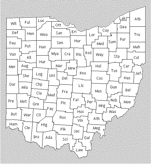
I hadn't realized this, but the northeast Ohio counties letter their county and township roads, rather than numbering them. What's more, the counties and townships coordinate their letters so that, for example, you'd drive north to south through the county and meet: County Road A, Township Road B, Township Road C, County Road D, Township Road E, Township Road F, County Road E, Township Road F, Township Road G, County Road H, etc. ref=C-A looks rather weird, but so does ref=CR A. In these counties, the roads are named "Road A" and such. So it might be reasonable to just label them like ref=A in the northeastern counties (Putnum, for example). – Minh Nguyễn (talk, contribs) 08:44, 2 August 2009 (UTC)
County Boundaries
I'm totally disregarding the USGS-imported county boundaries. I believe they were imported from a low-precision data source. Instead, I am drawing new boundary lines, connecting the points where TIGER roads change county. As long as these TIGER roads haven't been merged or extended across county lines, this works well. I can also integrate the process of connecting the disjoint roads together into this task, as well as correcting duplicate roads along county lines. (Of course, the one I keep is added to the relevant boundary relations.) This process seems to go quite quickly in rural areas. (Except, of course, when Potlatch gets fussy.) When a county's entire border has been redrawn and relationed, and its roads stitched with all adjacent counties, I call it "complete" and delete the USGS-imported boundary way. Vid the Kid 00:05, 27 July 2009 (UTC)
- Whatever works for you. It's similar to what I've been doing, except that I use the original way for redrawing. That works for me because I usually only do a side of the county at a time, and I don't want to leave the county boundary in a half-completed state. Besides, the USGS county boundaries are better than the TIGER data for some of the counties I've worked with (especially Butler County). – Minh Nguyễn (talk, contribs) 01:10, 27 July 2009 (UTC)
- Also, watch out for "county-line roads" duplicated for each county they touch. – Minh Nguyễn (talk, contribs) 01:12, 27 July 2009 (UTC)
- I look for those double roads specifically. I'm getting rather efficient at dealing with them. Regarding the TIGER vs USGS data, I think the precision of the USGS data is limited, I.E. recorded with too few digits. I say this because some short segments of USGS county boundaries I've seen are perfectly orthogonal (to the lat/lon grid) when they should be slightly angled. TIGER data has a fair amount of precision, something like 5m by my observations. As far as accuracy, the TIGER data usually matches up pretty well (within 10m) with the Yahoo! aerials for roads that have been around for a long time, while the USGS county lines can be off by hundreds of meters. (The original Franklin-Madison border along Big Darby Creek was atrocious, about a mile off in some places. And the points were about a mile apart, too. That tells me those boundaries weren't digitized with a high standard of accuracy or precision. The evidence of that is gone, however. The remaining USGS Madison County border is a refined version I did several months ago before I started drawing rivers and creeks. Though I suppose you could revert the way in Potlatch. I'm going to delete it when the rest of Madison's borders are redrawn anyway. ) Vid the Kid 07:16, 27 July 2009 (UTC) edited Vid the Kid 07:18, 27 July 2009 (UTC)
The Table
I think we need to clarify the meanings of the columns in the County Boundaries table. I recently listed the Gre-Mot and Gre-War boundaries as "complete" and re-listed them as "new" rather than any kind of "merged" because I completely redrew them. The way I've been working, the "progress" column indicates whether boundary segments have been drawn / tagged properly / added to relations ("relationed") or that and complete joining of TIGER data across the border ("complete"); the "merged or new" column indicates where the boundary ways came from, whether they were drawn new from TIGER data (my style) or they're the old USGS-imported ways left in place and split/merged (Minh's style); and I think the "TIGERification" column is supposed to indicate something about joining TIGER data but I couldn't figure out what your original entries in that column meant so I've left it alone. Anyway, I've had some trouble figuring out exactly how much of that Minh has accomplished on any particular border segment until I've gone in with Potlatch to do it myself. (Oops, forgot to sign.) Vid the Kid 15:03, 4 December 2009 (UTC)
- I'm pretty sure I've been doing the same thing as you, except I do a whole side of the county in one go, and I reuse the existing way (but split it as necessary). "Merging" just meant turning the overlapping county boundary ways into one way. "TIGERification" meant additionally hooking up dangling ways along the county line and connecting the boundary to the nodes where those ways meet. In the end, there's a series of non-overlapping ways drawn according to the TIGER data and Yahoo! aerial imagery (on occasion). Sorry for the confusion; feel free to rewrite the table, since you're much more active in fixing the county data than I am. – Minh Nguyễn (talk, contribs) 05:36, 7 December 2009 (UTC)
Places Import
It seems the Places (municipalities & CDPs) import for Ohio has been executed. Thankfully, this import process used relations, and where places are adjacent, a single way was created for both. This will make merging with existing ways (if desired) much simpler. On the other hand, what to do with the now-redundant GNIS POIs? Vid the Kid 06:26, 30 July 2009 (UTC)
- The GNIS POIs are still necessary: although Mapnik does render name=* in the center of mulipolygons, it's only visible at a fixed zoom level (whereas the POIs are visible according to how big the place is). Also, the POI isn't necessary at the center of the entire city: for large cities, it might be at the center of downtown, which can be miles away. – Minh Nguyễn (talk, contribs) 08:39, 2 August 2009 (UTC)
Forest and park routes
I've been mapping in Vinton County, and there are plenty of additional road designations we need to consider. Much of this is just a guess, since I've only been out that way a couple times, so feel free to make corrections:
- National Forest Development routes – looks like they would be highway=tertiary but potentially surface=unpaved, depending. Other states use
ref=NFD xxxxconsistently. - Forest Roads – for the main ones, I would probably go with highway=tertiary again, but the "collectors" might be highway=service. Either
ref=FR xxorF-xxlooks good to me. - Park Road – I saw a bunch of these around Zaleski. They might belong to a state park; I'm not sure.
Also, it'd be desirable to put at least the Forest Roads in relations, because, well, they need those cool-looking brown shields! :^) What should the network=* be, then? US:USDA:Wayne (since all Ohio has is Wayne NF)?
– Minh Nguyễn (talk, contribs) 06:20, 17 August 2009 (UTC)
I-275
I saw the strangest thing traveling along I-275 along the Hamilton–Clermont county line. Entering Hamilton County from Kentucky, the highway keeps its eastbound designation. It has a northbound designation in most of Clermont County. But just before the interchange with SR 125, the highway inexplicably switches from eastbound to westbound for a couple miles before changing to northbound. At one point, there are redundant blue mile markers on either side of the road, indicating "E ![]() XX/0" on the left and "W
XX/0" on the left and "W ![]() XX/0" on the right. The weird thing is that the highway pretty much continues in an easterly direction until after this point. Has anyone else seen instances of this? – Minh Nguyễn (talk, contribs) 22:43, 31 December 2009 (UTC)
XX/0" on the right. The weird thing is that the highway pretty much continues in an easterly direction until after this point. Has anyone else seen instances of this? – Minh Nguyễn (talk, contribs) 22:43, 31 December 2009 (UTC)
Full county names
Just a ping on this page (which is probably seen more often), I commented on Ohio Route Relations: Networks that for the purposes of shield rendering, 'fully spelled out names' has essentially "won". OsmAnd and a project potentially doing shields for OSM-Carto both assume fully spelled out county names (because from the top down, that's one pattern to remember), and the rest of the country appears to be already standardized, or standardizing on that. Skybunny (talk) 14:49, 3 September 2018 (UTC)
- Sorry for the late response. Ohio isn't the only county that has standard alphabetic county codes, but few states use them as pervasively as Ohio does on road signage. So if Ohio is unique in using these codes in network=* values, that's a reasonable reflection of the reality on the ground. As it happens, both OsmAnd and the shield renderer you're referring to special-case the three-letter codes for Ohio counties. That sounds unfortunate until you consider that they also special-case every other state's counties. [11] If anything, the scheme in Ohio is friendlier to data consumers because a hard-coded list is unnecessary: just look for
US:OH:[A-Z]{3}. – Minh Nguyễn 💬 07:12, 30 September 2020 (UTC)
Hello
Just found there is a OSM page for my state and I'd love to help out if I could. Is there a mailing list or a groupchat or anything for the state? Korgi1 (talk) 00:09, 12 July 2019 (UTC)
- There isn't a mailing list yet, but several Ohio mappers hang out on the #ohio channel in OSMUS Slack. The channel is more active when we're in the middle of an import project, but please make yourself at home and let us know if there's anything we can help you with. – Minh Nguyễn 💬 06:32, 12 July 2019 (UTC)
OSM Ohio Virtual Meetup
@AdamP, Bored, Doktorpixel14, Johnny Mapperseed, Jwolter, Mike Sherman, Minh Nguyen, Nate Wessel, Sahipsher, Skorasaurus, Stefan Bethke, Vid the Kid, and Korgi1: I'm pinging you as you're listed on the Ohio Wiki page and hoping you might know or be interested in helping others interested in Ohio know about the meetup. If anyone would like to join and/or co-host/organize the virtual meetup kickoff in July, let me know. If there is sufficient interest I'd like to keep this repeating monthly.
Given the lead time to July, it would allow us to send welcome messages to editors identified through tools like https://welcome.osm.be/ and other means.
See https://wiki.openstreetmap.org/wiki/Ohio#OpenStreetMap_Ohio_Meetup and OSM US Slack #local-ohio channel.
Please reply in this discussion and/or on OSM US Slack to express your interest as we decide when to meet in July. Wolfgang8741 (talk) 15:47, 8 May 2023 (UTC)