Template:Az:Map Features:information
Jump to navigation
Jump to search
Информация (information)
| Key | Value | Element | Təsvir | İşarə | Foto |
|---|---|---|---|---|---|
| information | office | Офис, где вы можете получить информацию о городе или регионе. | |||
| information | visitor_centre | A place where you can get information about a specific attraction or place of interest. | |||
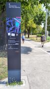
| information | board | Щит с информацией. Чтобы дать его более точное описание, используйте тег board_type=*. | |||
| information | stele | A stele for information. | |||
| information | terminal | Информационная стойка позволяет получить доступ к информации с помощью цифровых технологий. Часто эта стойка бывает подключена к интернет. | |||
| information | audioguide | Место, где вы можете получить информацию ч помощью плеера с наушниками ли через мобильный телефон. | |||
| information | map | Щит с картой местности. Чтобы указать тип карты или другие подробности, используйте к теги map_type=* и map_size=*. Чтобы описать доступ к указанным маршрутам, используйте ключи hiking=yes, bicycle=yes или ski=yes. | |||
| information | tactile_map | Тактильные карты, предназначенные для слабовидящих. Другое название "Осязательные карты" | на визуальных картах показывать необязательно, в отличие от HaptoRender | ||
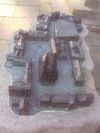
| information | tactile_model | Тактильные модели, предназначенные для слабовидящих. Объёмные модели зданий и окрестностей для слепых. | на визуальных картах показывать необязательно, в отличие от HaptoRender | ||
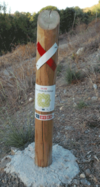
| information | guidepost | Указатели часто расположены на пешеходных и вело маршрутах. Они указывают направление на ключевые пункты этих маршрутов. Смотрите также Proposed features/Guidepost | |||
| information |
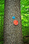
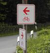
A marker that shows the position of the way of a route. Could be a symbol, a short pole or a painted marking. Note: 2 variant tag values are in use – route_marker and trail_blaze (see Taginfo comparison for the current number of uses or this tag history on taghistory.raifer.tech as a curve chart):
|
||||
| information | user defined | All commonly used values according to Taginfo |
This table is a wiki template with a default description in English. Editable here. Burdan cədvəlin Azərbaycan versiyasını redaktə et.


