Todo.pl
Introduction
Mainly I want that program to tell me where I still have to map something in an area. But how to find out what's missing and where?
todo.pl draws maps with things to do in the area. Input is an osm file and possibly a gpx file with bugs (from OSB or other source).
You could see it as a simplified, but extended Walking Papers map without the ability to process the result online.
Sample maps
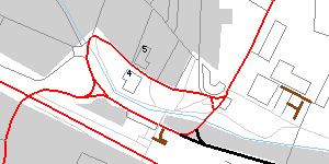 here you can see buildings with numbers, stubs in brown and unlabeled streets in black.
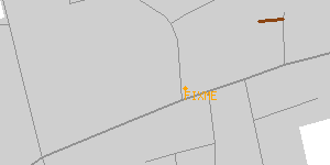 this picture schows a node with a FIXME or TODO note. A way tagged this way would appear in the same color.
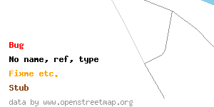 the legend so far...
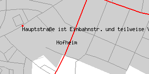 a bug displayed in the map. imported from schokokeks.org gpx export.
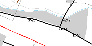 unnamed ways are labeled with the last four numbers of their id for reference.
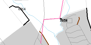 here in pink a given route is displayed to follow when mapping.
Things to highlight in the map
- Short stubs of roads, tracks etc. that possibly have to be extended. They could have been drawn but not surveyed completely when mapping a main road or track.
- 3 dots at the end of a way (sign for extension by Frederik, Gerhard and others?)
- Nodes and ways with FIXME, todo etc.
- Residentials with no name
- Primary, secondary, tertiary without ref
- Tracks without tracktype
- Waypoints from OpenStreetBugs (if file is present)
- Residential ways without accompanying houses (nodes or ways tagged using addr:housenumber and sharing the street's name or associatedStreet-relation membership)
- ok, good idea. I think this could simply be done by drawing the houses/buildings and the nodes/ways containing the house numbers. --Gary68 09:16, 29 July 2009 (UTC)
- number unnamed streets for reference (last 4 digits will be displayed in map)
- optionally draw route given in gpx format (if gpx file given exists)
Usage
perl todo.pl data.osm bugs.gpx route.gpx output.png [picsize]
If you can't or don't want to provide gpx files then just give false filenames that the program can't open. Then these steps are not performed.
Example
perl todo.pl data2_hofheim.osm OpenStreetBugsOpen.gpx route.gpx hofheim.png 8192
Output
- PNG file
- SVG file
Wishes / Ideas
- Missing attributes (maxspeed, access-restrictions etc.)
- Not sure if this is a good idea. Since you can not assume that access restrictions apply you will get lots of false alerts. Also maxspeed should - in my opinion - only be given if it deviates from standard. So I wouldn't consider a maxspeed=50 missing in a town in Germany! So, lots of false alarms again... --Gary68 19:18, 28 July 2009 (UTC)
- Maybe I should paint all existing elements in gray (different shades and strengths) so I have more colors for the "todos". --Gary68 09:27, 8 August 2009 (UTC)
Source
Libraries osm.pm und osmgraph.pm needed.